to the index page
Half-way into my third semester of college, I left a resume at a career fair in November and got an on-campus interview with a laboratory I knew almost nothing about. I got an offer, packed two big duffel bags, and left gray icy New York for warm and sunny southern California in the middle of January. I started making money, friends had cars, and we were in a huge new place with mountains, deserts, beaches, and even the Mexican border not far away. Every single weekend something fun happened, and for folks back home I wrote these updates to the website.
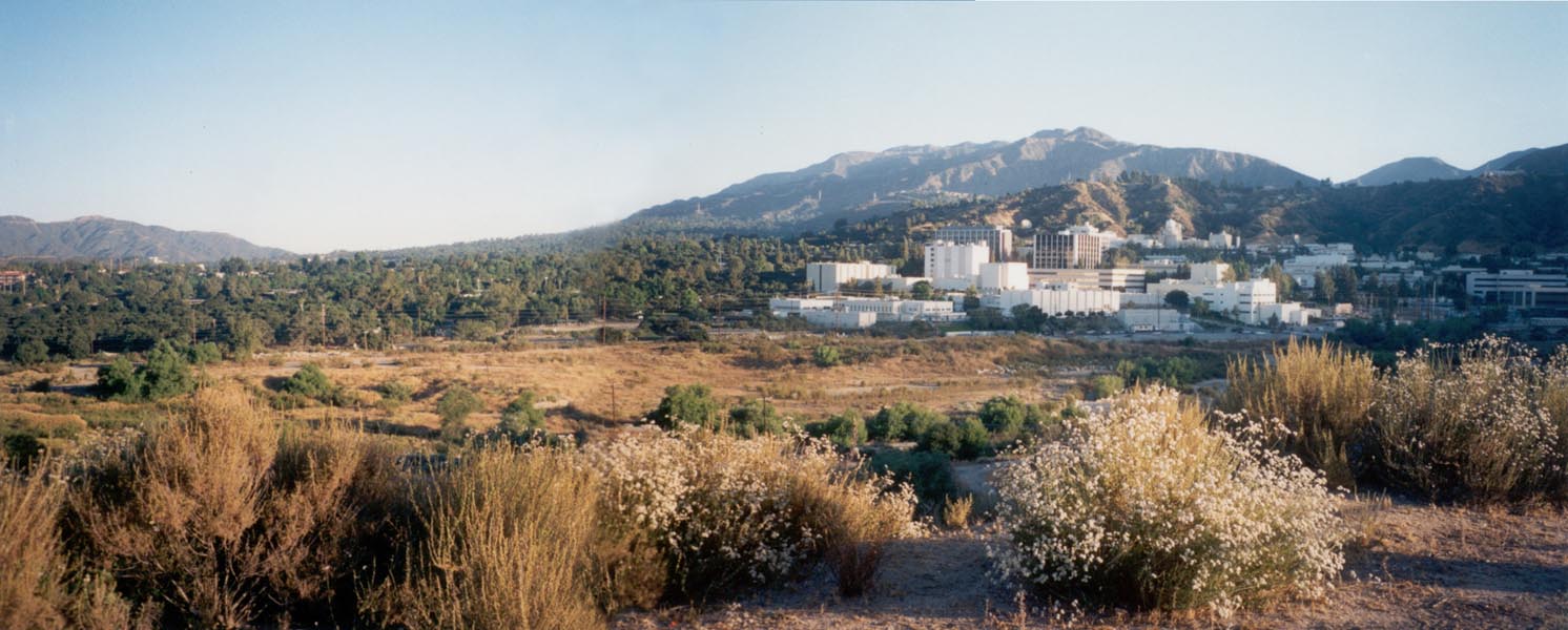
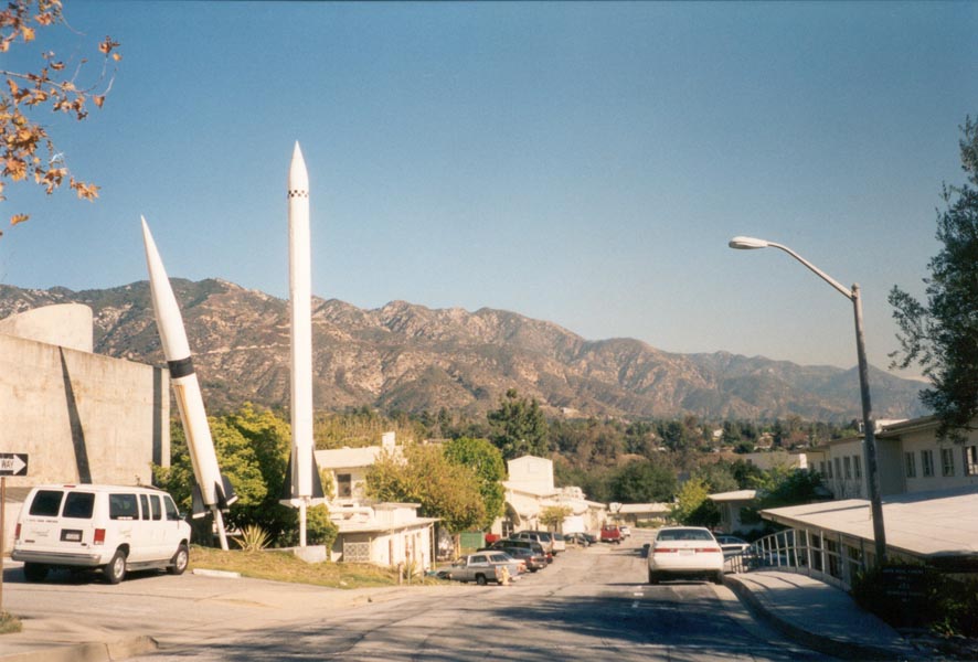
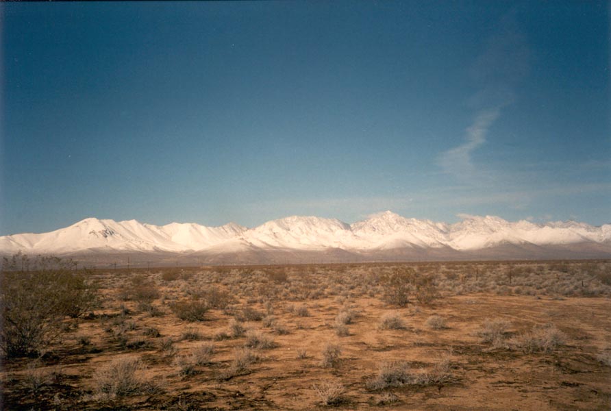
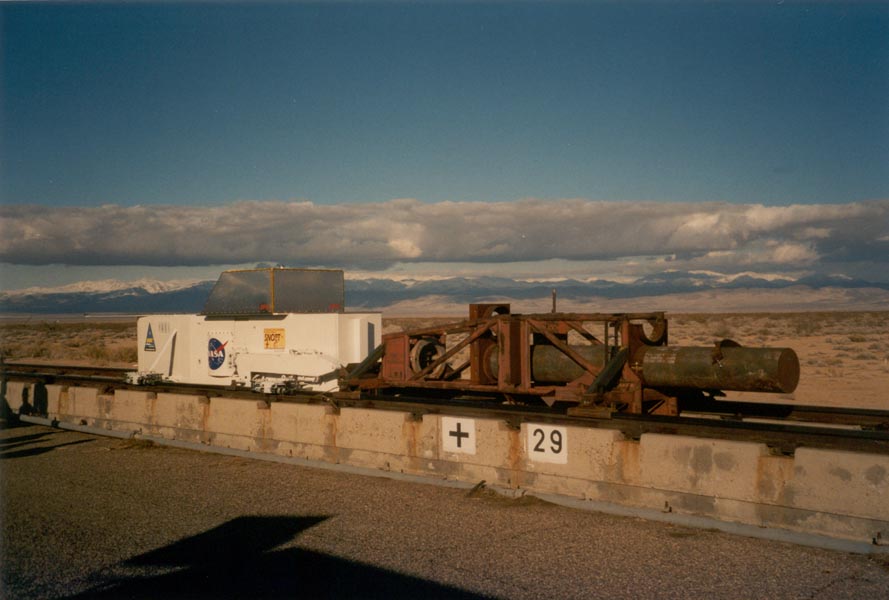
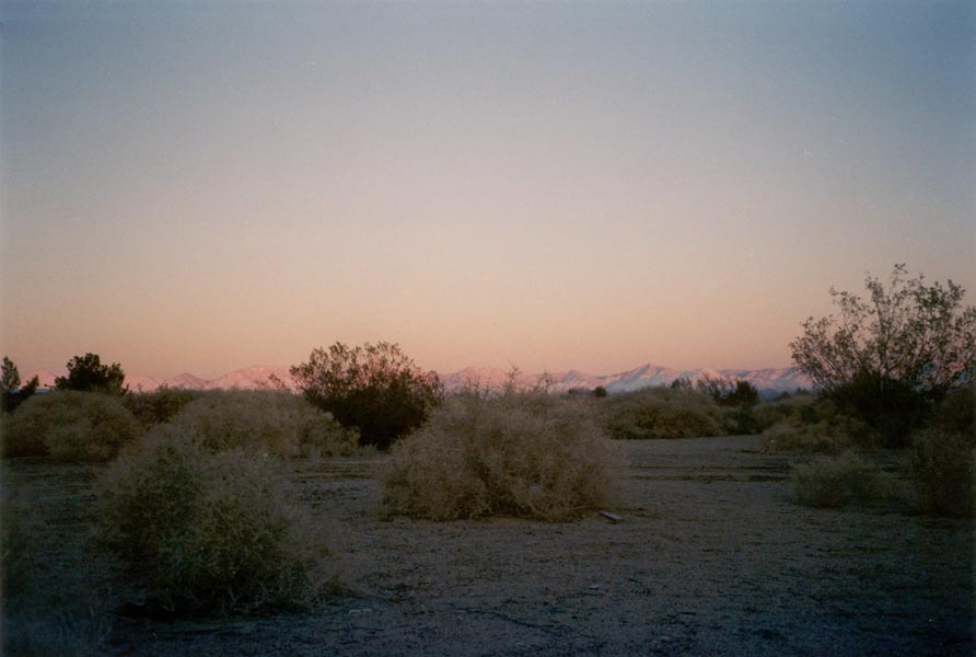
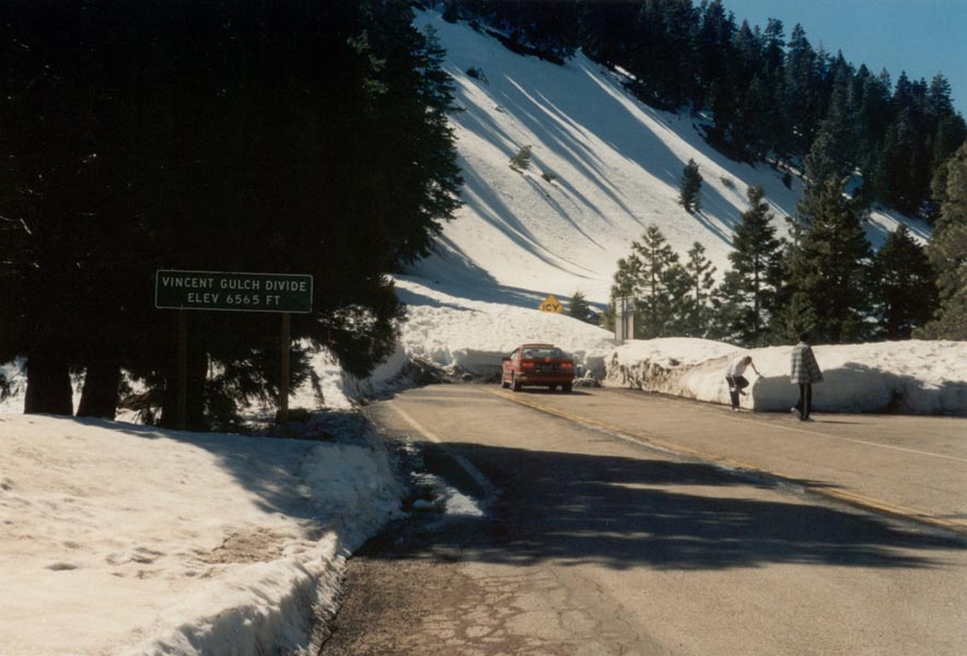
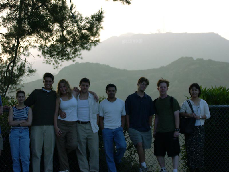
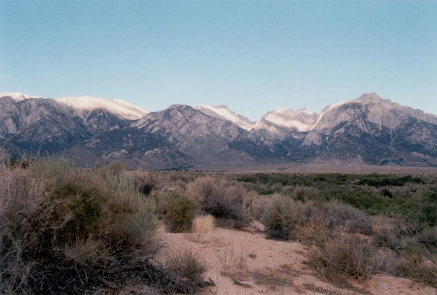
It is sunny every day here. Highs are in the 70s, but the ski slopes are just an hour away. So are the beaches. There are palm trees all over the city. The San Gabriel mountains catch the sunrise as I go to work and the sunset as I leave. They tower above the lab, rising higher than 6000 feet. 10,000 foot high snow-covered mountains can be seen to the East in San Bernardino. I spend workdays in one laboratory or another, drilling rock samples to test an ultrasonic driller/corer and rock abrasion tool that may fly to Mars in 2003. Next week I'll be out in the desert at China Lake Naval Weapons Center to set up rocket sled testing of a laser navigation system to fly on Mars 2007.
January 29, 2001
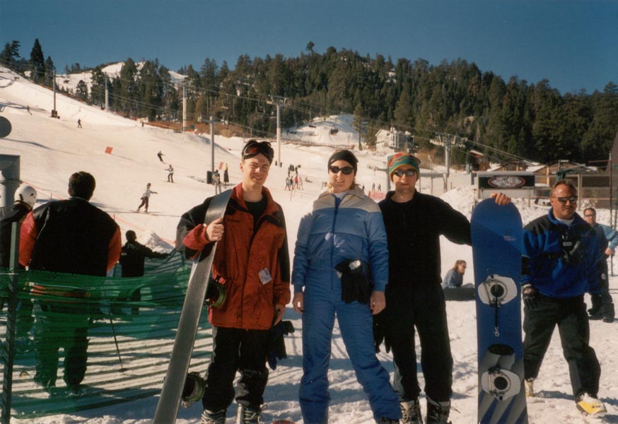
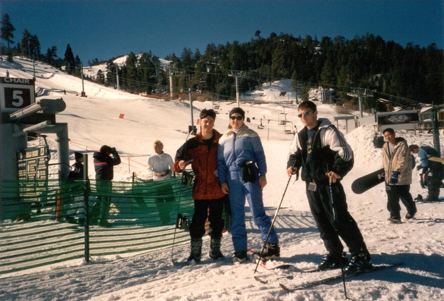
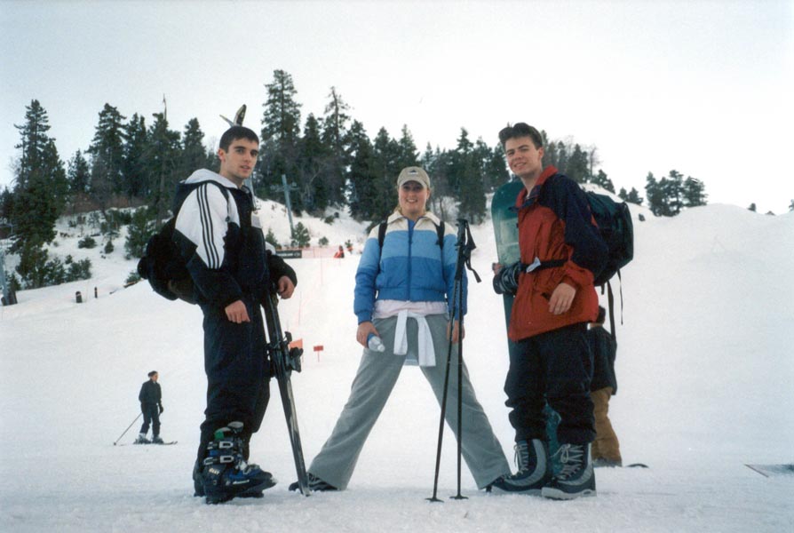
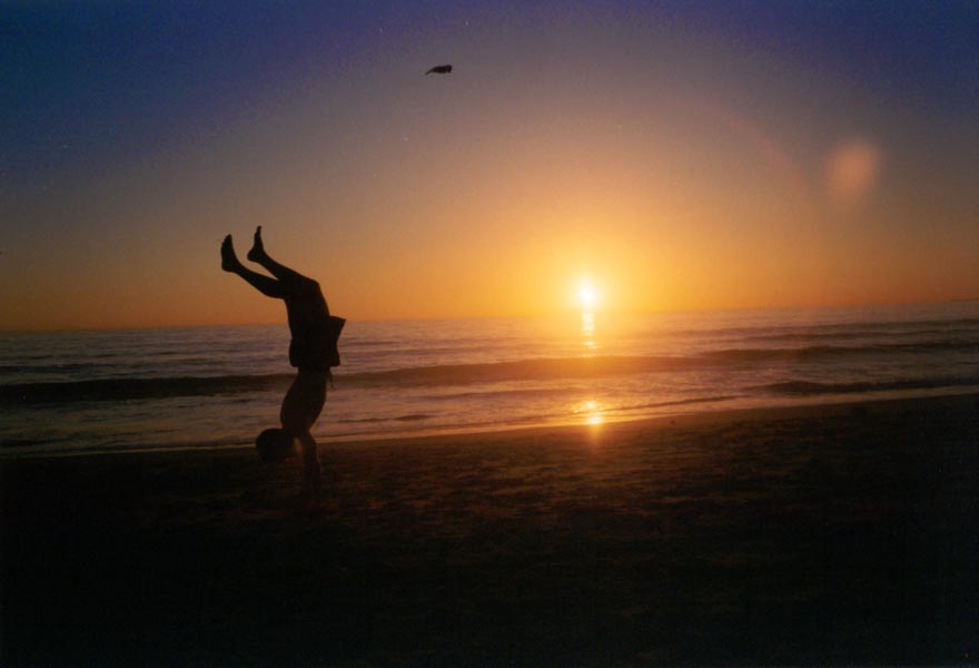
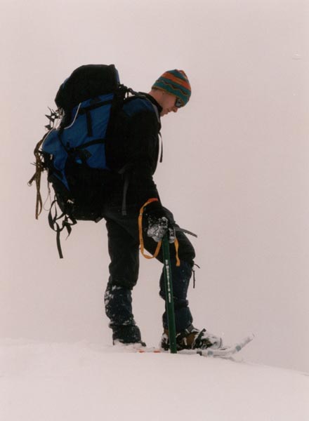
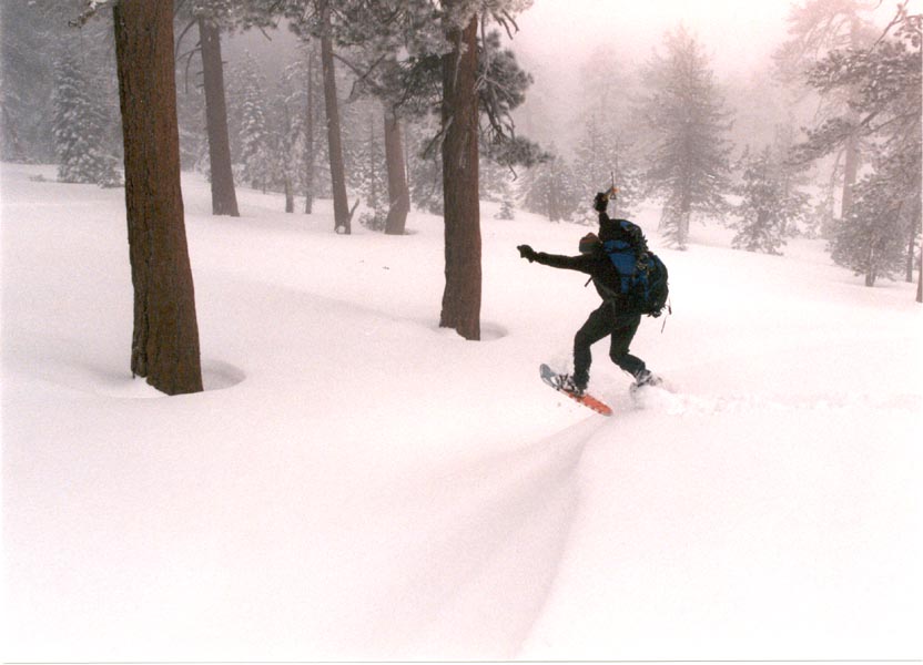
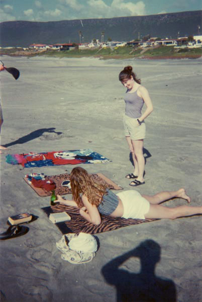
I was standing at the top of an 8500 foot ski mountain on Saturday morning, a snowboard secured to my feet with the hope that I would learn to ride it before reaching the base. There was a meter of snow at the middle summit of Big Bear Mtn but temperatures were in the 50s and the sky was clear. At the end of the day I had actually gained a respectable level of skill at boarding. We drove two hours back West through spectacular high desert country and repacked our bags for a beach trip the next day. After an hour's drive down the Santa Monica Freeway we arrived at the beach. The water was cold but not too cold to swim and temps were in the 80s. We played frisbee, floated around in the surf, and made sand sculptures as the sun sank to the waves with a spectacular sunset over the Pacific.
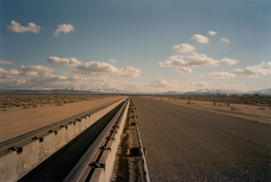
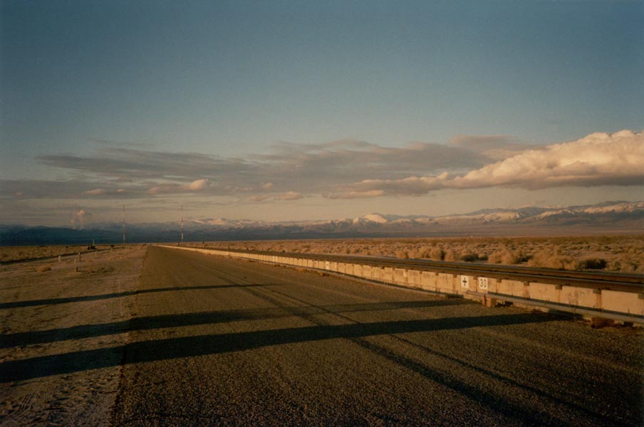
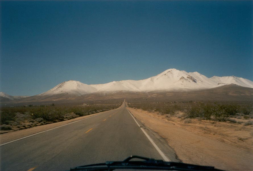
It is winter, after all, so it's not so unusual that it's raining and 50 degrees. The weather put limits on weekend trips so I never did get too far from home. Except for the business travel, that is. Mid-week I spent two days in the Mojave Desert at the China Lake Naval Air Weapons Station. Tumbleweeds, joshua trees, beautiful desert sunrises, F18 fighter jets, supersonic test tracks, endless miles of arrow-straight roads through the sand, active bombing ranges to the north, late night work at the base under a huge full moon - all in preparation for preliminary rocket sled testing of our Mars 2007 laser navigation system.
February 12, 2001
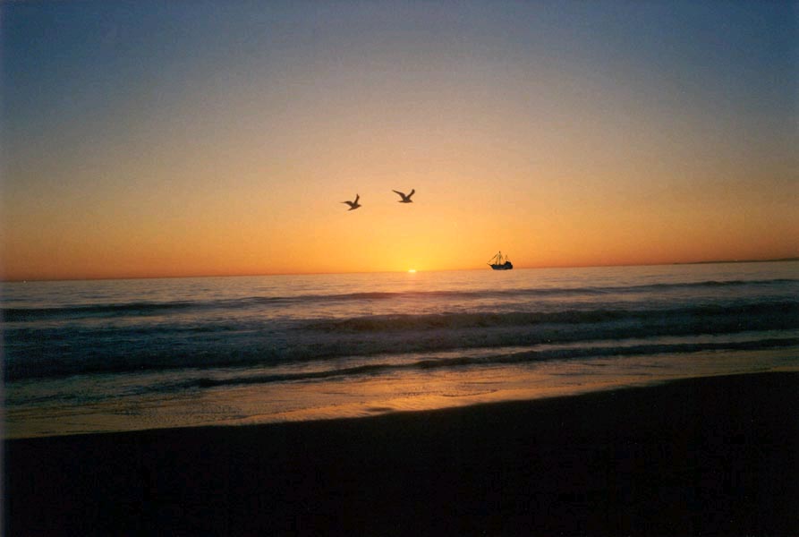
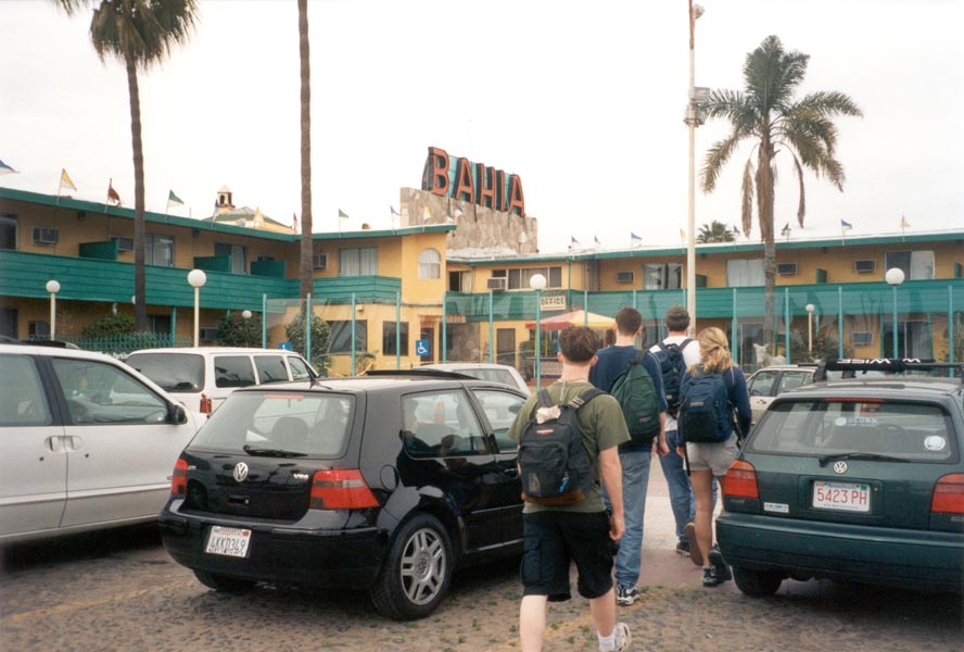
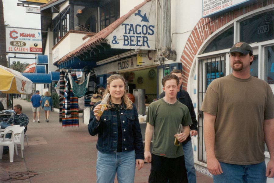
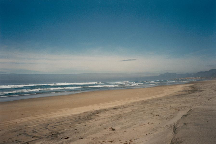
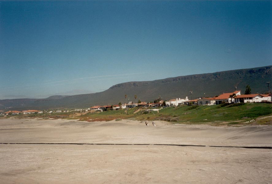
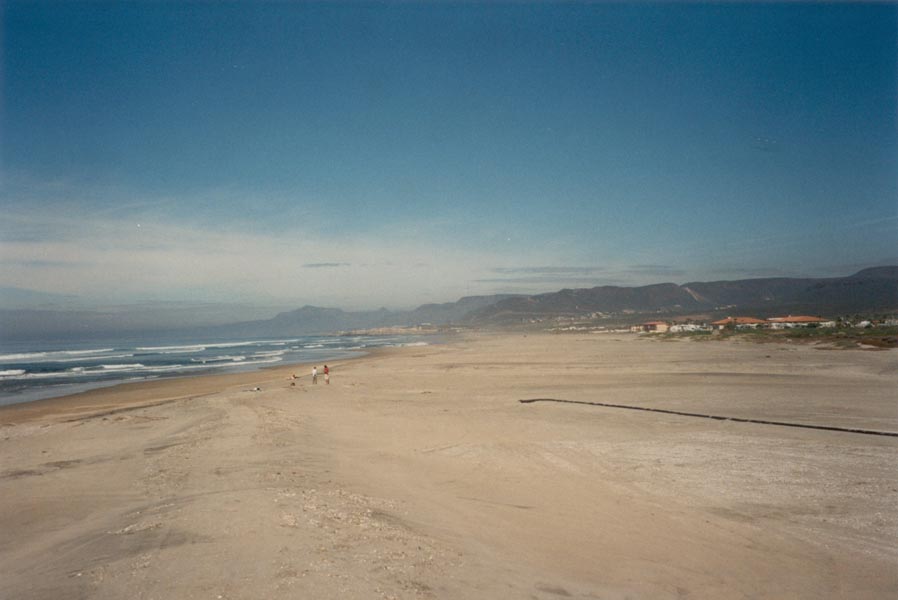
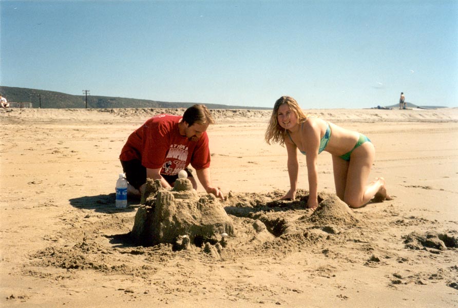
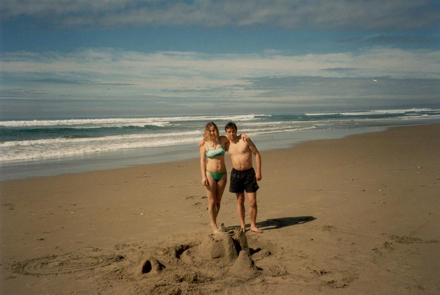
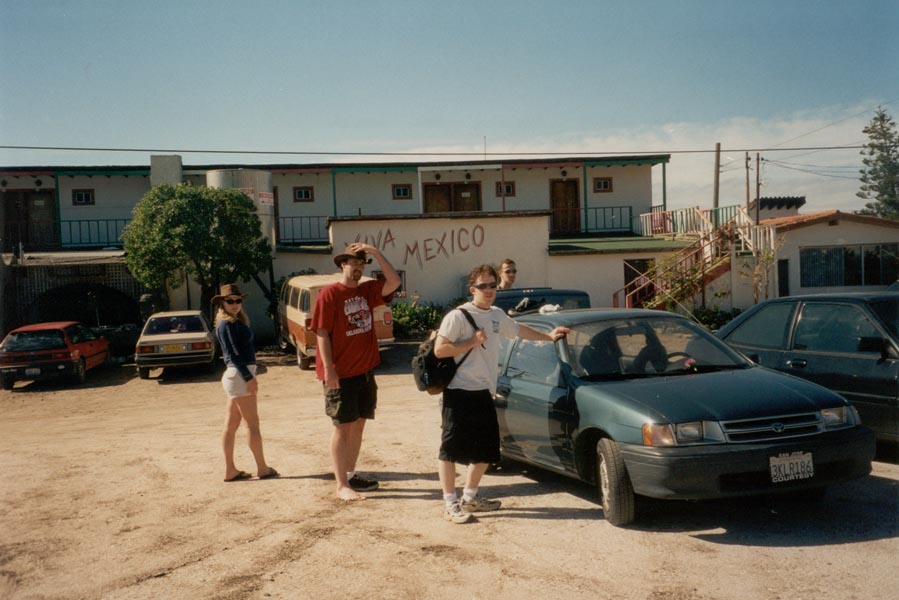
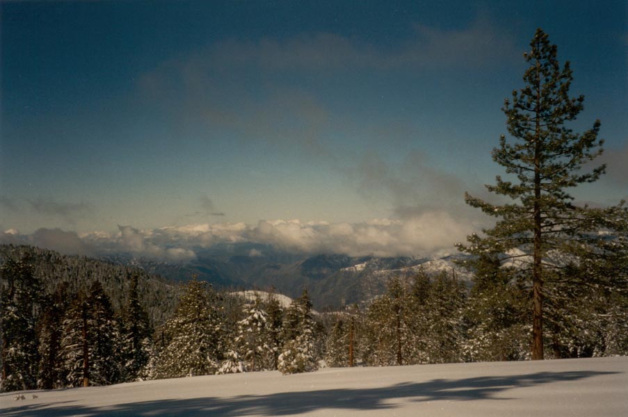
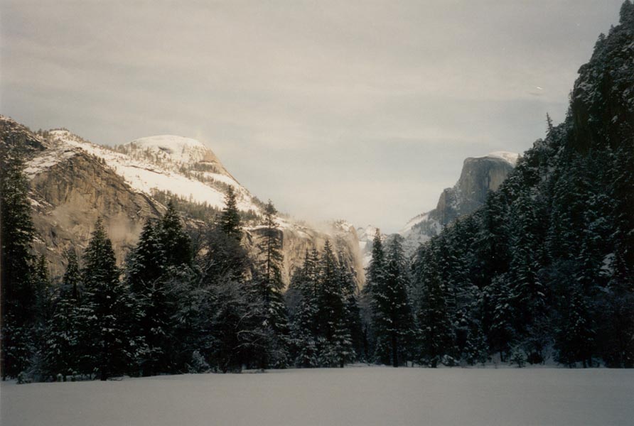
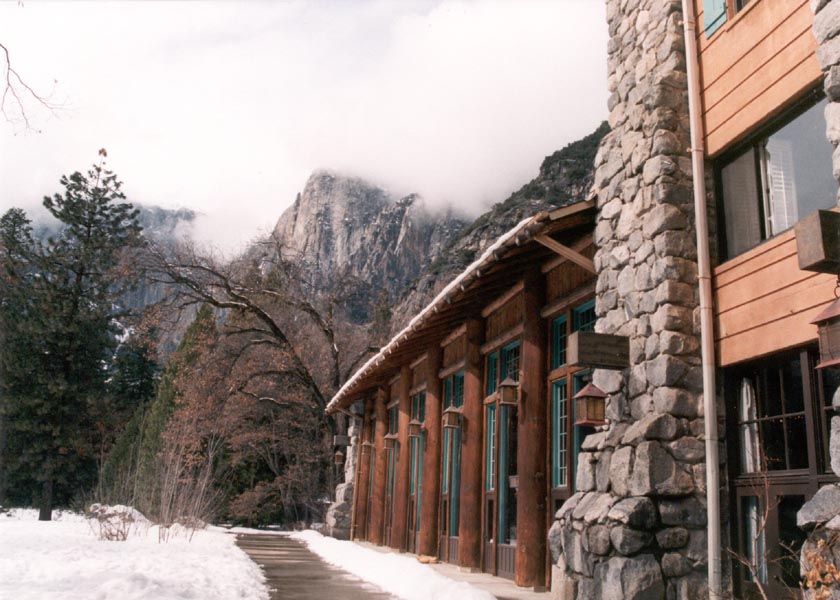
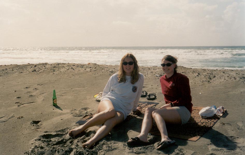
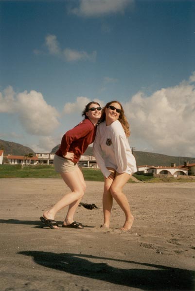
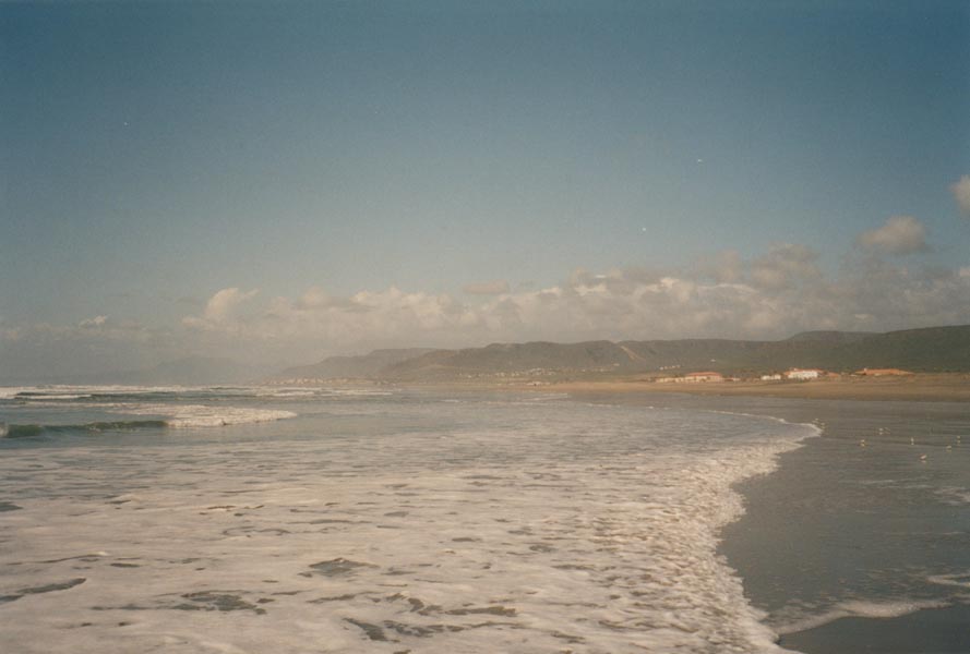
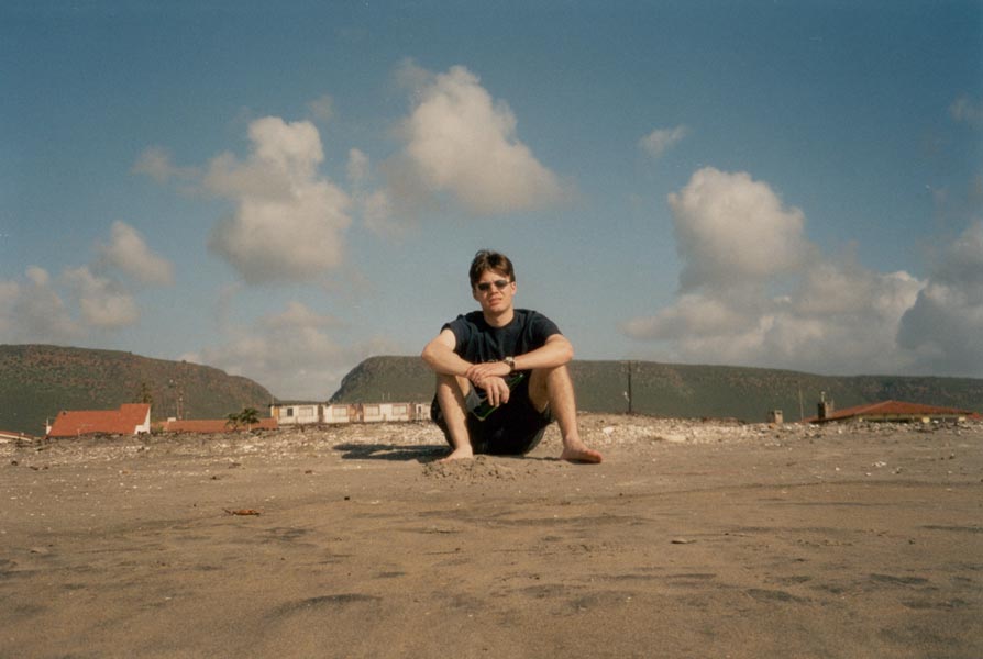
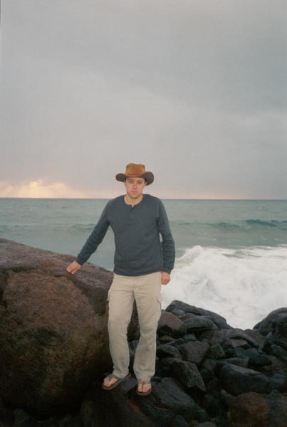
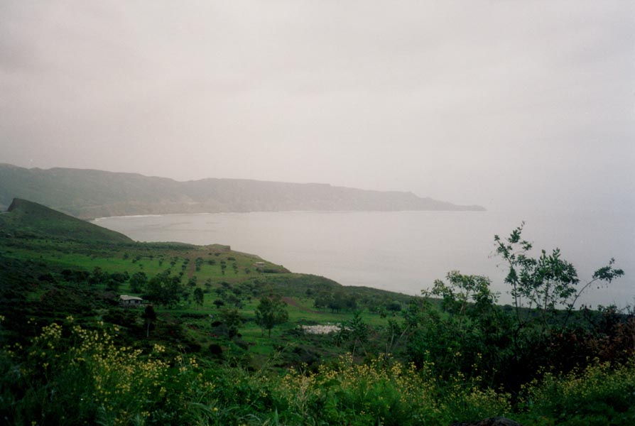
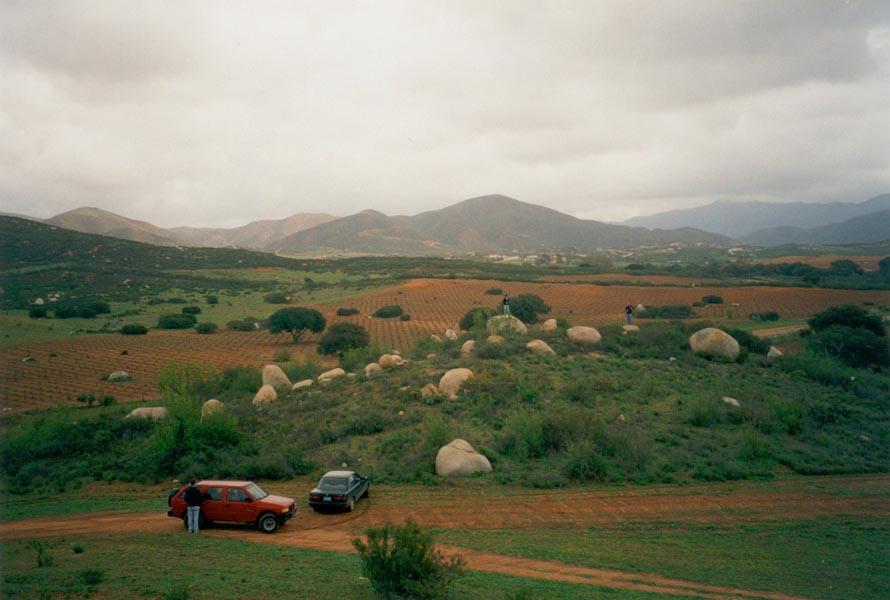
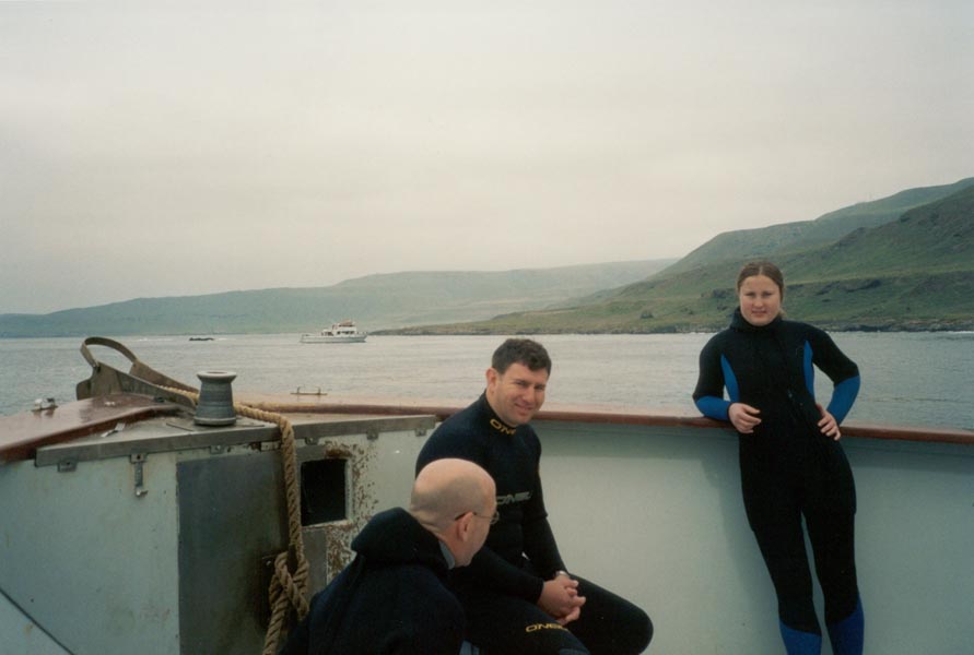
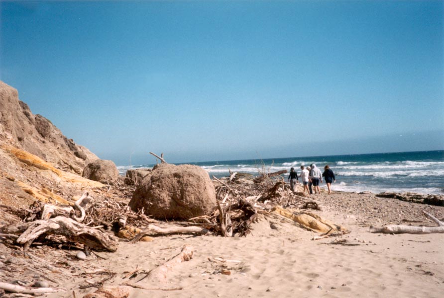
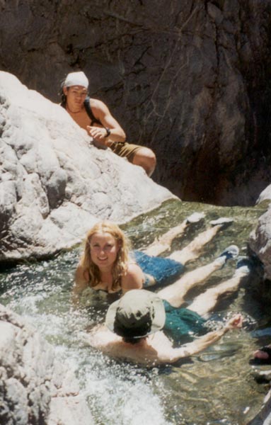
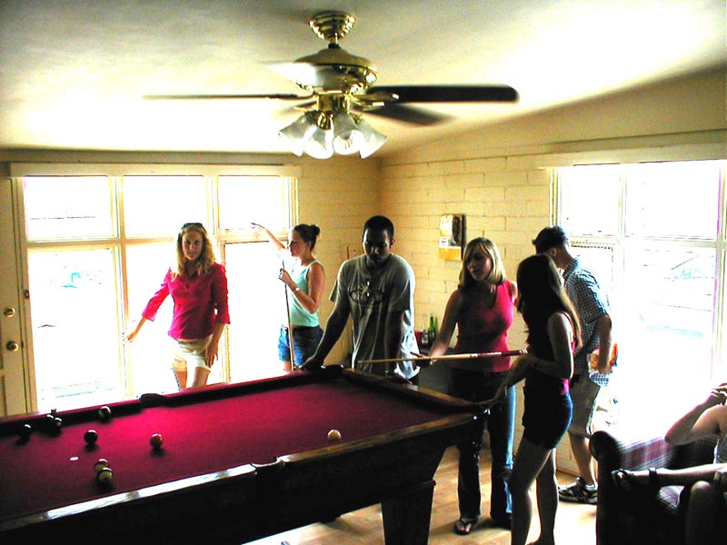
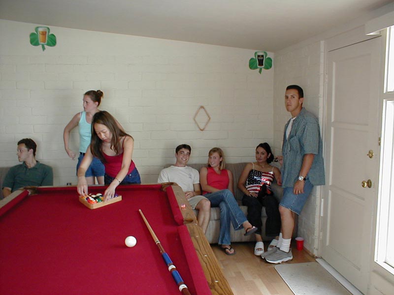
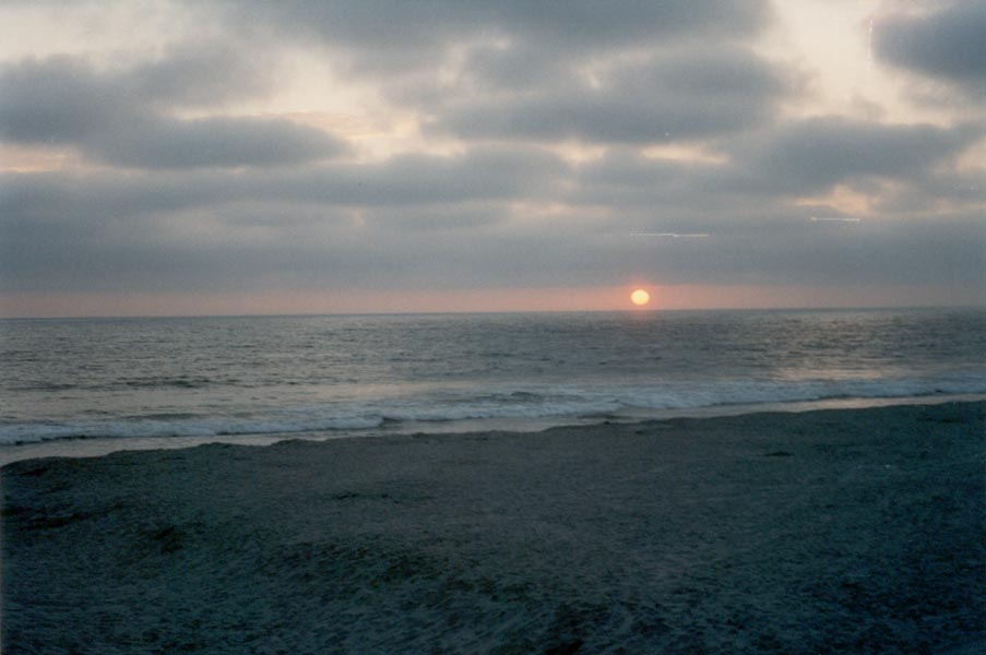
There was snow in the high desert last week, lots of it. But the rocket sled testing went as planned. It was another week of picture perfect days in the Mojave - white snow, blue sky, red rocks, beautiful sunrises... On Saturday we decided to go to Mexico. The road south along the west coast of Baja winds through spectacular rangeland above the crashing blue surf. We spent the night in Ensenada - tacos and beer, Mexican seafood, clubs and street markets. Sunday we went to a beautiful beach between Rosarita and Ensenada. The sand was trackless, the water clear, the sky blue and breezy and temperatures in the 70s. After swimming in the surf, building a sand castle, and running on the beach we played a few games of pool and ate the best Mexican food around before returning home to get ready for a Monday barbecue. Thursday I go to Yosemite for a few days of snowshoeing and ice climbing, and then next Tuesday I start SCUBA lessons. By the end of March I'll be diving in the kelp forests.
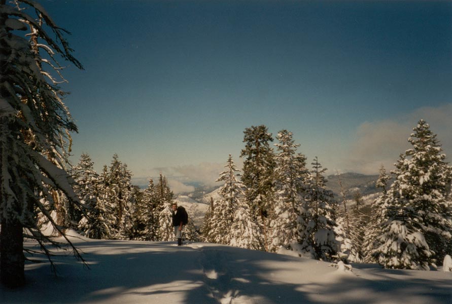
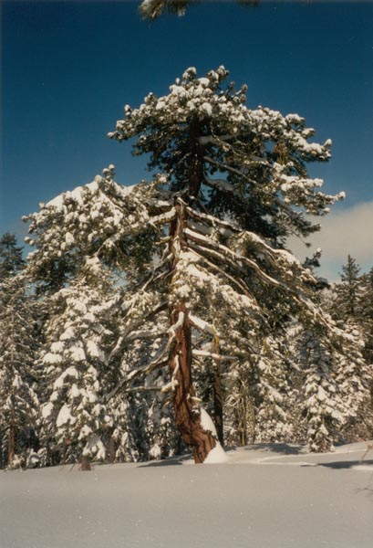
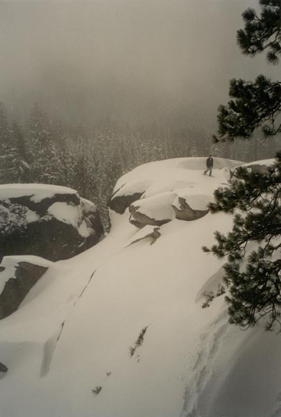
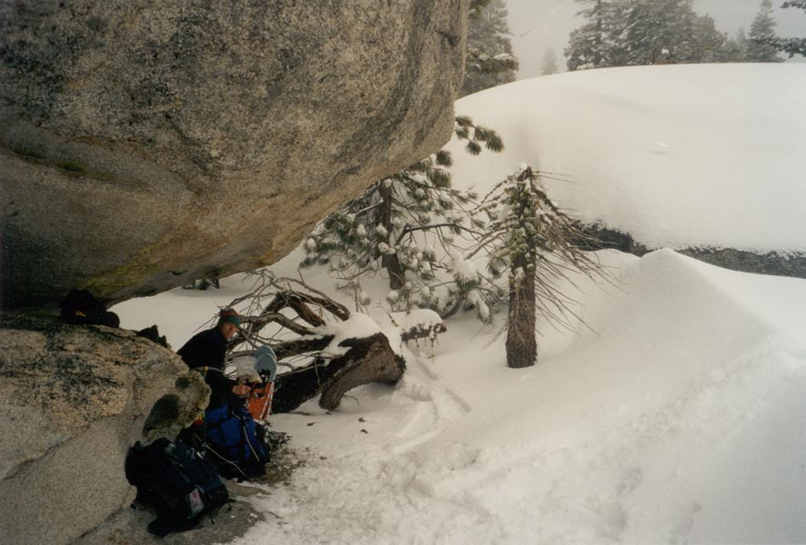
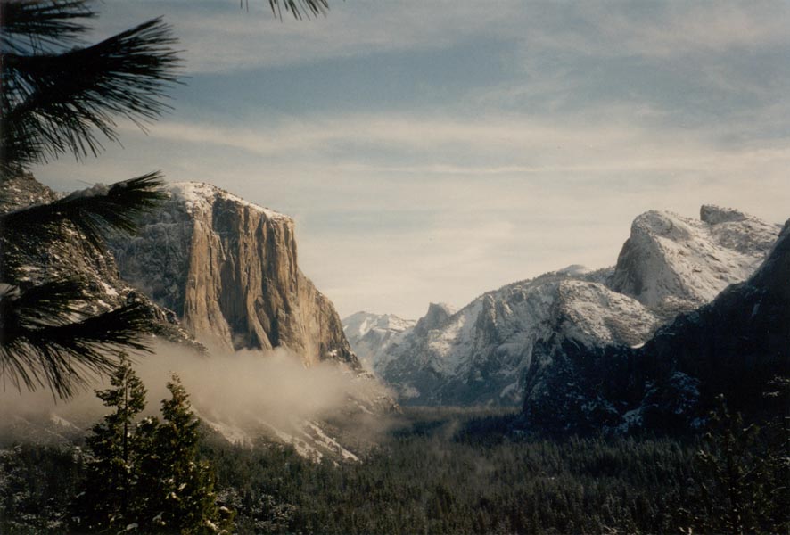
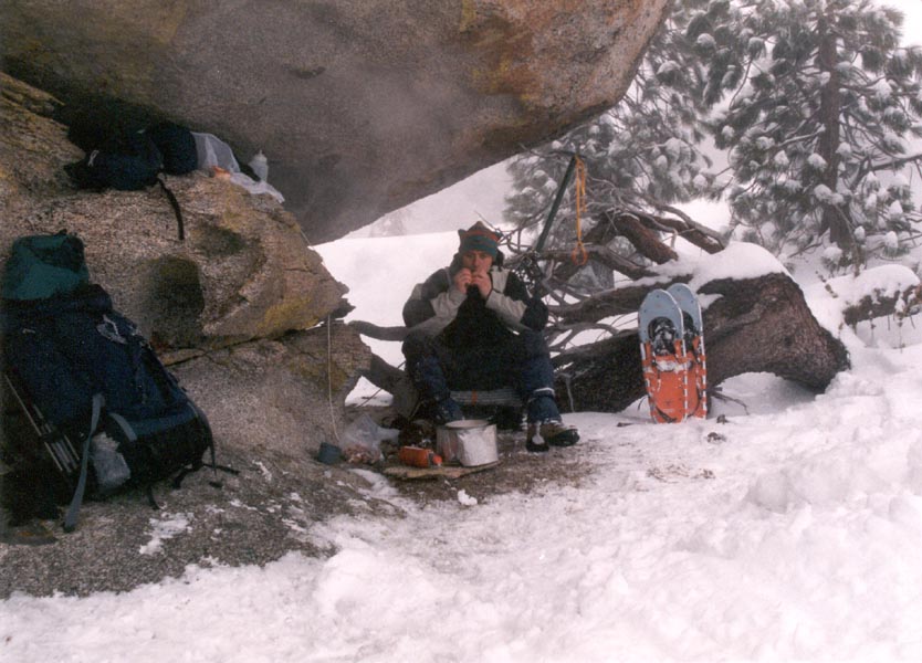
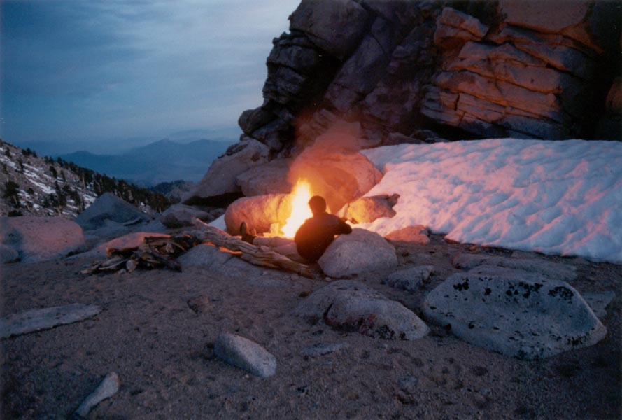
We broke trail through fresh powder for several miles, our snowshoes sinking deep under the weight of heavy packs. The morning sunshine was obscured by low clouds before Sean and I reached the overlook above Yosemite Valley so we were unable to determine where we were or what lay ahead. We traversed steep slopes, climbed giant slabs of granite, cooked a meal in the shelter of an overhanging boulder, and then made our way back to the pass. The next day dawned with light snow falling. The storm intensified as we hiked out to Dewey Point and snow fell so quickly that we had to break trail in both directions. The snow depth in the forest was between five and seven feet. At the Point we peered over the valley rim and looked straight down the granite faces to snow slopes that disappeared into the clouds a thousand feet below. The altitude, blowing snow, and deep powder made travel very difficult but we had the place to ourselves. On Sunday skies finally cleared and we drove into the Valley. We enjoyed spectacular views of El Capitan, Half Dome, and Yosemite Falls. The sun sparkled on the fresh snow and the soaring granite walls. After brunch at the Ahawanee we drove out via a winding road along the Merced River.
It is raining. I am at my cube designing and drawing up the flight configuration for the rock abrasion tool that I've been testing in the lab for the past few weeks. Maybe my instrument will be the one to find life on Mars. That would do good things to the NASA budget, so wish us luck.
If you have never played frisbee underwater, you must do so or you risk missing one of the great pleasures of life. Well... maybe it's not quite that momentous. Just two more weeks till my SCUBA trip to San Clemente! In the mean time I'm going to Baja again, and the next weekend I'll be climbing in Joshua Tree.
March 5, 2001
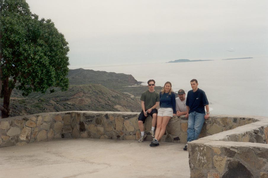
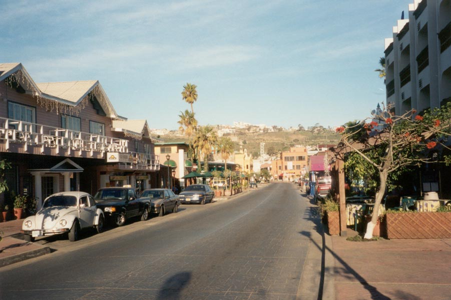
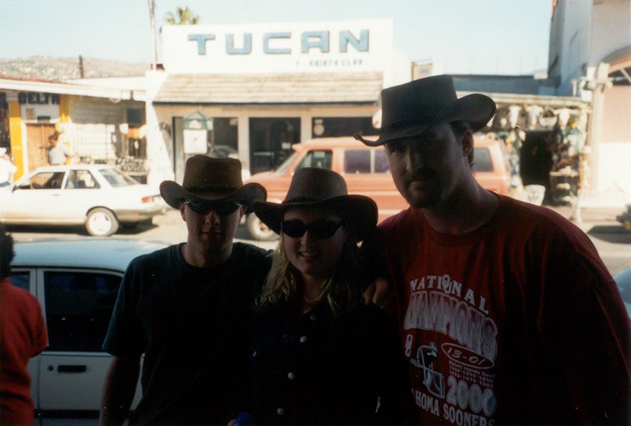
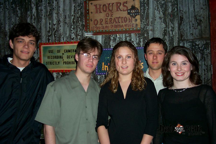
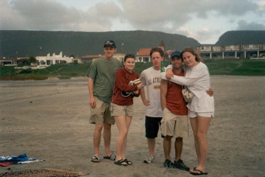
House of Blues, Sunset Blvd, on Thursday; the Ice House Comedy Club, Friday; to the beach in Baja Saturday: sunshine and surf, moonlit waves crashing on the rocks, live music, good food. I sat with a paperback book from the shelf of worn novels in the corner of the beach house at La Salina and read as the windblown rain lashed at the windows and the blue-gray waves rolled in. Later a band set up and we enjoyed live music. We continued to Ensenada Sunday and then returned home via Tecate on Hwy. 3 - a narrow winding road through rugged rocky hills, vineyards, villages, and misty mountain passes.
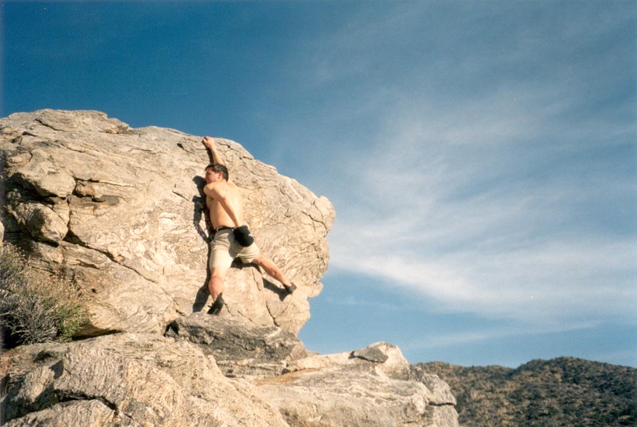
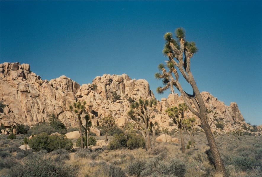
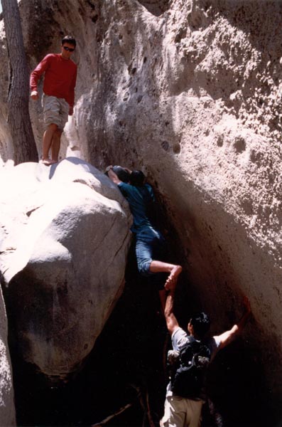
I leave for Joshua Tree this afternoon. The climbing shoes are packed, the chalk bag filled, and water bottles readied for a weekend of bouldering in the desert. It's Friday again, I almost didn't notice. This is the first job I've had where I look forward to coming in each day. There's always something interesting to do. I can play in the sandbox with rover prototypes, or go talk to the people processing flight data from Cassini, or wander down to fabrication to seek out the parts I'm having made. Today I'm crunching numbers - calculating tolerances and thermal expansion at the surface of Mars and spring rates and surface finishes and mass properties...
March 12, 2001
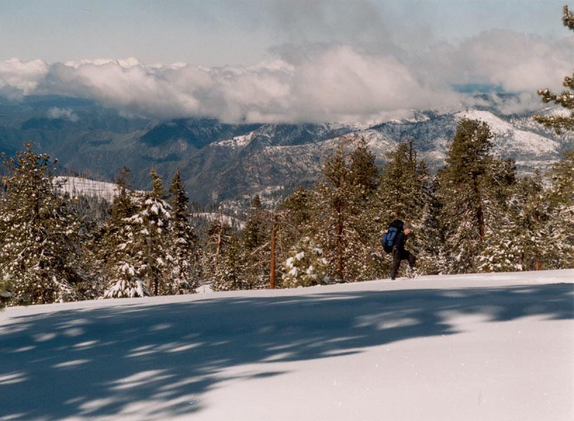
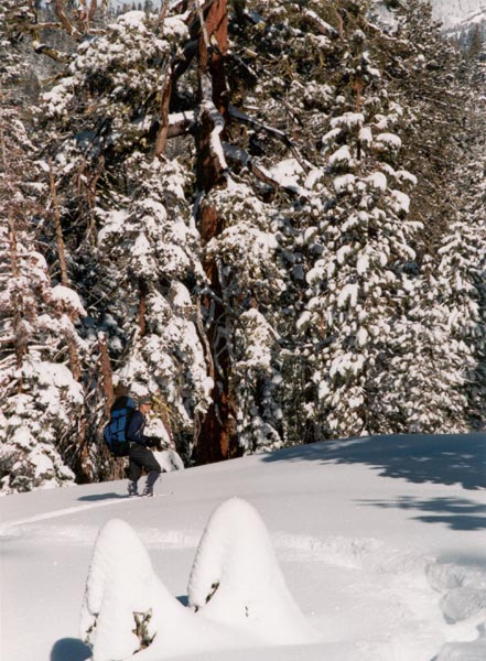
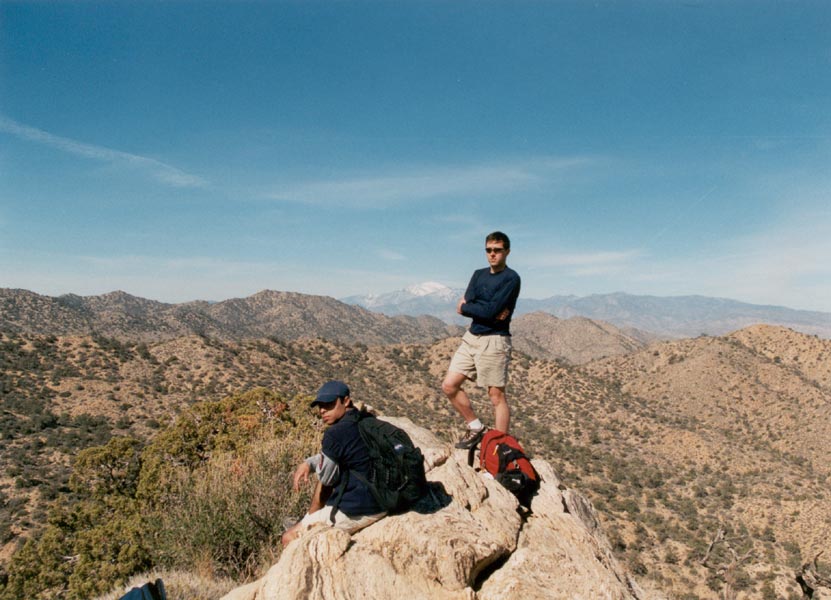
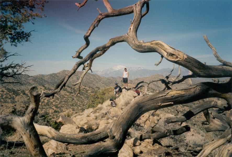
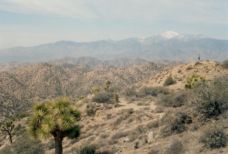
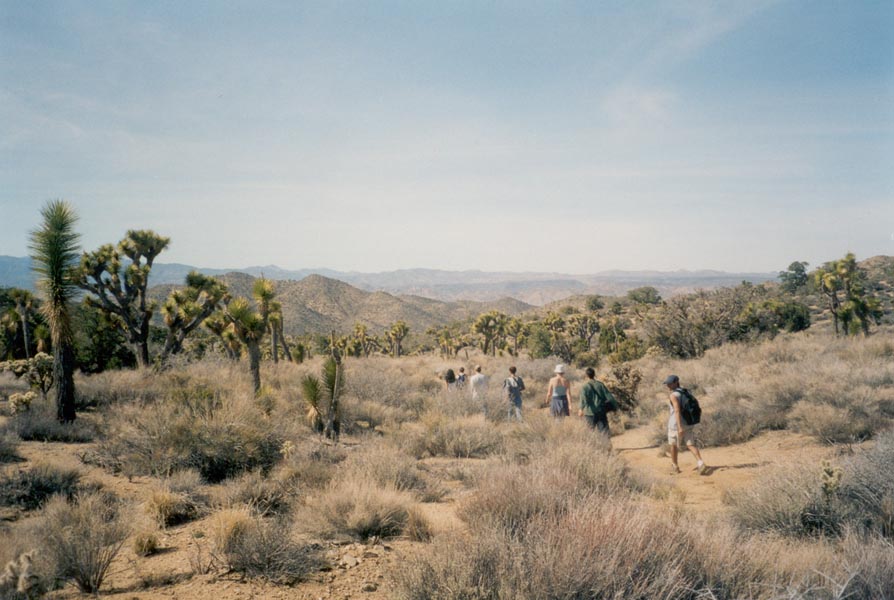
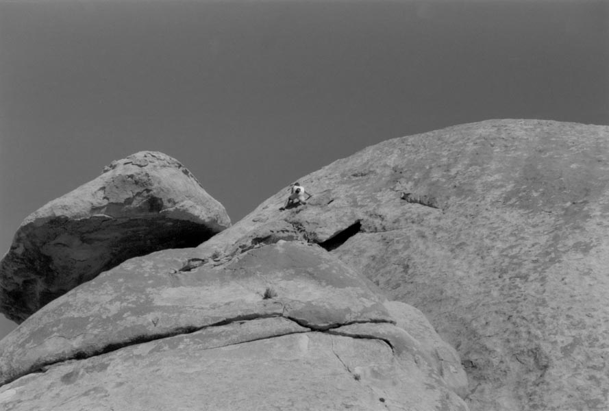
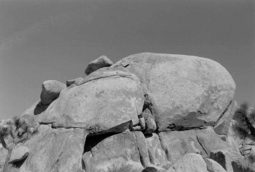
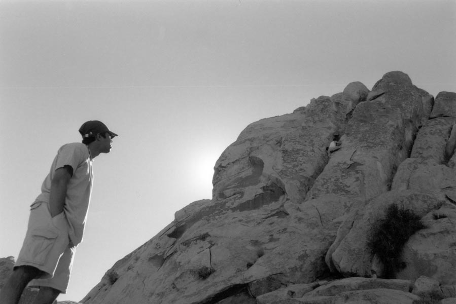
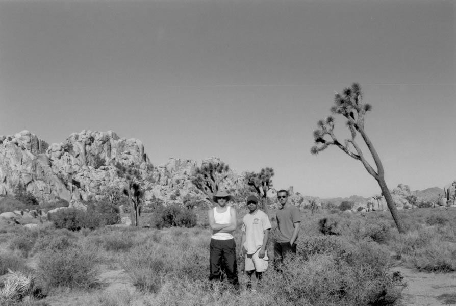
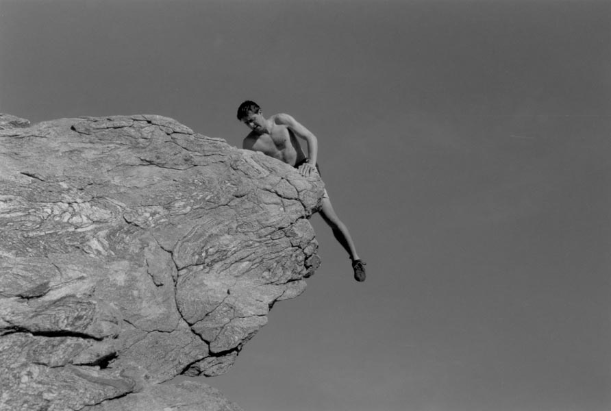
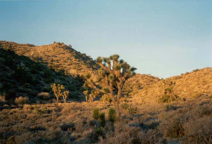
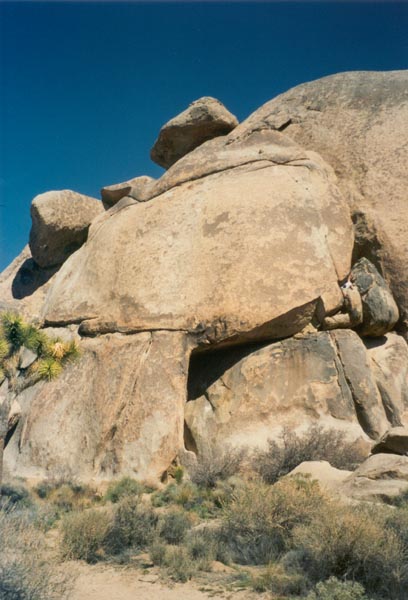
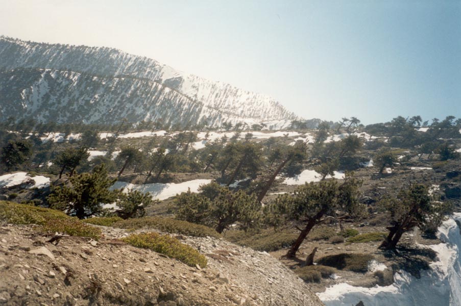
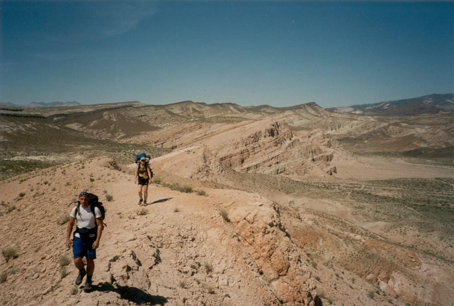
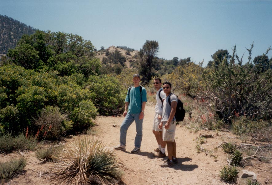
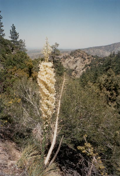
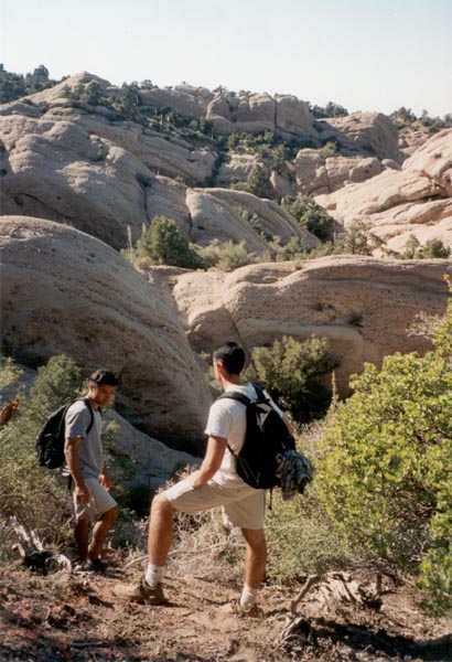
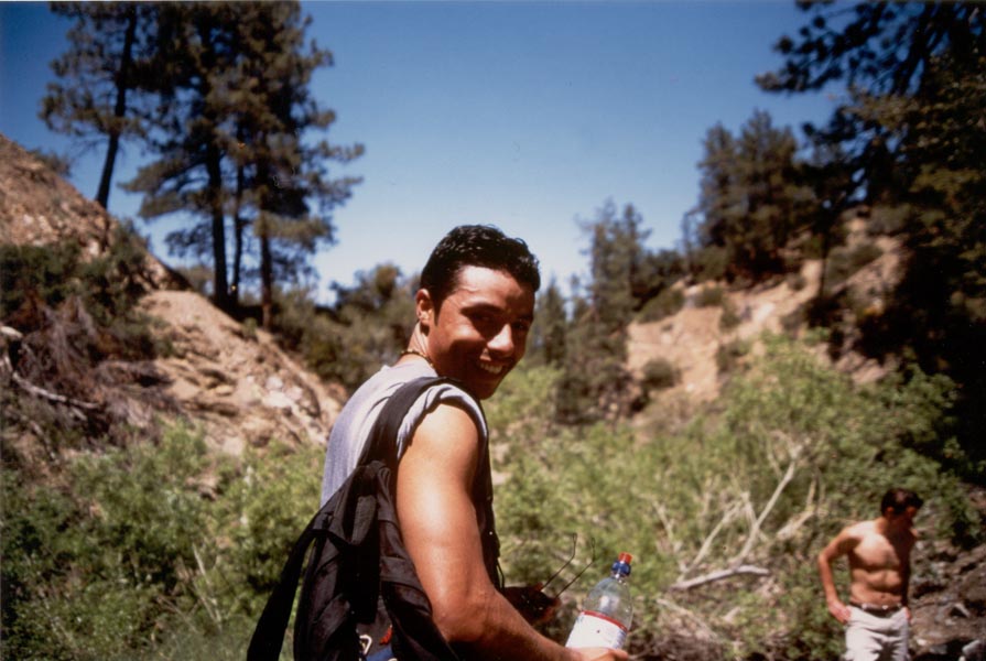
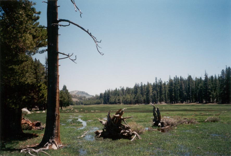
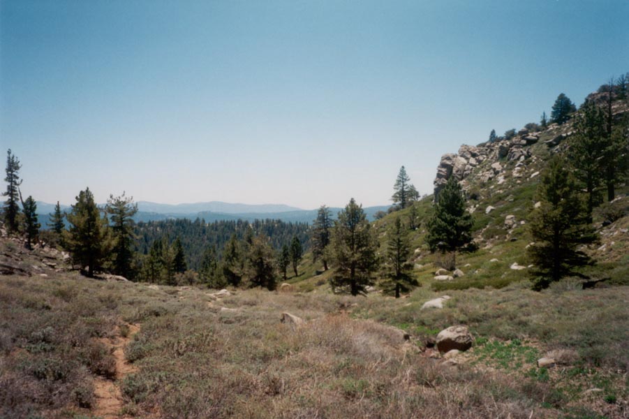
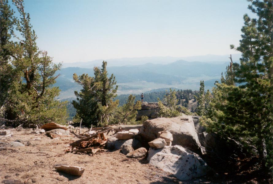
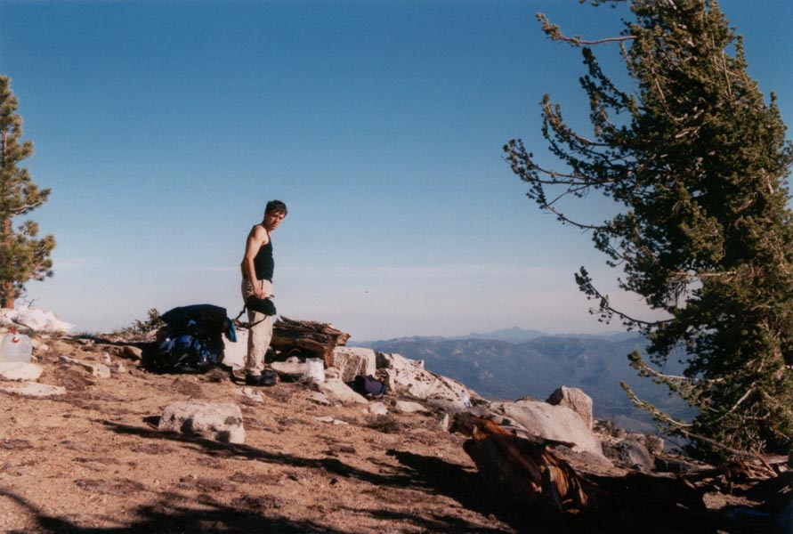
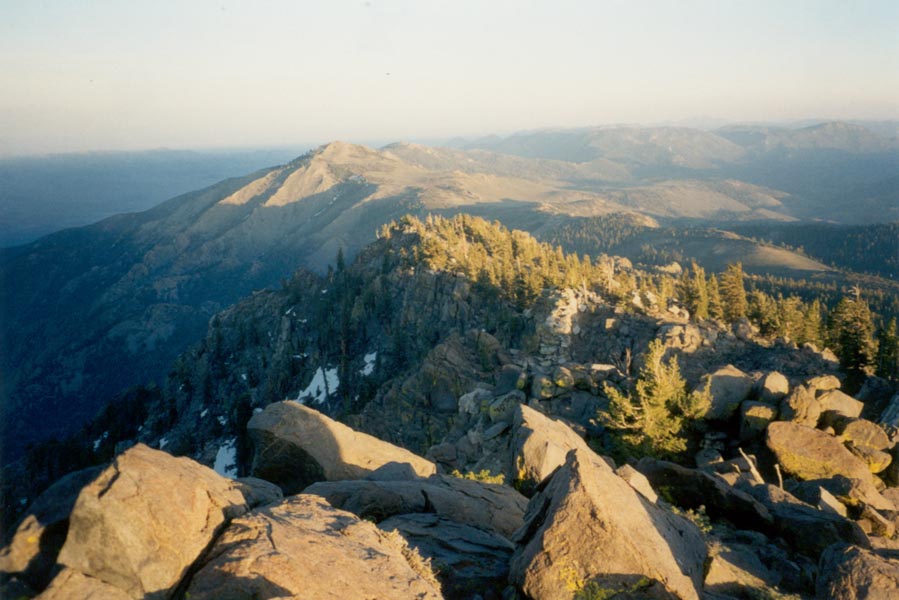
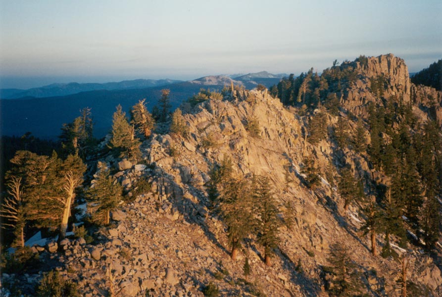
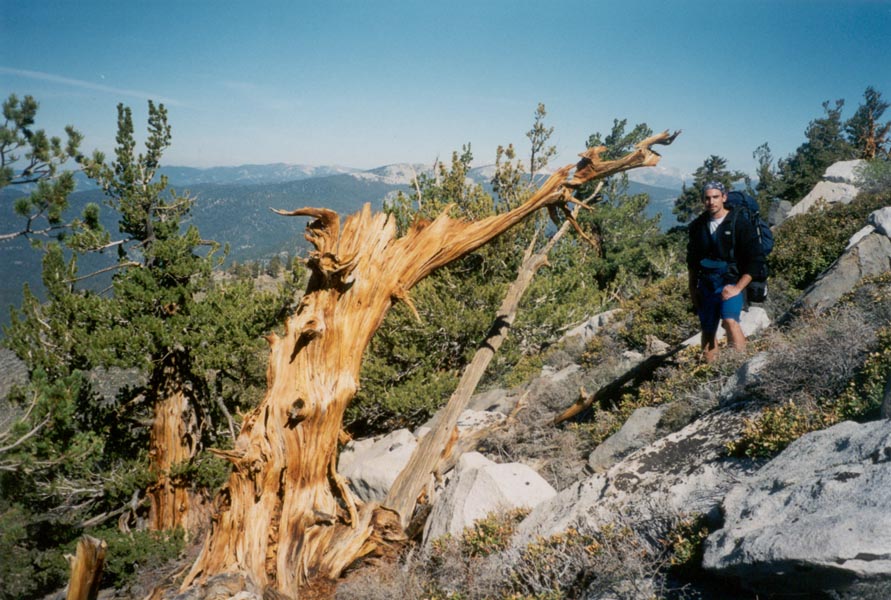
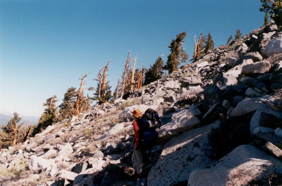
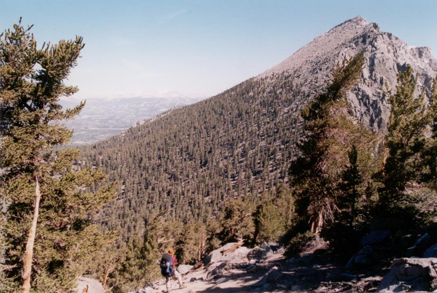
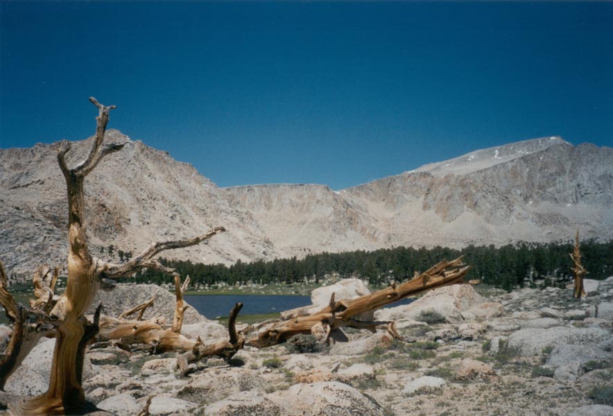
Another Southern California weekend - hiking in Joshua Tree National Park, the best bouldering I've ever done, and a road trip home taking us through deep snow in the San Gabriel Mountains. We arrived in Joshua Tree after dark Friday so it was not until sunrise that we saw the park. The desert was lush with spiky yucca and joshua trees, cactus, creosote bush, cedar, and pine. This winter's heavy rains made the desert more green than usual and small flowers were just beginning to bloom. By mid-morning Sean, Oscar, and I were several miles from camp and several hundred feet above the trail, climbing the wall of a canyon. The bright blue sky contrasted sharply with the snow-covered summit of San Gorgonio to the west. At length we arrived at Eureka point, 5500 feet high, and looked across the valley to where the face of Mt. San Jacinto rose abruptly more than 10,000 feet from the base to the summit.
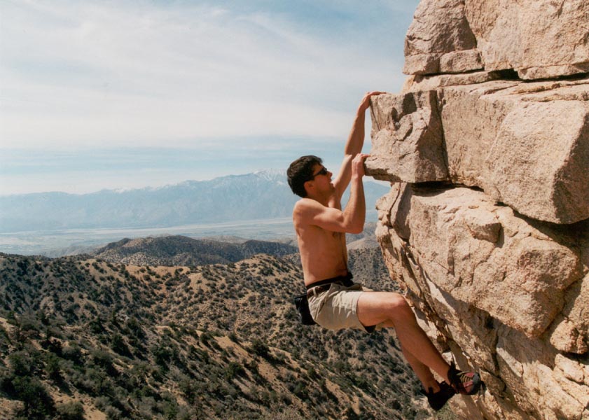
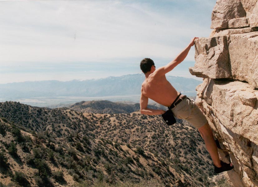
We returned to camp and settled in for the night after one last session of bouldering. I managed to stay out of the cactus and yucca en route to the rocks but disturbed a rattlesnake mid-climb. The coyotes began to yap and howl soon after darkness and the stars were brilliant in the clear night sky. I rolled out my sleeping bag on the sand beside a joshua tree and was soon asleep.
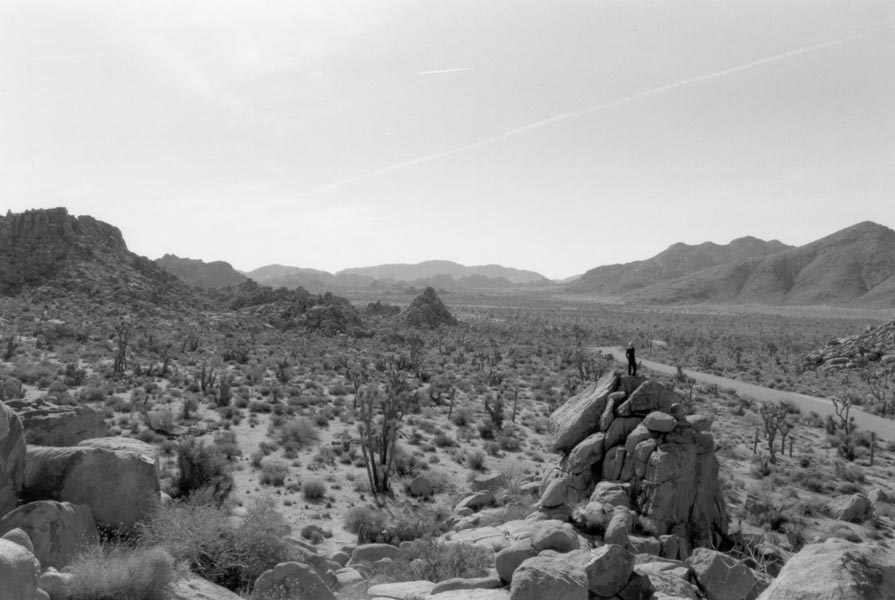
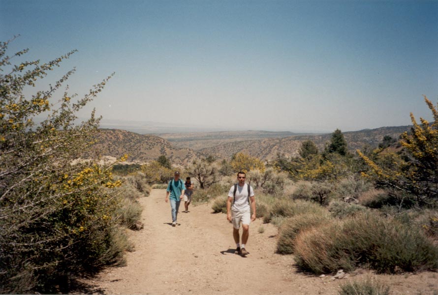
The air was cold clear the next morning. The birds woke me before sunrise and I climbed to a hilltop to watch the first light shine on San Gorgonio. We left Black Rock Canyon and drove into Hidden Valley. From the Key's View overlook we could see Signal Mountain 95 miles away in Mexico, the high peaks to the west, the great expanse of the Mojave Desert, the Salton Sea, and the southern peaks of the Sierra Nevada. The sun was getting hot by the time we returned to the valley but I did a couple more climbs on Cap Rock and some other nameless crags.
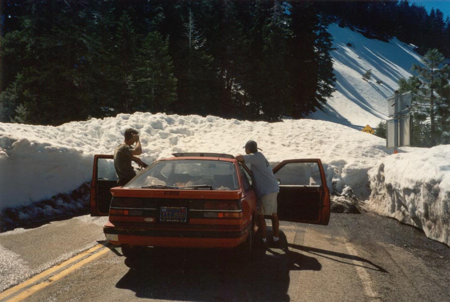
We drove the scenic route home, leaving the desert for the snowy slopes of Mt. San Antonio. The road was dry and well traveled so we ignored the "road closed to Glendale" signs and pushed on until we found our way blocked by a 7-foot high wall of snow. The snowblowers only went half way, just far enough to dig out the ski resorts and Pacific Crest Trail crossings. We returned to the desert and made our way home around the mountains to the rugged but snow-free pass to the west.
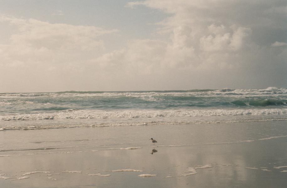
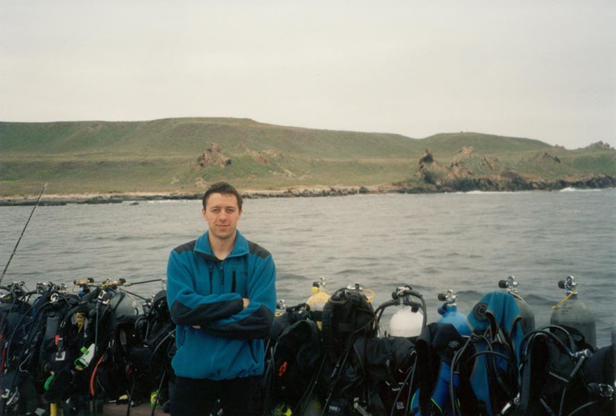
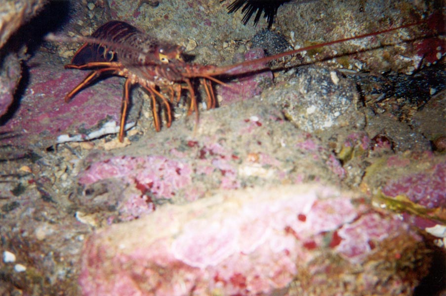
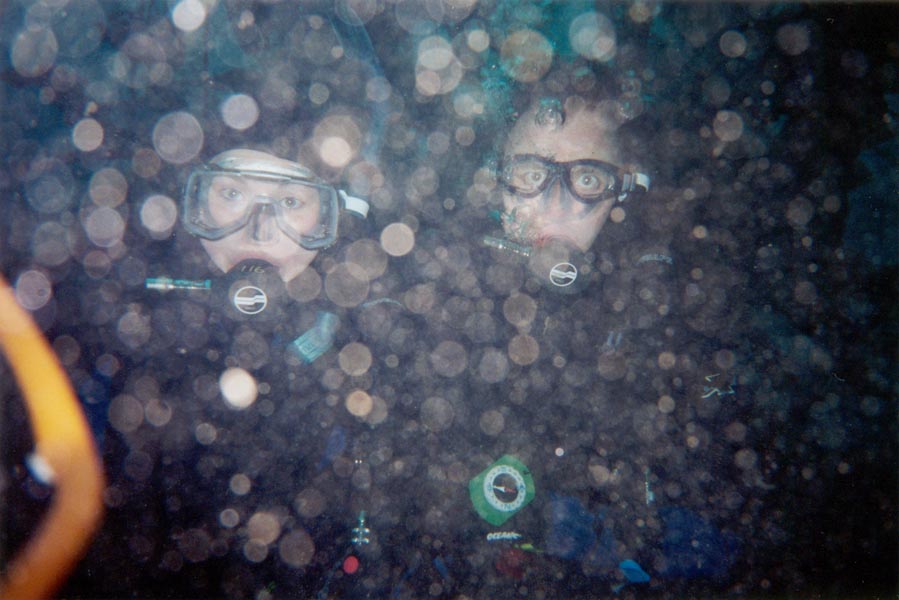
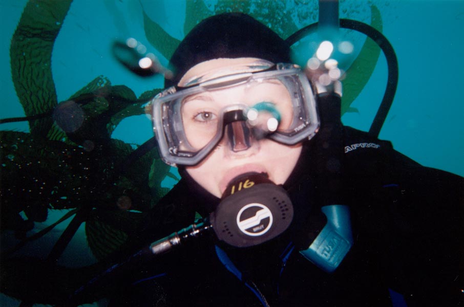
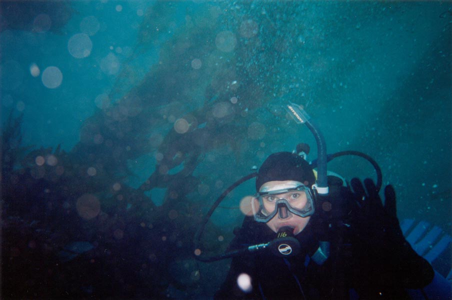
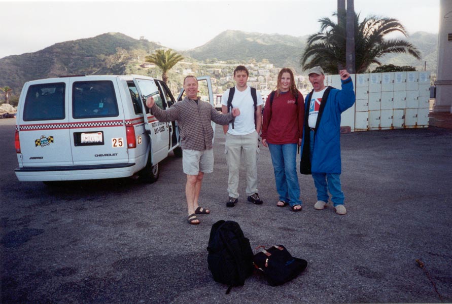
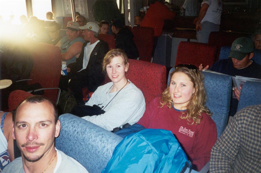
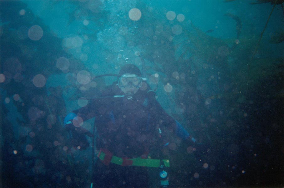
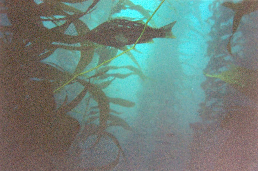
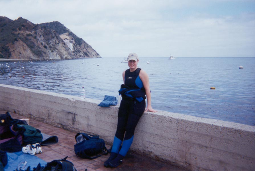
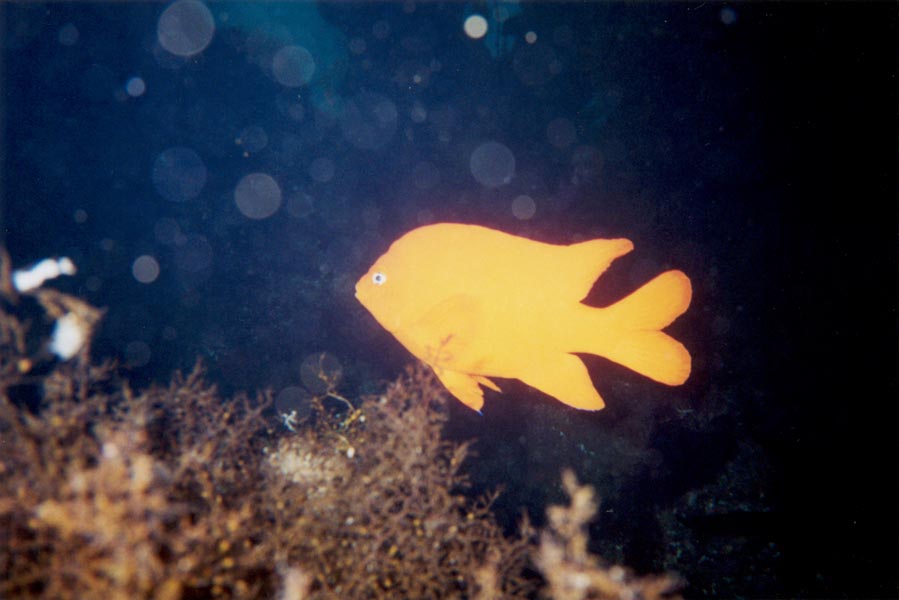
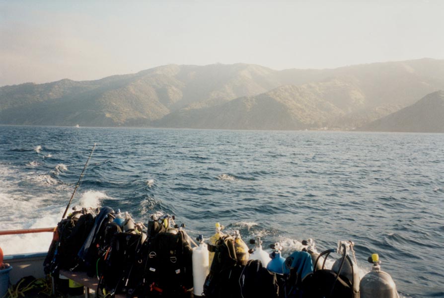
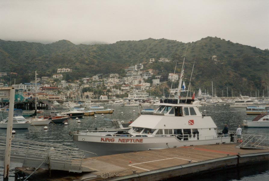
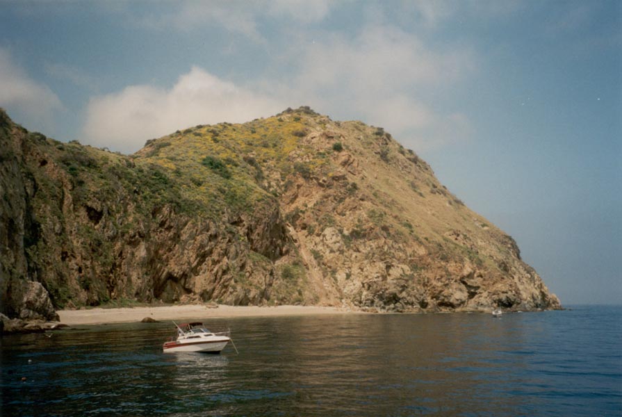
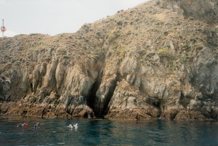
I was underwater for three hours this weekend. We slept on the dive boat Friday night as it motored out to San Clemente. The sky and the water were cold gray when I came above deck the next morning, but below the surface it was beautiful, a completely different world. We made our first dive in forty feet of clear blue water among canyons of kelp and white sand. Schools of fish swirled around us, sea stars and lobsters clung to the coral-encrusted rock, and thousands of tiny animals and plants swayed with the surge. We swam off a cliff that dropped away to sixty feet and explored the channels and crags. The next two dives were similarly spectacular. Sunday morning we took a ferry to Catalina Island for a day of diving at Avalon. The visibility was only 20 feet or so but the diving excellent nonetheless, with some very large fish around us in addition to the usual kelp and lobster. So it has begun - the addiction to diving that could only be broken by something like ...hang gliding. I'll be soaring in San Bernadino in two weeks.
It's very relaxing being neutrally buoyant. Everything is slowed from the hectic pace of life at the surface, gravity is gone, and one can swim in any direction - cruising upside down beside a towering cliff, descending vertically into crevices and holes, gliding through tunnels in the kelp, hovering motionless just inches from the most delicate corals, eyeing fish face to face with equal curiosity on both sides...
March 26, 2001
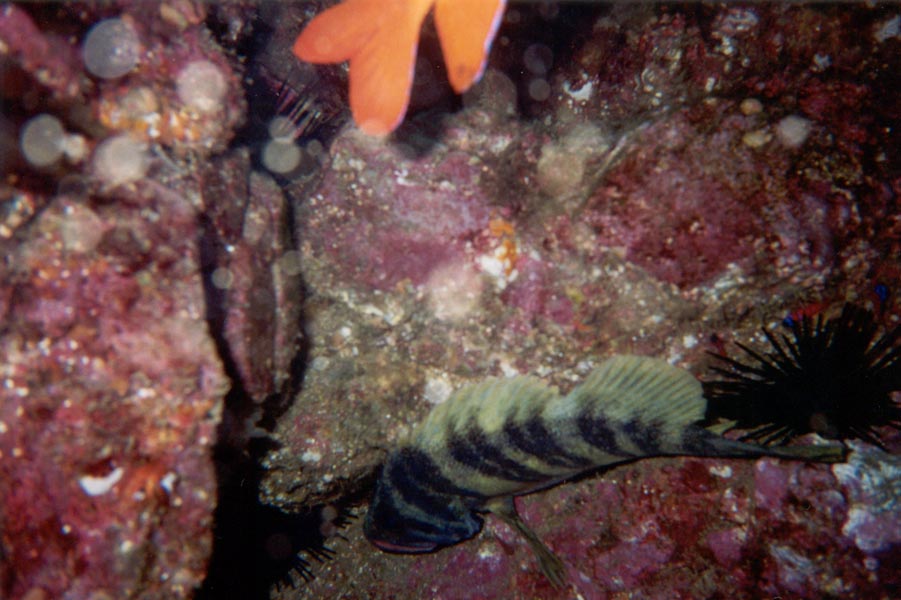
After another dinner-on-the-waterfront/evening-at-the-harbor/sleep-on-the-boat sequence, this time at Ventura Harbor with the lights shining through the fog and the sailboats bobbing in the swells and good food at Milano's Restaurant, JC and I squirmed into wetsuits and immersed ourselves in the 53 degree waters off East Anacapa Island. We descended to a sandy bottom and then moved among kelp covered boulder piles that were home to giant crab and lobster, large schools of fish, and countless plants and animals clinging to the rocks. We poked around in a hole five feet across and counted eight lobsters, each one eyeing us inquisitively. Suddenly five or six sea lions appeared, whirled around us, and were gone. We turned to the next kelp forest and soon found ourselves among several hundred fish hanging motionless in the kelp. Farther along, we encountered a crab skittering sideways across the sand from one rock to another. It peered up at us with its spiky eyes and waved its claws until we floated off. The sea lions whirled by again as we returned to the anchor line for our ascent. The next dives turned up immense lobsters hiding in caves, octopus and sea bass, cliff-dwelling shellfish and a multitude of corals. Eventually the surge, changing currents, and cool gray weather got the best of us and we returned to the boat for dry clothes, food, and nap time.
The moonlight was shimmering on the crashing surf, the cormorants were sitting motionless on the rocks, the twinkling lights of Santa Monica stretched down the coast as far as I could see. It was 1:00AM and I was rock climbing on a sea stack as the waves crashed against the sand and rocks below. We had missed an exit while returning from a sports bar in LA so we took a scenic route home - over the Santa Monica Mountains, overlooking the great shimmering expanse of the Los Angeles Basin, and down a narrow winding road through Topanga Canyon to the coast highway. Business casual dress isn't the best for climbing but who cares, the beach is beautiful at night.
April 9, 2001
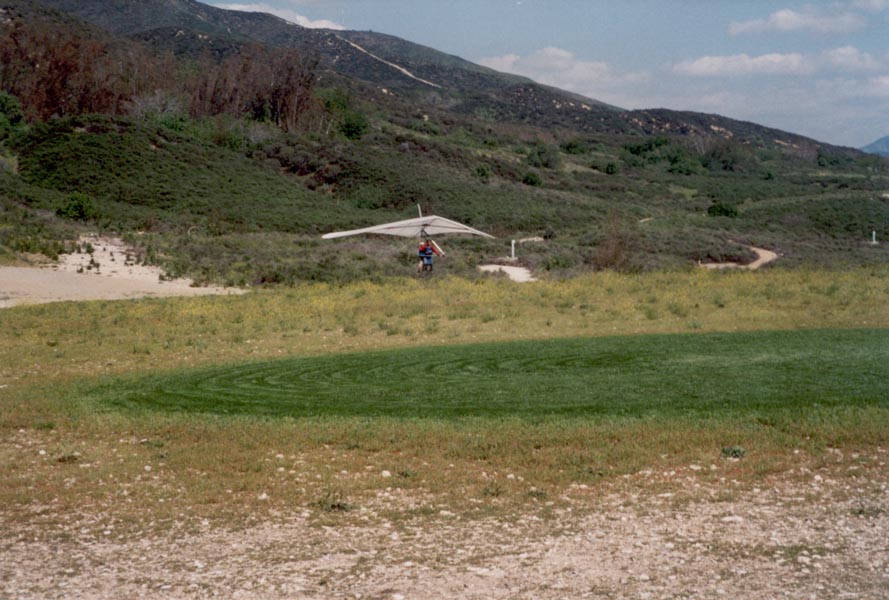
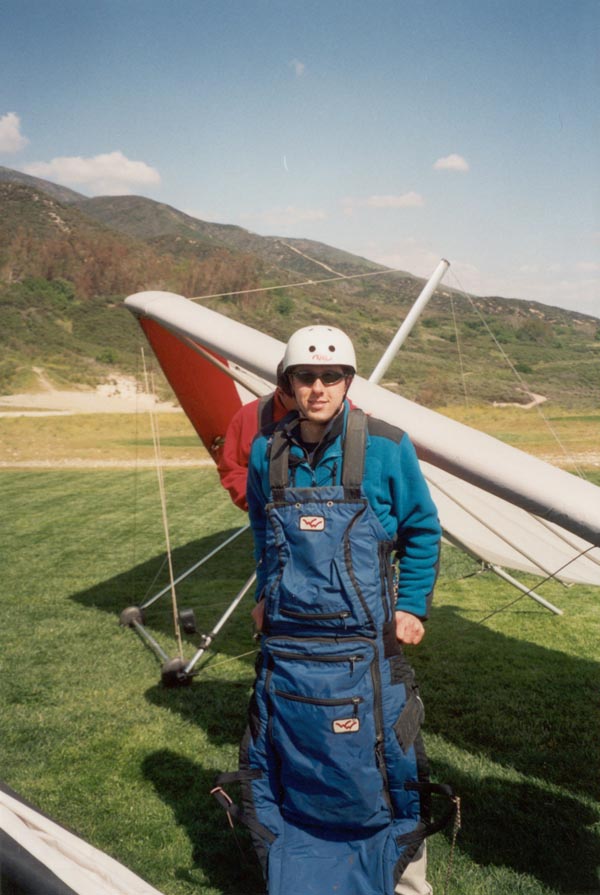
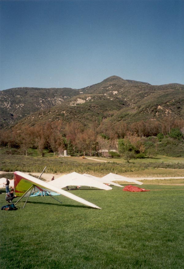
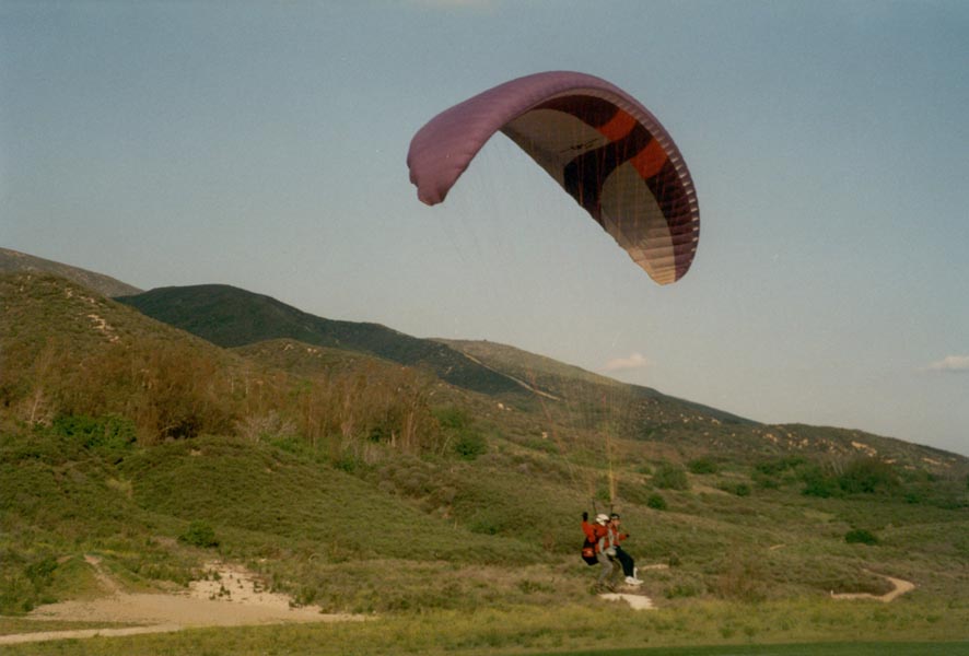
From 4000 foot high Marshall Peak in San Bernardino I could see snow-covered mountains on three sides. Wind gusts shook the shrubbery and fluttered the sails of numerous hang gliders perched on the rocky point. After setting up the wing, my instructor briefed me on the flight and we took a few quick steps into a gust. The ground dropped away quickly and we began to climb, circling above rugged gullies, flying with birds, catching the wind coming up from the south. I took over the control bar after a few minutes and flew along the ridge. The glider could fly itself if I let the bar go but to keep on a straight course or circle I shifted our weight left and right. We banked and turned and caught lift as fast as 400 feeet per minute that took us 3000 feet above the ground. The gliders on the peak became tiny, the city below even smaller. After 45 minutes of soaring we made a soft landing so Vlad could go up in a paraglider. He flew even higher, to 6000 feet, on smoother late afternoon air.

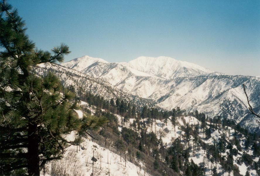
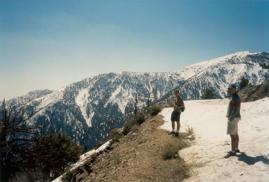
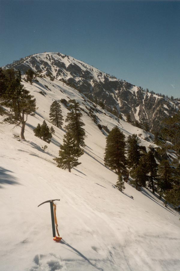
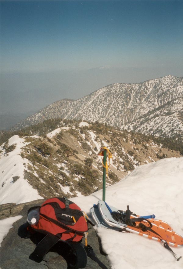
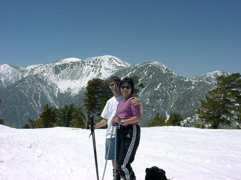
Early Saturday morning JC and I swam out through the surf at Redondo Beach and spent a half hour searching the sandy bottom for anything but sand. The visibility was around seven feet so there was little to see. Back on the surface the weather was warm and sunny so we lay on the beach for the rest of the day. Sunday I packed my ice axe, crampons, and snowshoes and arrived at the Mount Baldy ski slopes just before noon. After wandering across the Notch for a couple hours I went west along the Devil's Backbone, a narrow knife edge leading to the 10,000 foot summit. A steep snow slope dropped several thousand feet on the north side and an equally steep scree slope lay to the south. I turned back a few hundred feet below the summit to return at my planned time to meet Vlad and Jenny, and after making my way back along the ridge, removed my crampons and glissaded two thousand feet down the mountain until there was no more snow. It was a beautiful day - the sky was blue but the haze below obscured most of the Mojave desert and the coast. The summit of San Gorgonio rose above the clouds to the east and shone bright as the sun sank toward the horizon.
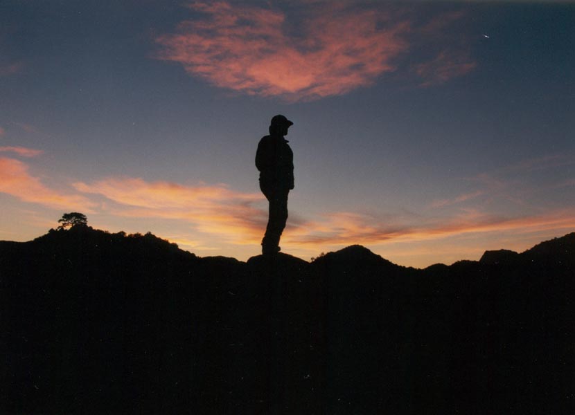
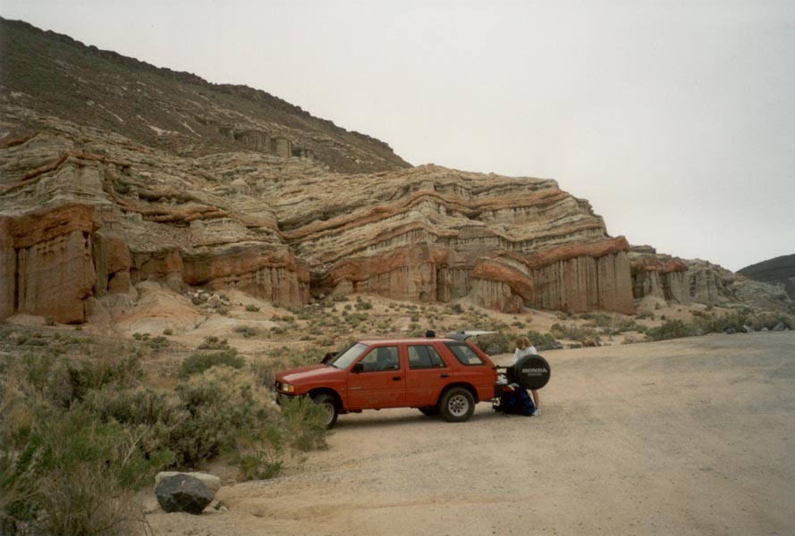
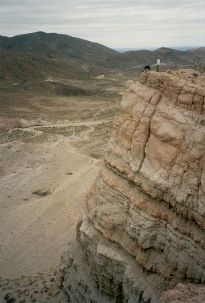
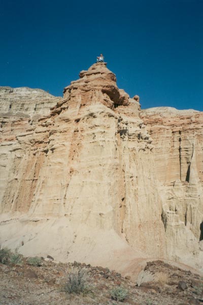
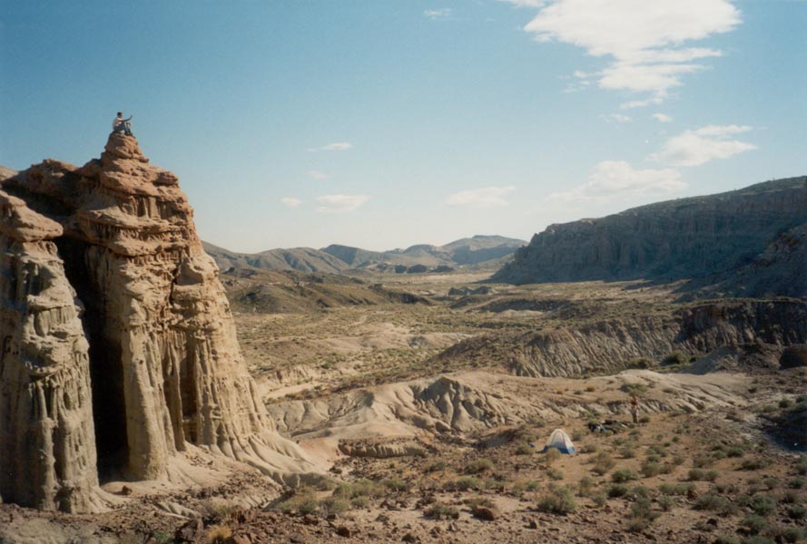
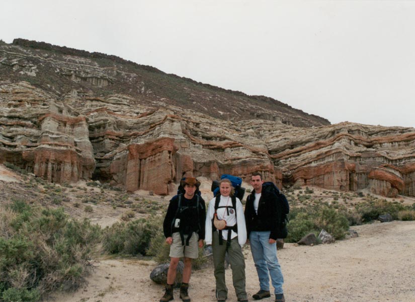
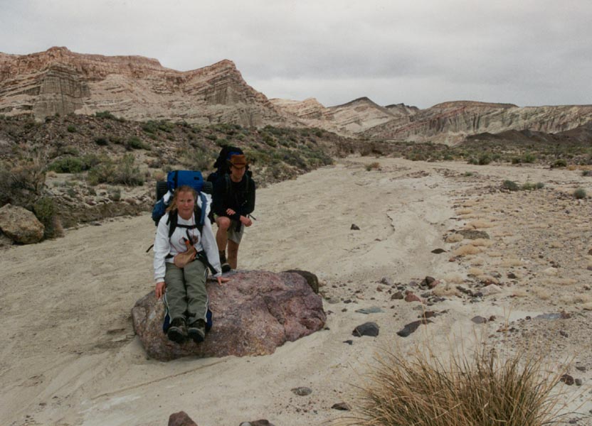
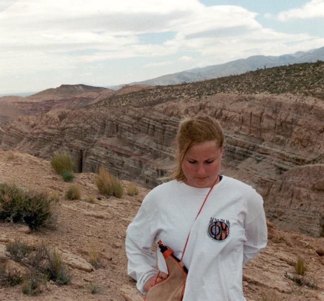
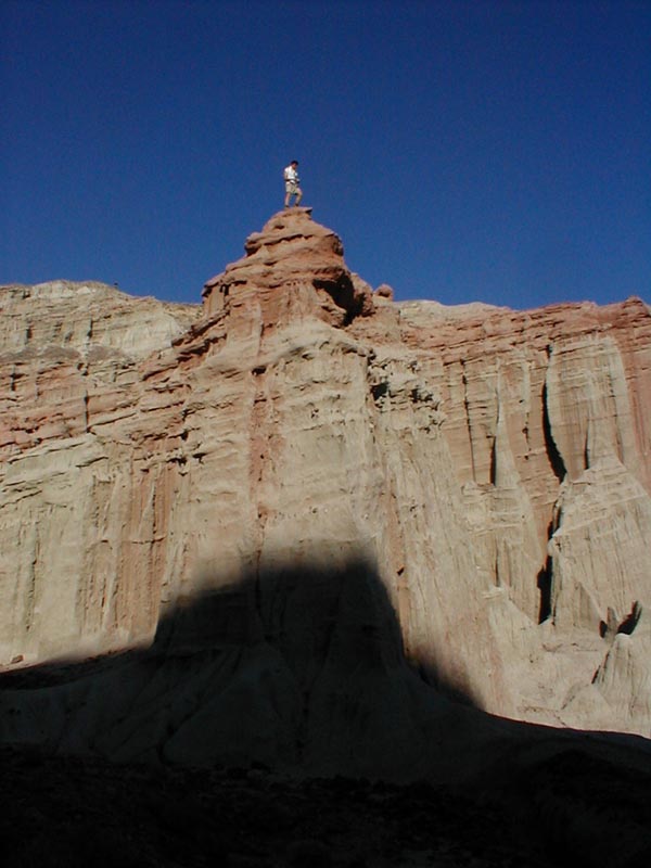
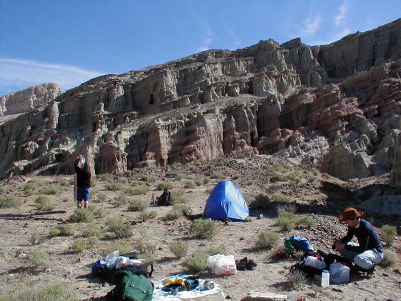
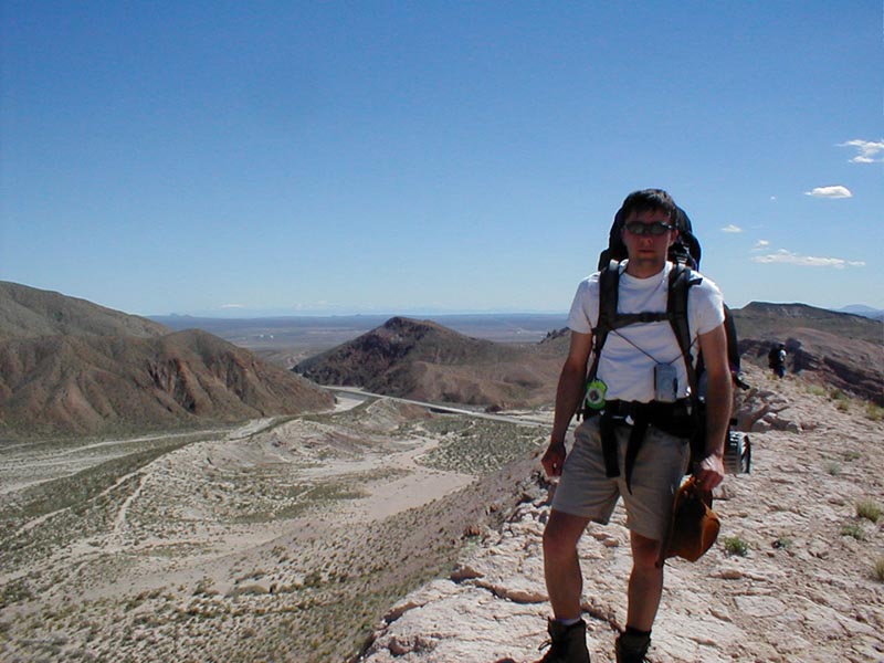
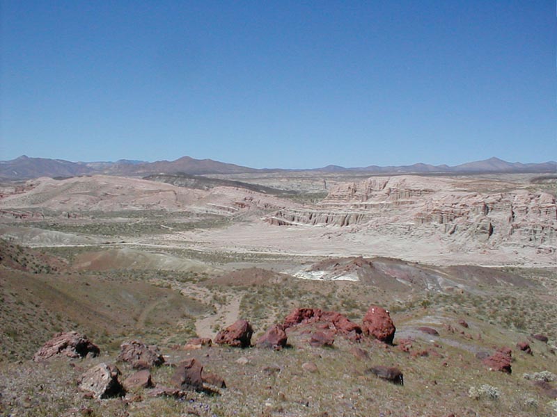
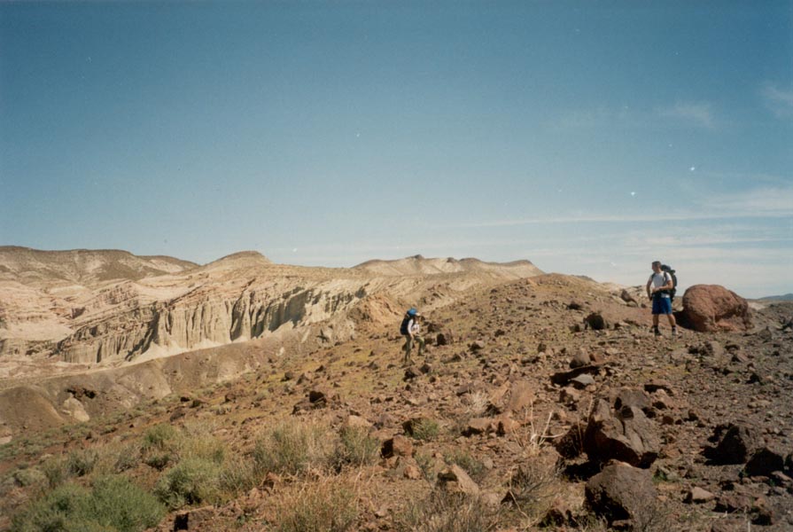
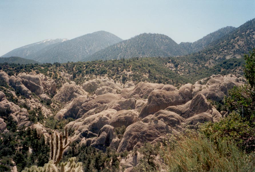
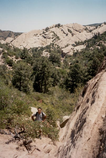
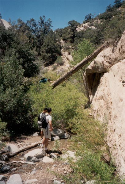
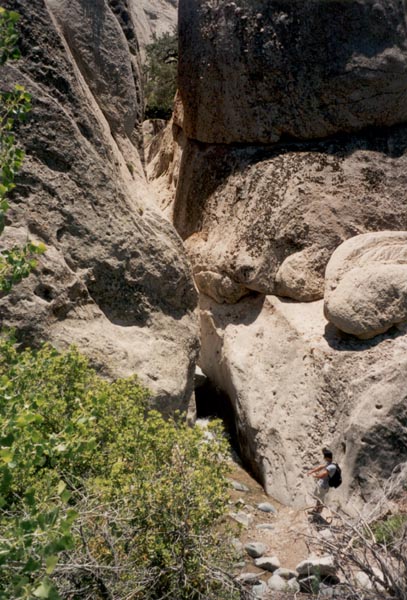
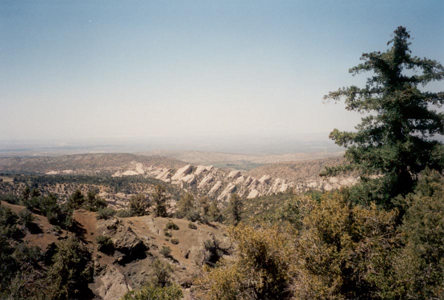
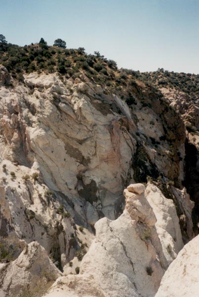
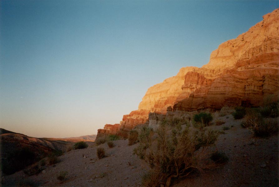
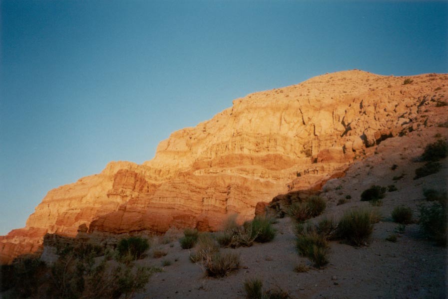
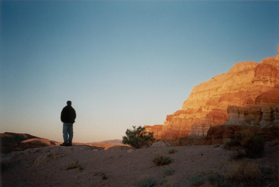
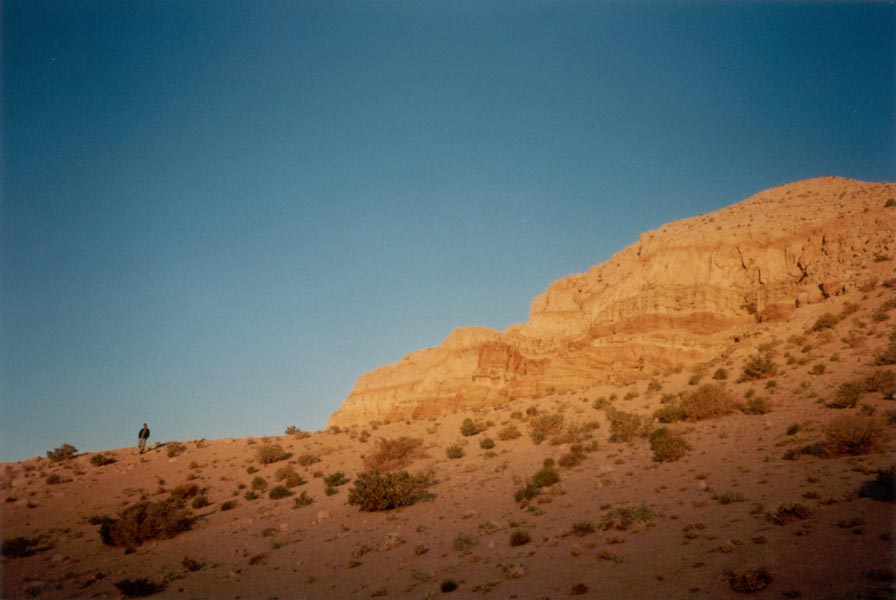
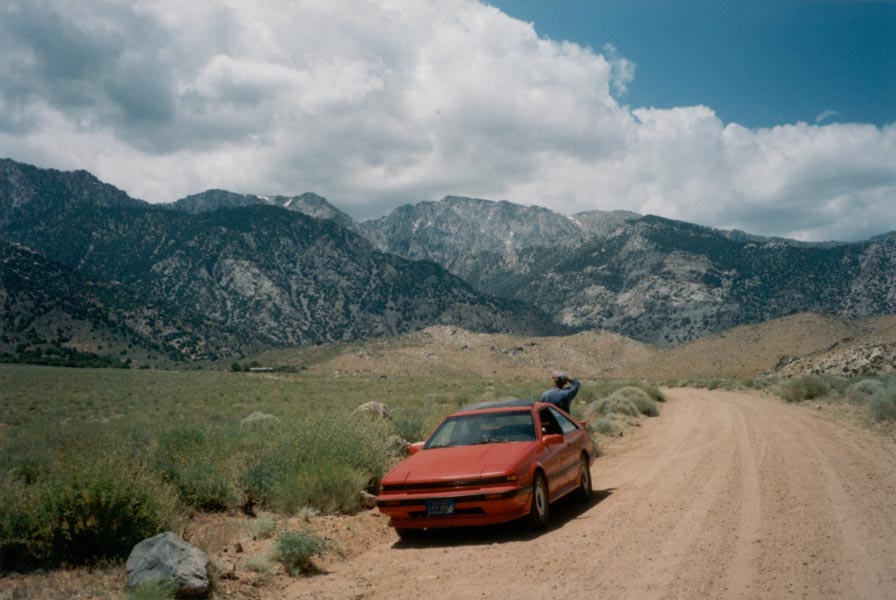
The winds blowing through Tehachapi Pass on Saturday morning were so strong that our car swerved with every gust. A cloud of freshly fallen snow blew off the higher peaks and small pebbles and sand picked up by the wind clattered against our windows. The air was unusually clear and as we drove down out of the hills overlooking the Mojave desert we could see distant mountains normally hidden by haze. At Red Rock Canyon we parked in a gravel turnout, donned our packs, and hiked into a wide valley bounded by soaring cliffs to the north and rugged hills to the south. In the midst of the el paso fault zone the land has been broken and thrust upward, exposing three or four hundred feet of red and brown sedimentary rock capped with hard pink lava and eroded by wind and water to form fluted columns and hollows and overhangs. We hiked below the towering pinnacles and crumbling walls for a couple miles, explored a mine tunnel extending a short way into the hillside, then cached our packs and scrambled to the canyon rim. From the top we could see the maze of side canyons and washes that continued on into the hills. We climbed higher to another ridgetop, where a solitary bush stood alone overlooking the windy expanse of desert, and looked north to the southern slopes of the Sierra Nevada.
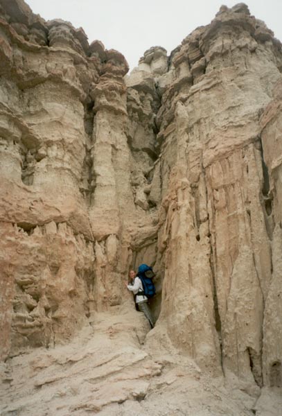
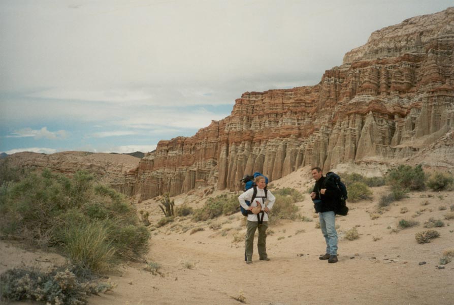
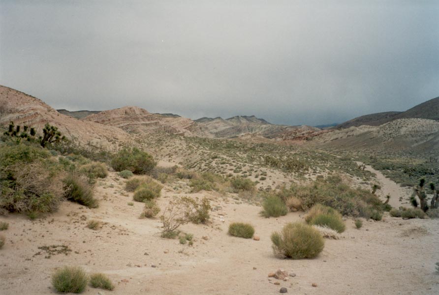
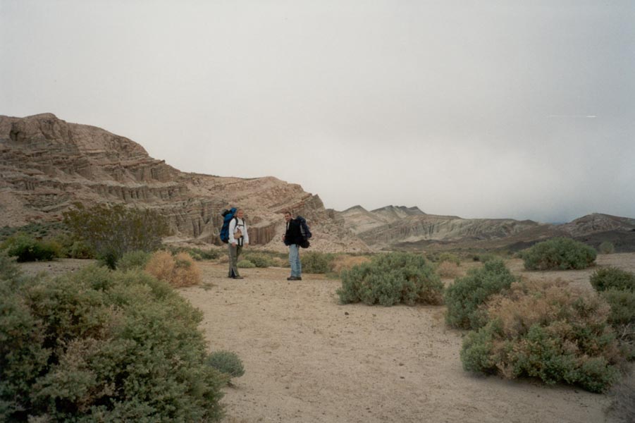
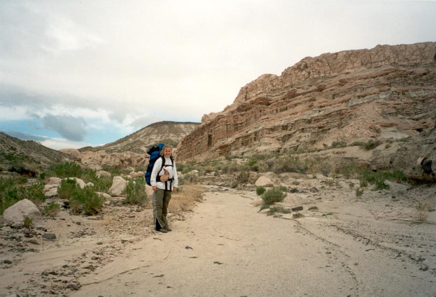
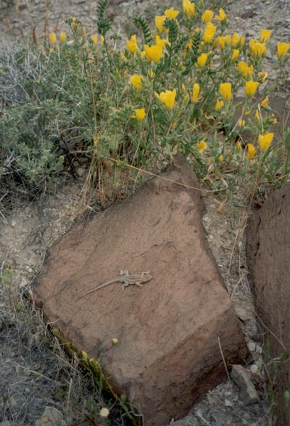
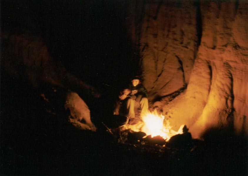
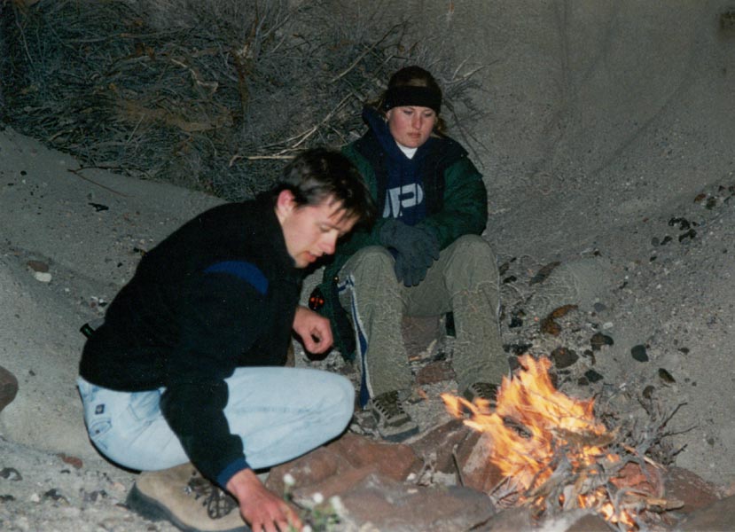
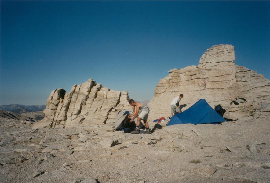
The desert was green with small plants and the wildflowers were in peak bloom - purple and white lupines, yellow poppies, huge pink-petaled flowers atop short stems, purple rosettes of petals perched on tiny stalks rising out of the sand... the cacti showed off brilliant pink petals and the shrubbery was studded with colorful flowers. The climb down proved to be more difficult than the climb up. We tried an alternate route farther up the canyon but found ourselves at the top of a seventy foot high precipice in a narrow canyon smoothly cut from the hard pink rock. We continued on up the canyon and crossed to another rocky wash high in the hills, then walked down to a broken land of sand towers and steep gullies and eroded hillsides of many colors, labeled Nightmare Gulch on the map. At length we emerged from a narrow channel nearly hidden by the overhanging canyon wall, returned to our packs, and continued back up the canyon to a beautiful site on a bank above the creek bed at the head of the valley. As the sun sank lower the hills glowed with color. We set up tents, gathered firewood, and rigged ropes from a pinnacle of sand to hang our food away from the small furry denizens of the desert. The wind died as I cooked dinner but as the shadow of the canyon rim fell over us it became sharply colder. Pasta, bread, and a bottle of wine never tasted so good. After dark we built a fire in a sheltered hollow of the canyon wall. The light reflected off the weathered sandstone and formed a sphere of warmth. Above us the clear sky sparkled with stars. Owls hooted in the distance but little else broke the silence.
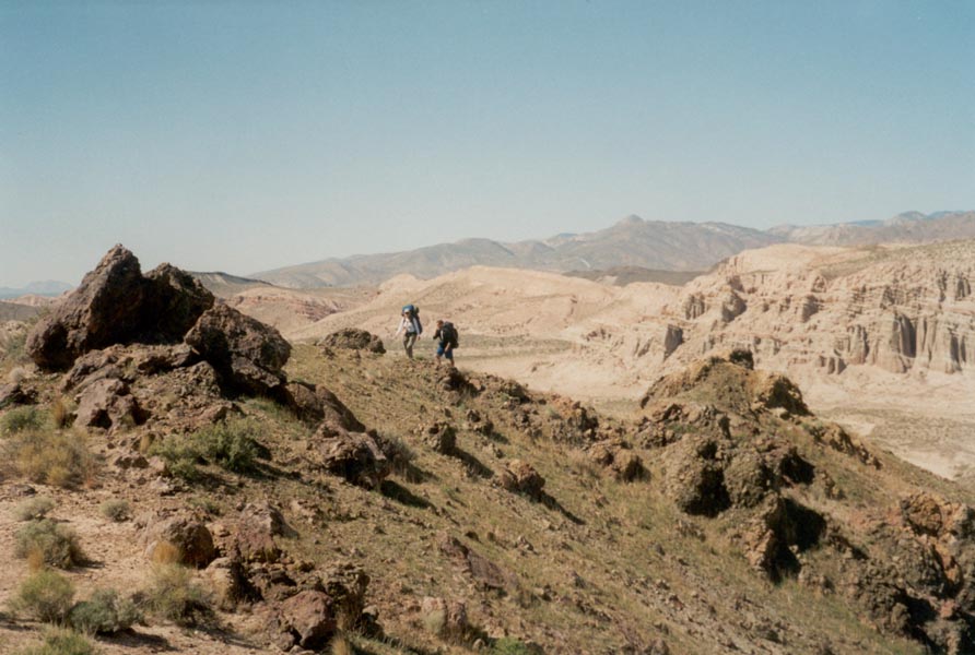
The morning sun soon burned away the cold as it made its way down the canyon wall opposite our camp. After breakfast we climbed to the far ridge and began to make our way out of the canyon, but twice we found our ridge traverse blocked by deep gullies so we stopped on the slope and napped in the sunshine. The midday sun eventually sent us on across the canyon to the shade of the far ridge once again, where we climbed to the highest point and looked south to the snowy peaks of the San Gabriel mountains. Our descent was once again blocked by a dry waterfall, but this time we were able to lower the packs down with ropes and scramble around. Home again, to the place where water is plentiful but the quiet canyons are nowhere to be found. Next weekend I go where there is no shortage of water - diving at Catalina Island.
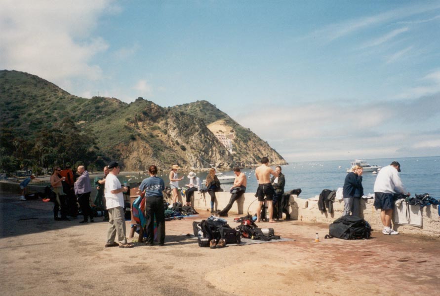
The weather was cloudy at Catalina Island, like it always seems to be when we dive. Underwater the weather makes no difference though and we made two excellent dives at Avalon. After dark we reluctantly put on our cold wet neoprene once again and made one more dive. Our lights swept through the water, illuminating colorful coral and kelp. Many of the fish had gone to sleep, tucked into cracks in the rocks, but the shrimp were out and the sea urchins scooted across the bottom. Best of all was the bioluminescence. At every fin kick tiny green sparkles scattered in the water. When we turned off our lights the luminescent plankton faintly lit the other divers and the bubbles rising from our regulators. Back on shore, Avalon was teeming with activity but we retired to our hotel around 11pm to rest before the boat departure the next morning.
100 feet below the surface the water was cold but reasonably clear. Schools of fish swam by, the kelp swayed in the current, and as we poked around in the rocks all manner of aquatic life stared back at us. A solitary sea lion pup swam by as we ascended from the first dive. The next dive turned up a school of barracuda in addition to the usual fish. That was before we swam beyond the point and into the current that took us 200 yards from the boat and into deep blue water where there was nothing but a few schools of fish. Sometimes the fish swam past by the thousands, in a silver cloud around us. The third dive of the day turned up a couple of sharks, some large crabs, shellfish, and a variety of other interesting fish. The sun had come out at last and in the shallow water the colors were brilliant. Sunlight filtered down through the kelp forest and shimmered on the rocks below. I would have been content to stay the week but such hopes were not to be and we took the 6:45 ferry back to San Pedro. The sun lit the sky red and yellow as it sank below the hazy waves.
May 14, 2001
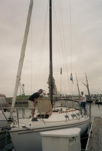
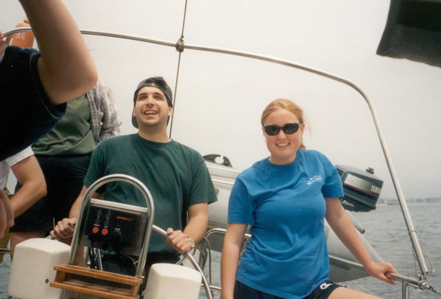
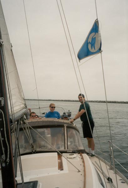
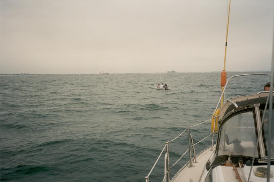
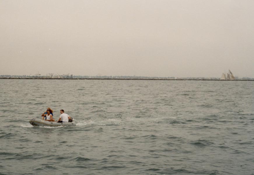
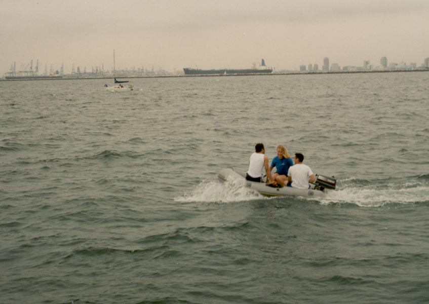
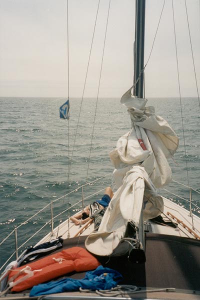
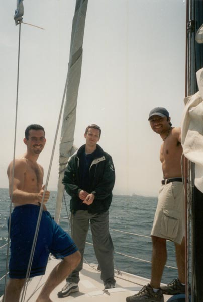
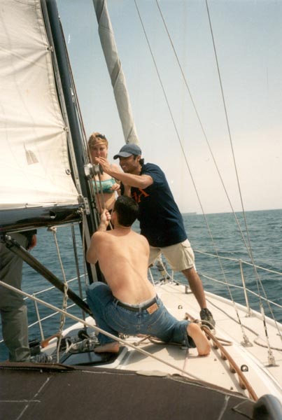
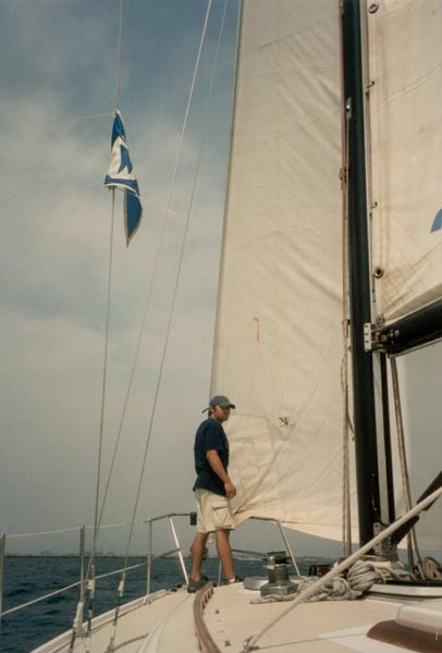
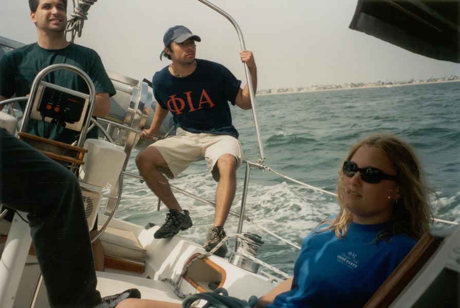
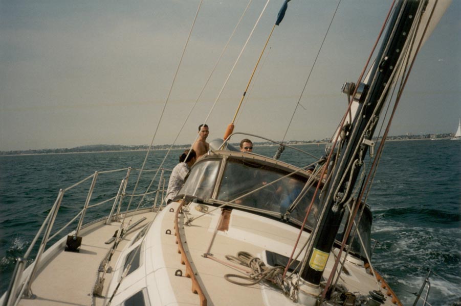
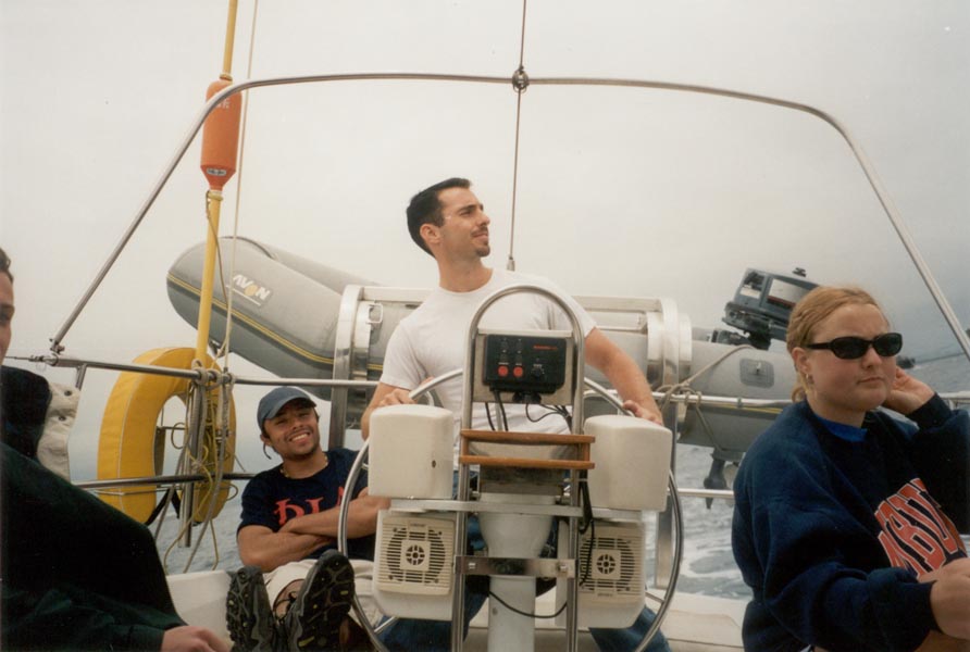
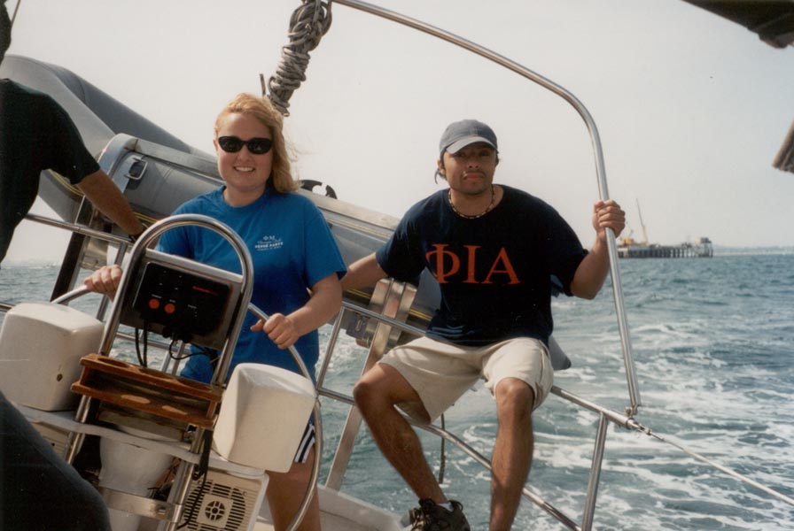
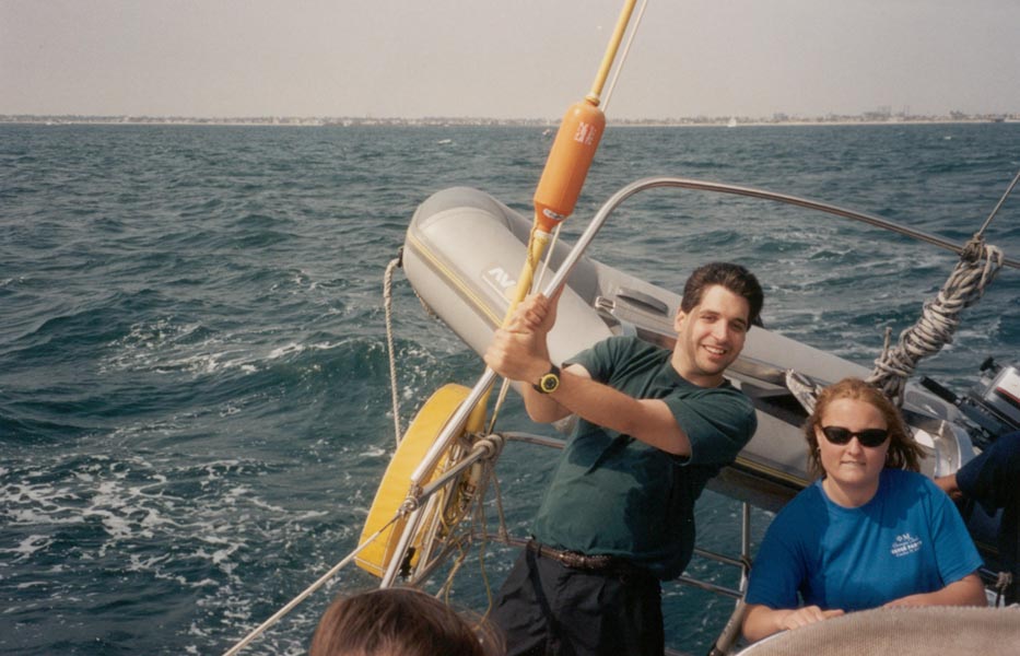
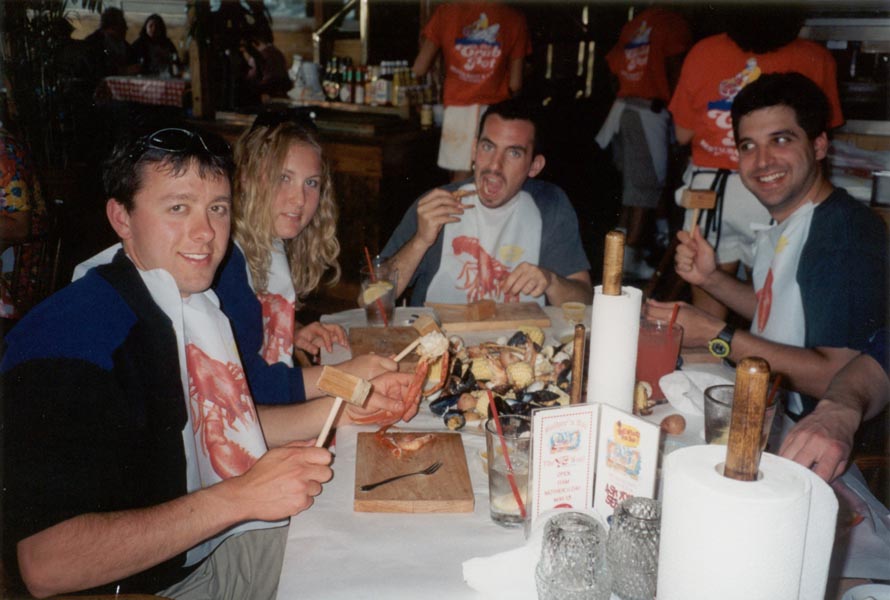
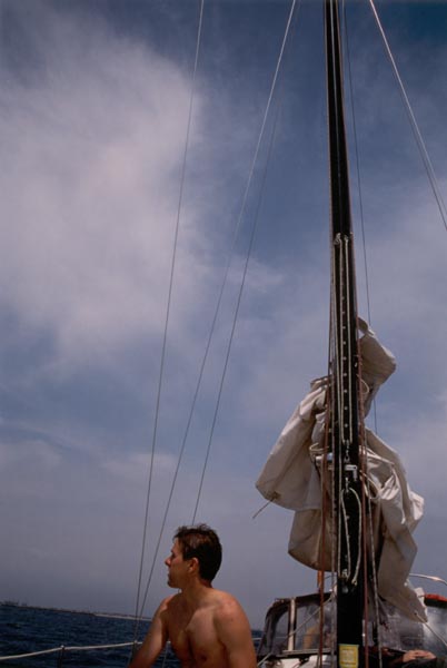
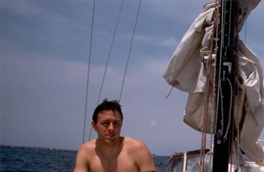
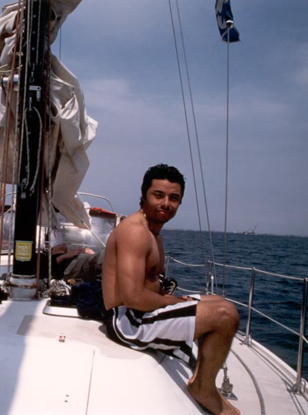
Saturday morning was cloudy, but this time the shifty weather meant favorable winds for sailing. The seven of us rigged the sails on a 36 foot boat and sailed out into Long Beach Harbor, navigating between container ships anchored between oil rigs and the breakwater. Once we were beyond the breakwater the sun came out and the wind died, so we anchored and swam for a while. We lowered the dinghy and motored around in circles, watched the little catamaran sailboats zip past as the wind picked up again, and finally pulled anchor and sailed down the coast to a seafood restaurant. We ordered the Seafest, for which the staff gave us bibs, wooden mallets, clam forks, and chopping blocks. They emptied buckets of crab and shellfish and corn on the cob and sausage and potatoes and lemons onto our table and we cracked and hammered and chewed our way through it until only shells and corncobs remained. Returning to the boat, we sailed back to Long Beach under cloudy skies once again, arriving just as darkness fell.
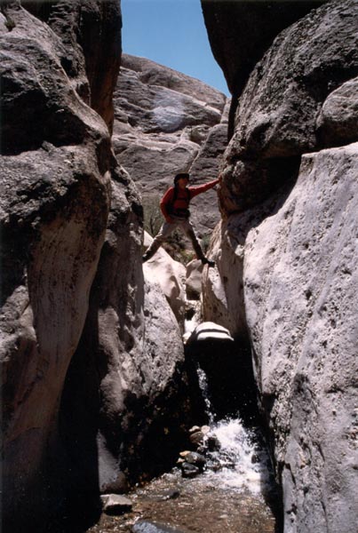
There was rushing water in the desert on the north slope of the San Gabriels, due to the melting snow high above. We walked/climbed/scrambled/waded/thrashed our way through a maze of twisted sandstone in the midst of the Punchbowl fault zone. The sky was clear, the water was cold, and the wildflowers were in full bloom. To the north, the great expanses of the Mojave desert faded to the horizon.


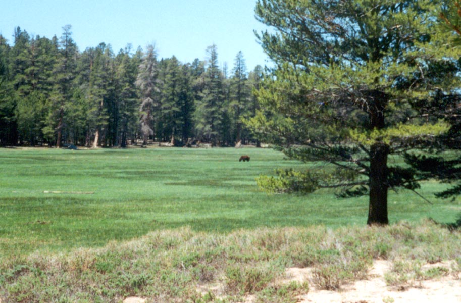
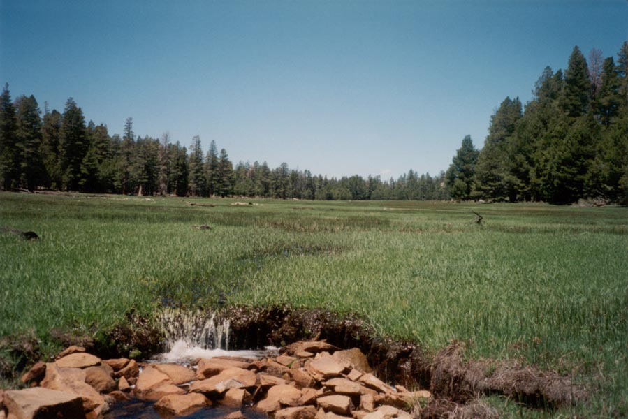
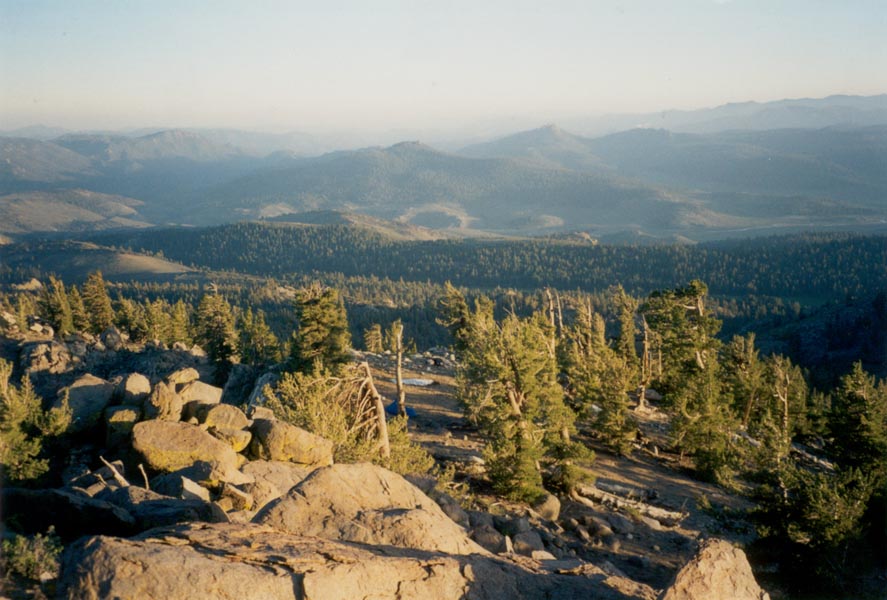
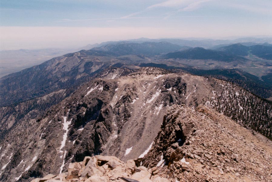
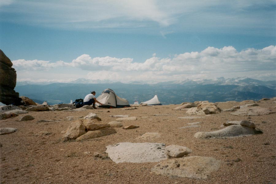
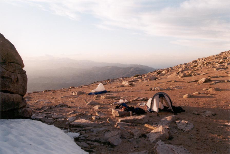
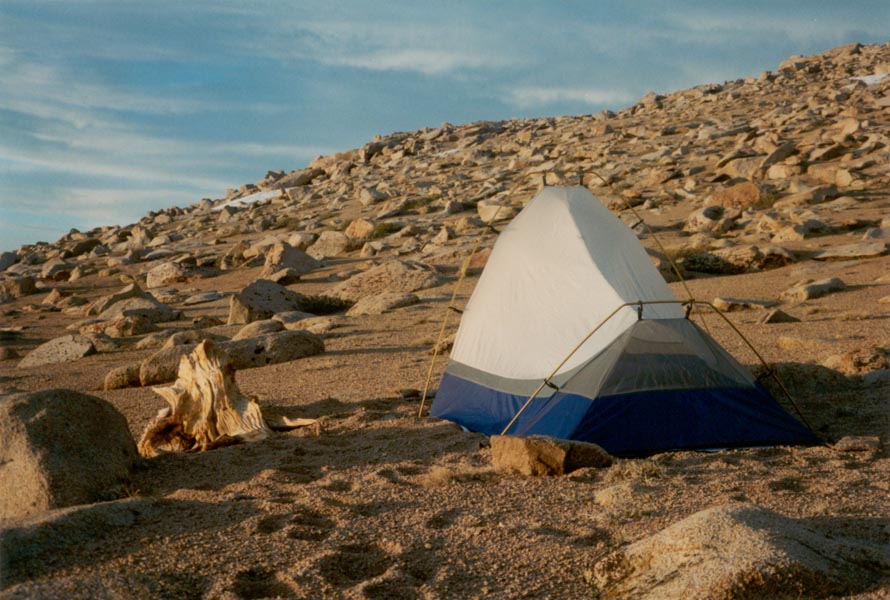
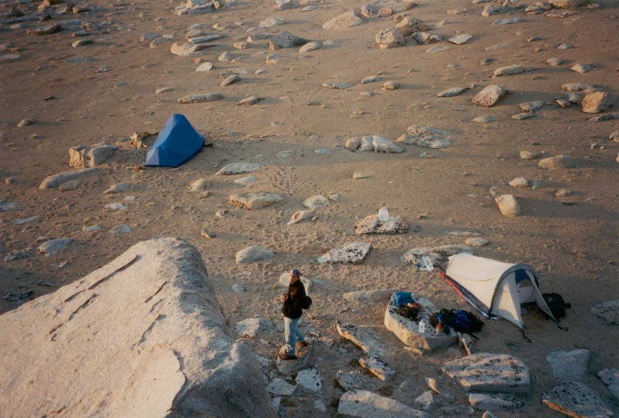
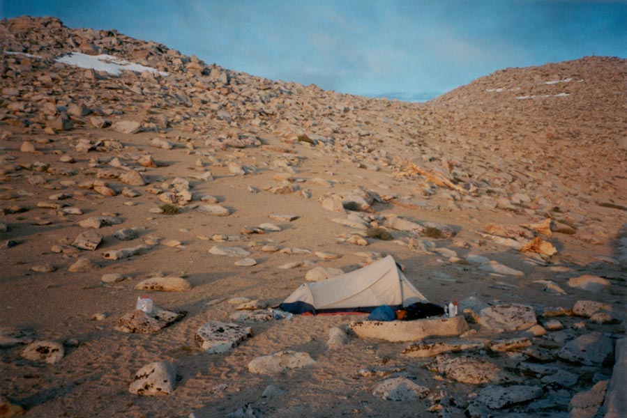
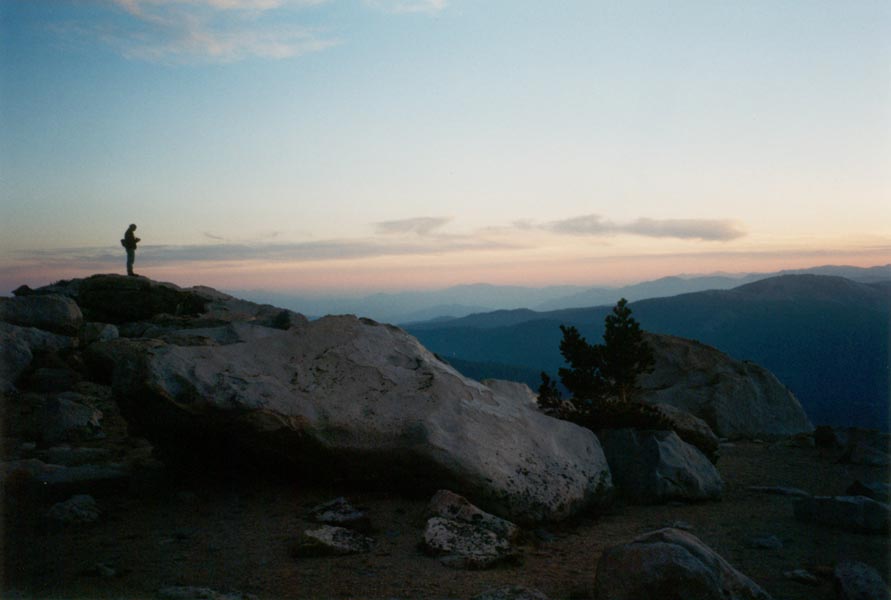
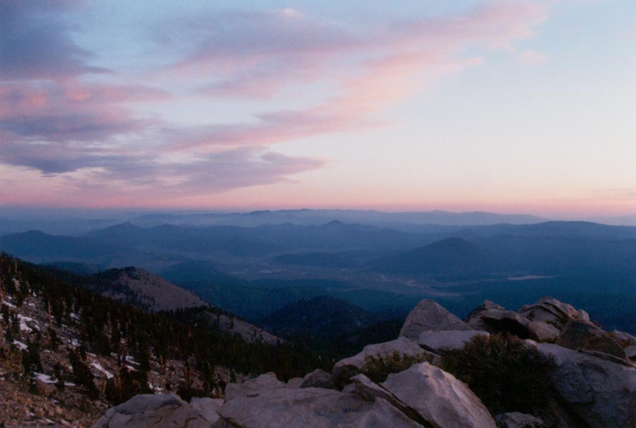
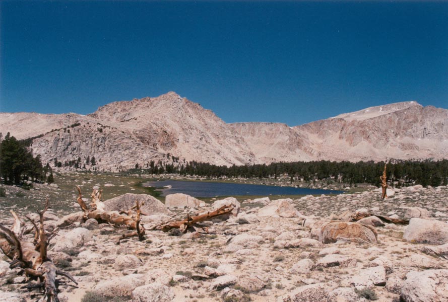
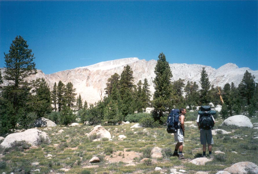
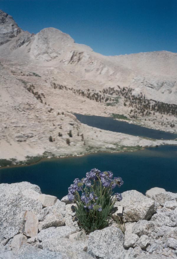
The stars were so bright Sunday night that my tent cast a sharp shadow in their light. Sean and I were camped in a gravel moonscape 12,000 feet high on Olancha Peak, overlooking the high country to the north. We had driven to Red Rock Canyon on Friday night, where we slept beside the towering red cliffs, and we continued on to Sage Flats the next morning after watching a beautiful sunrise. We hiked out of the hot dry desert to open pine forest and lush meadows, where we came upon a large black bear foraging in the grass. The mosquitoes found us a short time later but we managed to escape by climbing rapidly to the ridge, no easy feat at 10,000 feet with 35-pound packs. Our first camp was perched at the edge of the east escarpment, which dropped vertically for more than a hundred feet and then sloped steeply down an avalanche-swept gully to the desert six thousand feet below. We watched the sun set and the distant mountains turn shades of purple and gold, then built up a fire to combat the cold wind. Morning came with a beautiful sunrise that thawed the frozen ground and quickly warmed the air. After breaking camp we continued up the ridge to the summit. The view was spectacular, to say the least. The Whitney High Country was still partially covered in snow. The dry expanses of Owens Valley shimmered in the heat, streams in the lush meadows to the west glittered in the sun, and far to the south the peaks of the San Gabriel Mountains were just visible through the haze.
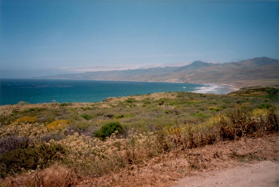
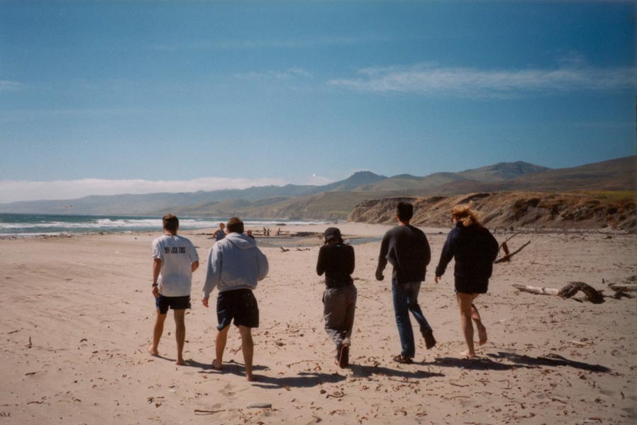
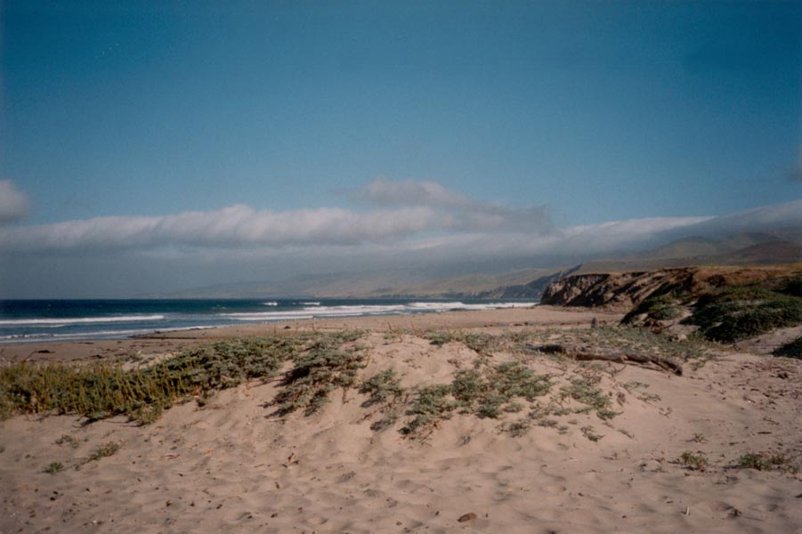
Another weekend at the beach, with sand, sun, wind, water, and not much else. Quite relaxing... Jalama Beach is beautiful, as is the drive from US 1 to the coast - 14 miles of narrow winding road through golden grassy hillsides covered with oak trees. The windy beach is backed by cliffs and rolling hills. Kelp forests offshore shimmer with purple hues in the blue water. Surfers bobbed about in the waves, kites flew in the air, and while armies of seagulls invaded the surrounding campsites we relaxed in the sun.
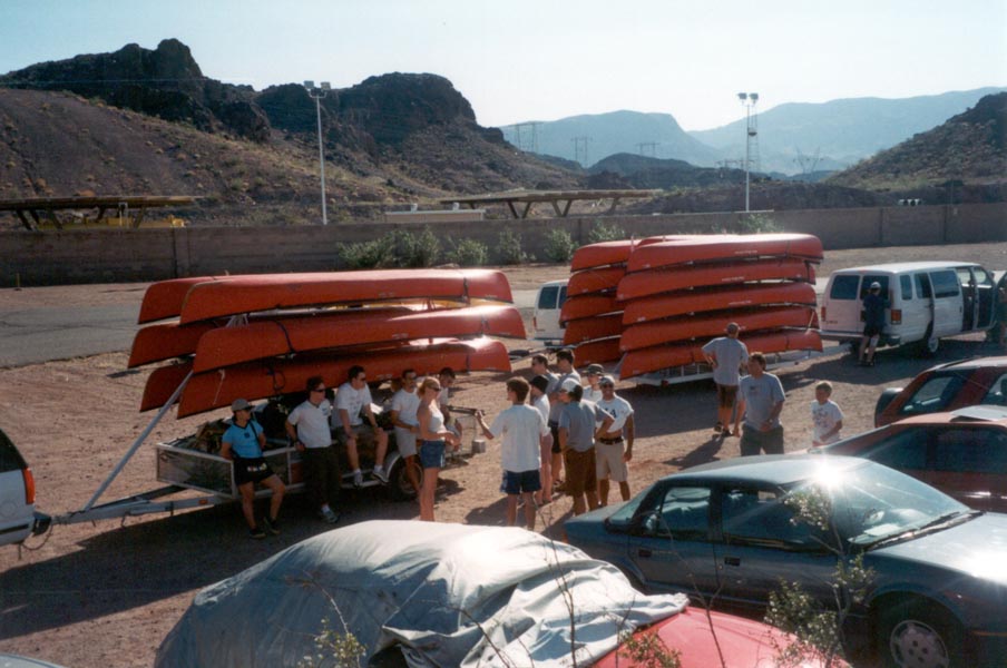
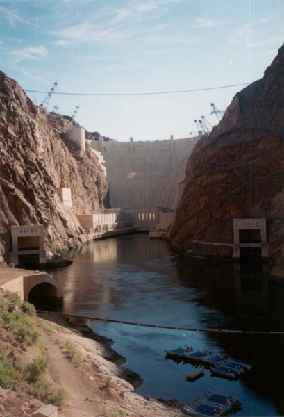
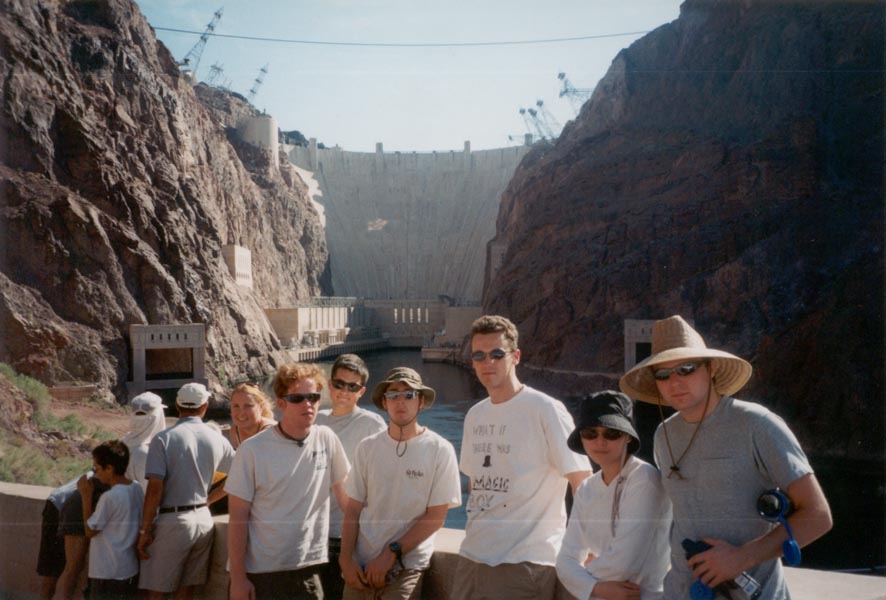
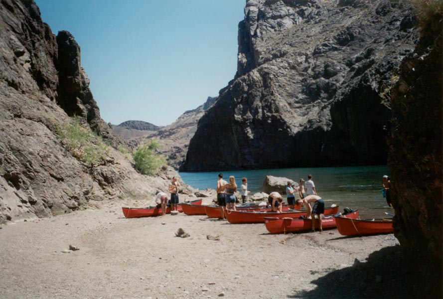
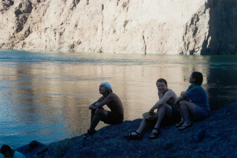
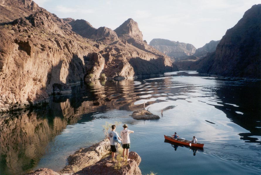
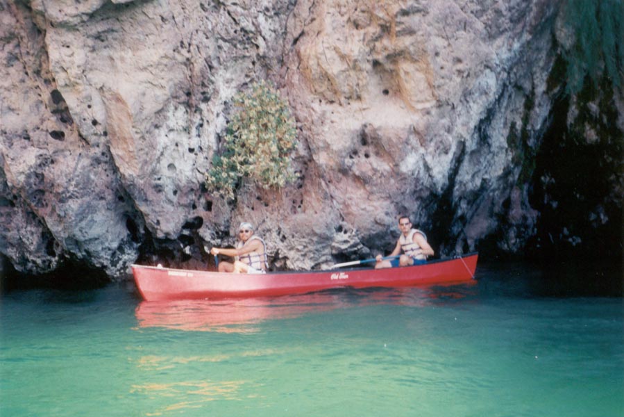
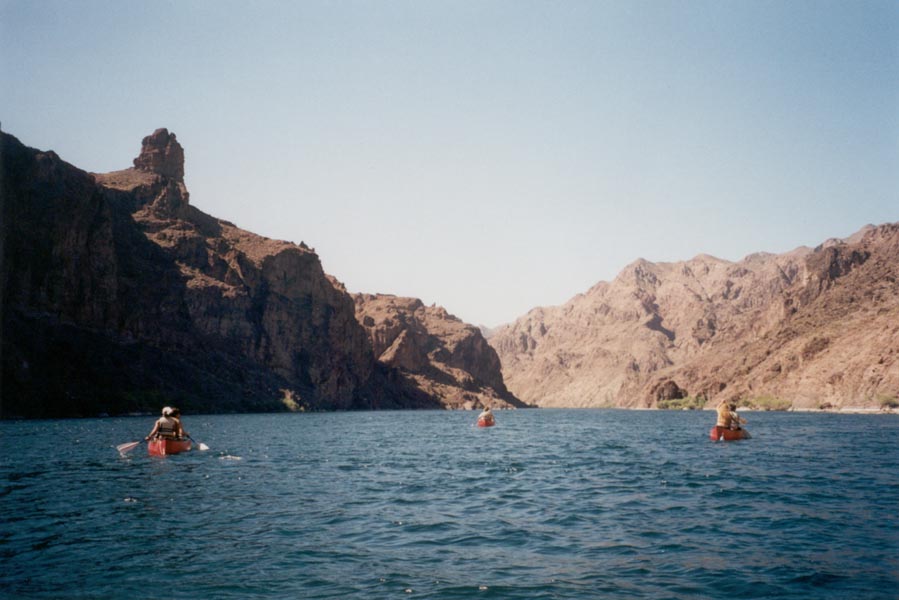
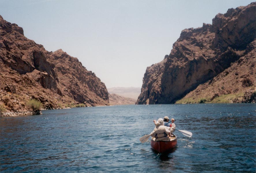
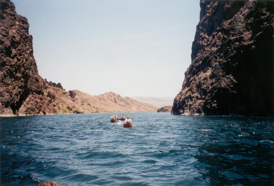
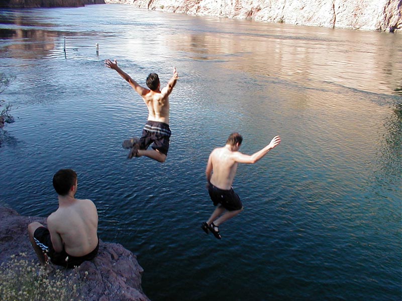
Friday evening after work 14 of us began our migration across the Mojave Desert to Lake Mead. We made it through the evening traffic without delay and rolled on into the incredibly hot sandy hills where it was still 98 degrees late at night. Midnight found us slightly off course on the Las Vegas strip. There, in the middle of the desert, we wandered through a lush rainforest at the Mirage, then drove around town past the castles and towers and the pyramid with the light on top responsible for a big chunk of California's energy shortage. We continued on around 2am to a campground on the shore of Lake Mead. The local birds awoke us a few hours later with hideously loud shrieks and chirps so we packed up and drove down the road to meet our ride to the river. It was just starting to get hot again as we pushed off shore a few hundred yards downstream of Hoover Dam. The seven red canoes dispersed quickly, some going to inspect the gigantic spillway and diversion tunnels, others drifting far downstream. We regrouped at a side canyon where hot water rushed down and then suddenly vanished into the gravel riverbank. There were numerous hot waterfalls and pools carved out of solid rock and in spite of the hot weather the water was still very comfortable.
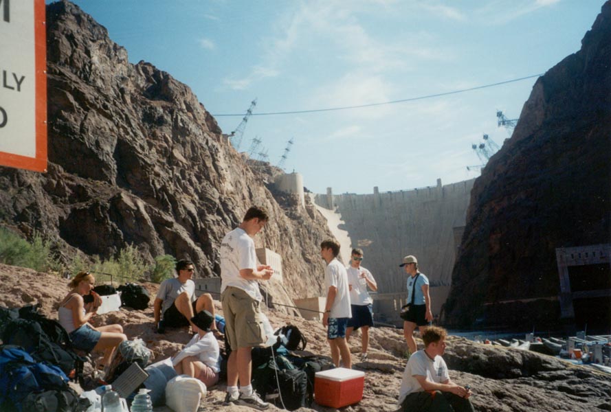
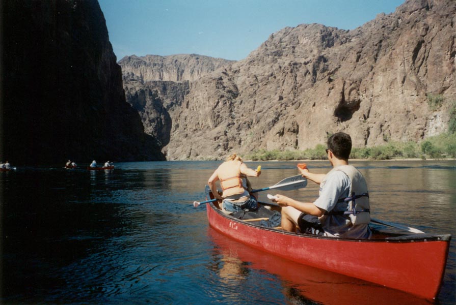
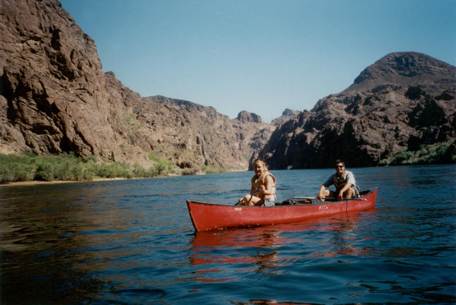
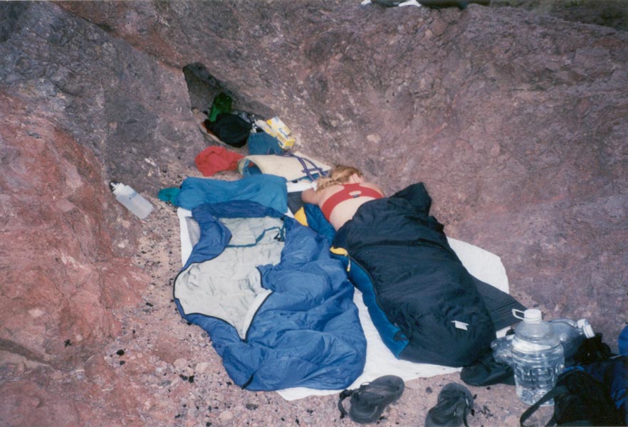
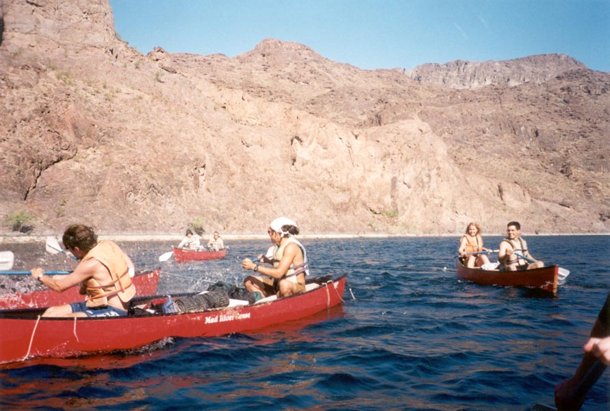
Back on the water some time later, we only made it a short distance before it became necessary to stop and swim again. We paddled into a cave deep enough to hold all seven canoes, where little brown bats hung from the ceiling. Moving on, we set up camp on a rocky point at a bend in the river from which we could see far in both directions. We secured the boats on a small gravel beach and scattered our sleeping bags across the point on the few flat ledges. As the sun sank lower and the river level dropped the water became smooth and quiet. Bighorn sheep appeared on the canyon rim high above and I climbed up to investigate, finding a herd 18 strong on the far ridge. From the rim, hundreds of feet above the water, our campsite looked very tiny. After the sun set the hot wind continued through the night, cooling the rocks so that just before dawn the temperature was quite comfortable.
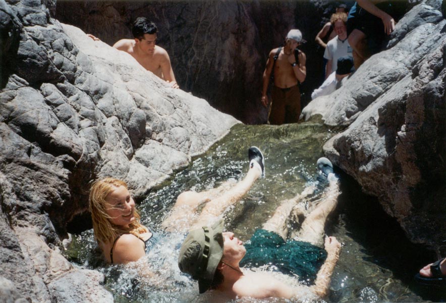
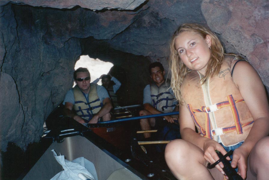
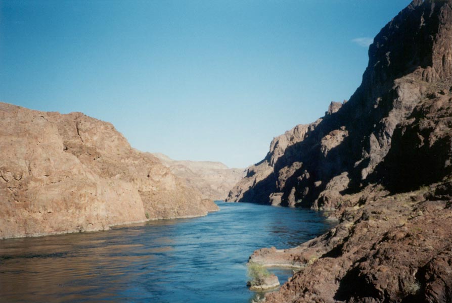
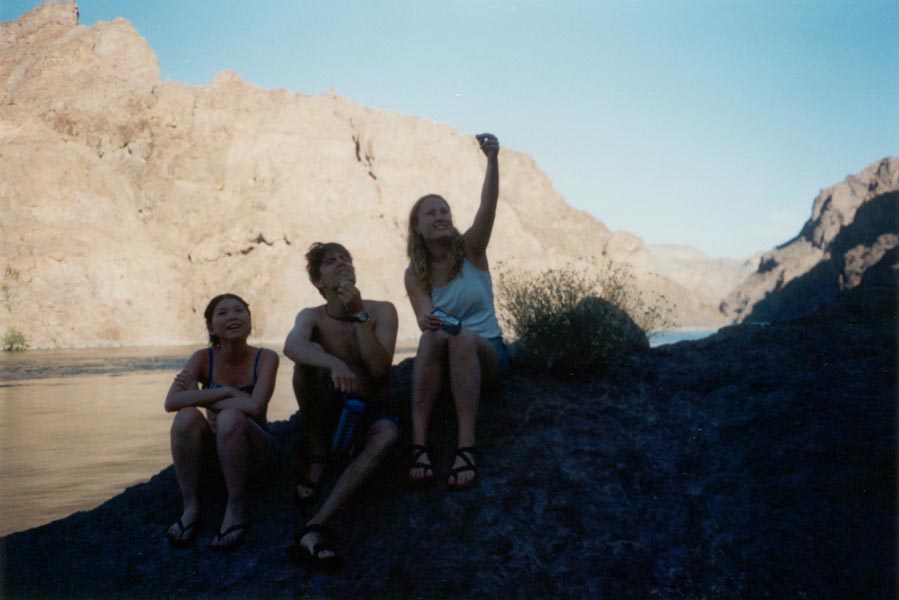
We awoke before the sun and enjoyed an hour of relative cool, enough time to cook some breakfast and swim in the glassy river. After the sun reached our camp it quickly became hot and we were soon on the water. Great battles raged among the boats as we as one water gun attack after another led to paddle-splashing retaliation. The wind picked up, blowing hard upriver, so at times we were tossed about by the chaotic result of boat wakes, strong winds, and the narrow canyon. We made a mid-morning swim stop to do some rock climbing and cliff jumping, explored more caves, played frisbee, and drifted downriver to the end of the canyon and our take-out point in Arizona.
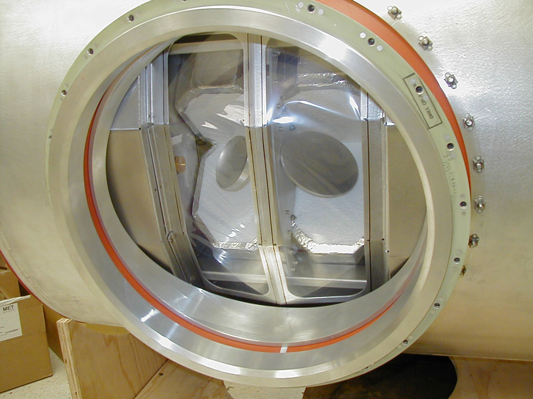
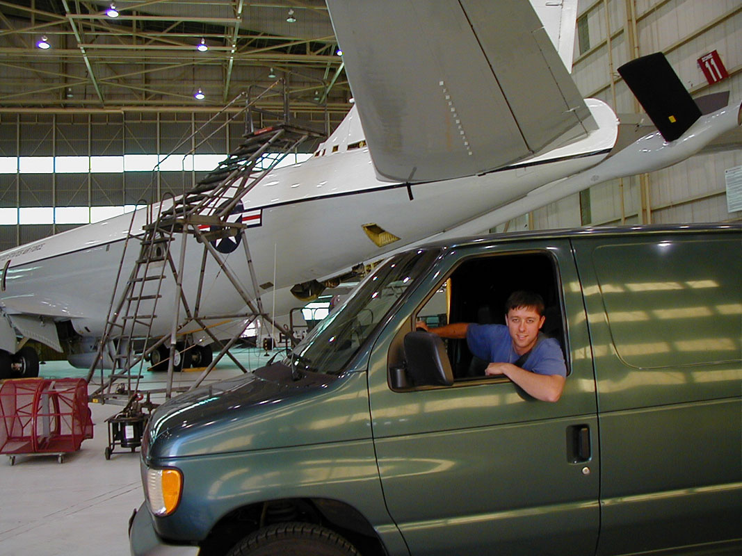
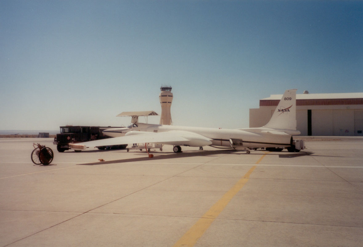
I drove a dark green cargo van to Edwards Air Force Base and made a quick run across the tarmac while watching for wayward jets, entering through giant doors into NASA Dryden's large aircraft hangar. I parked almost under the wing of a big Air Force plane. In the van, strapped to a pallet, was my welded aluminum pressure enclosure. Dubbed "the giant mailbox" and "the little airplane hangar" by the machinists, the 80 pound aluminum box cost $25,000 to build. It was soon to be discovered whether I, as cognizant engineer and test director, would take the credit for a good design or take the blame for a misfit. As it turned out, the test fit went well and with only a few tweaks the enclosure was secured to the ER-2 wing pod. The ER-2 aircraft is a U2 spy plane with new paint, a new name, and a storied history. The u2 was designed in the '60s to overfly Russia higher than any missile could fly, but the newer, slightly larger ER-2 only flies scientific missions.
July 9, 2001
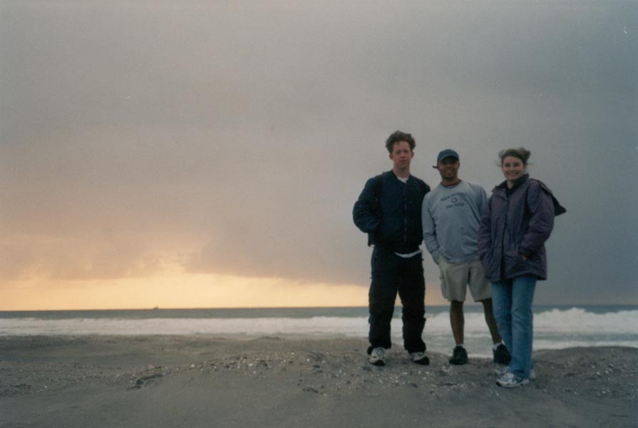
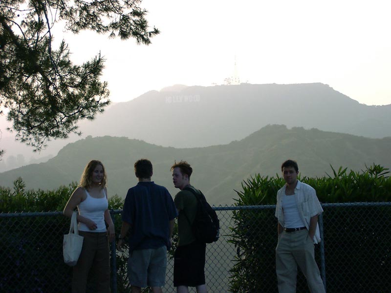
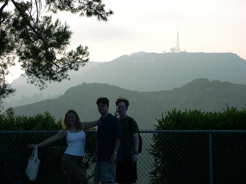
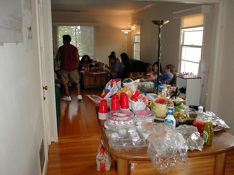
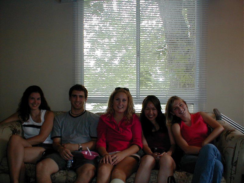
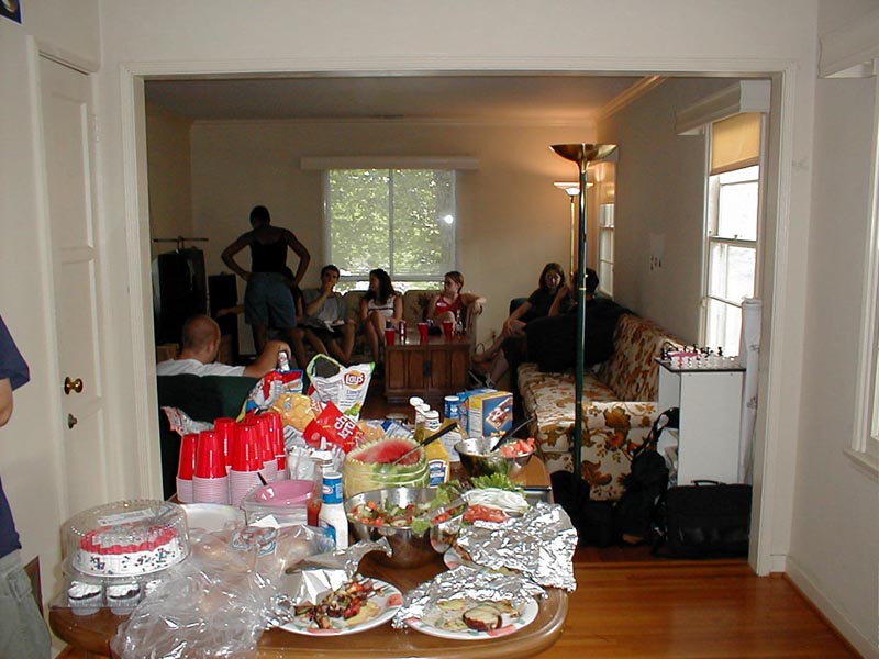
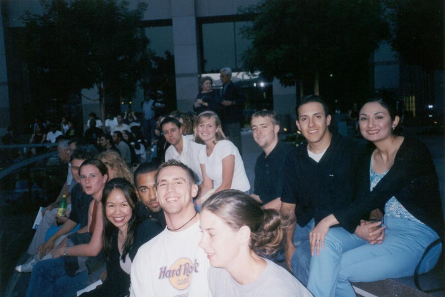
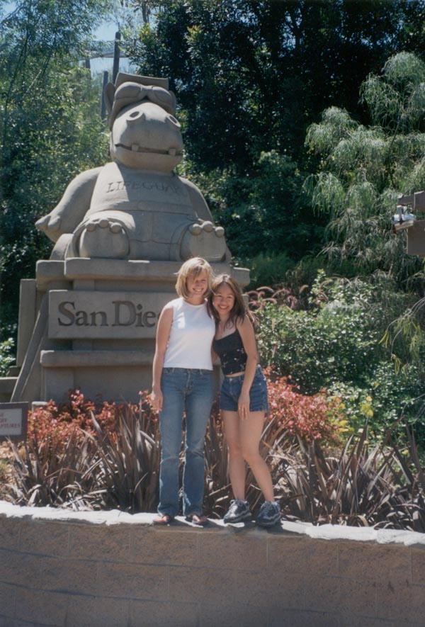
Barbecue Wednesday, concert in LA on Friday, San Diego Zoo on Saturday, bonfire on Coronado Beach Saturday night. Two more weeks and I'm leaving Los Angeles, going back East for school. The barbecue on the Fourth was quite a production - 40 people at our place for burgers and chicken and kebabs and salads and pool and music and then fireworks over the Rose Bowl. As zoos go, the San Diego Zoo was nice. There were some well kept exhibits and some that could use a little green grass. We watched the sunset from the beach and sat by a bonfire until late at night, occasionally wandering out to the edge of the surf to watch the waves roll in.
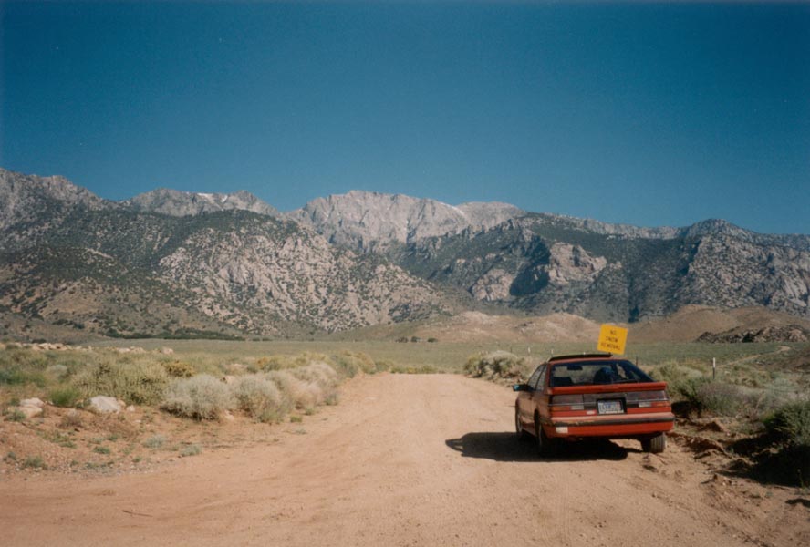
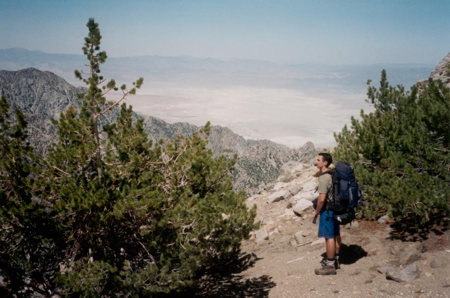
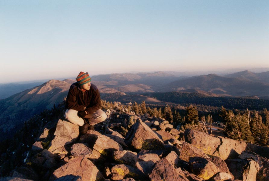
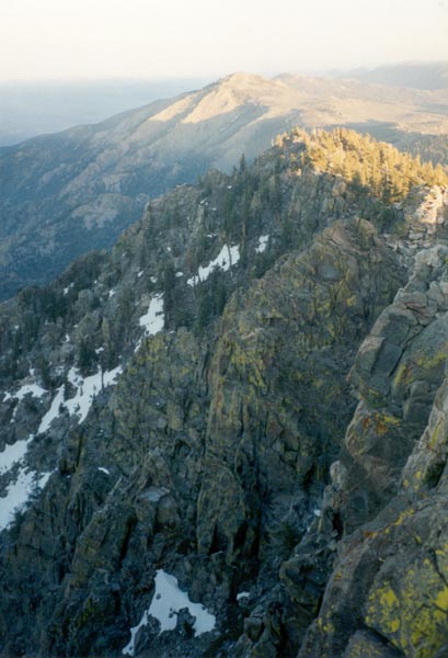
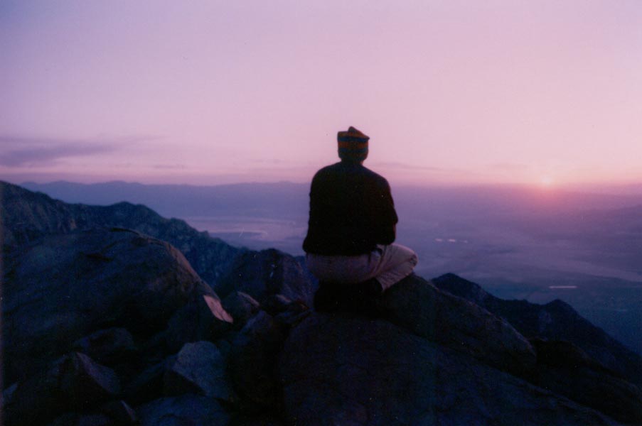
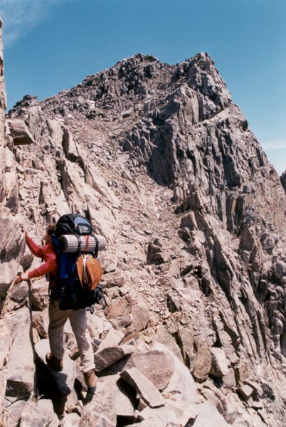
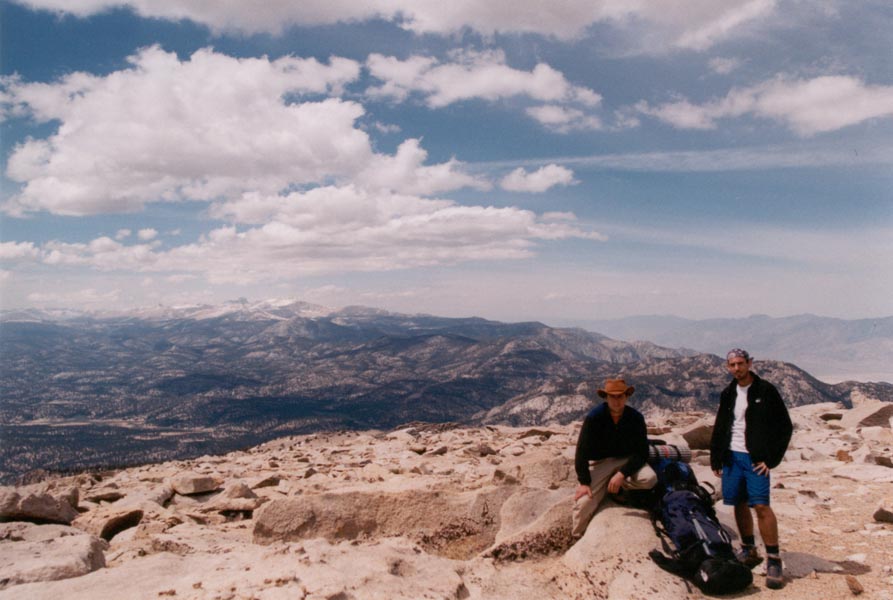
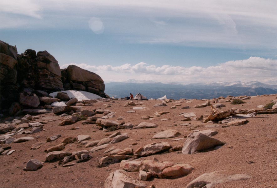
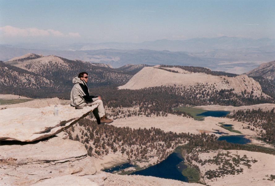
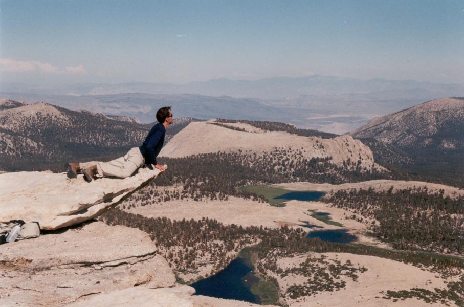
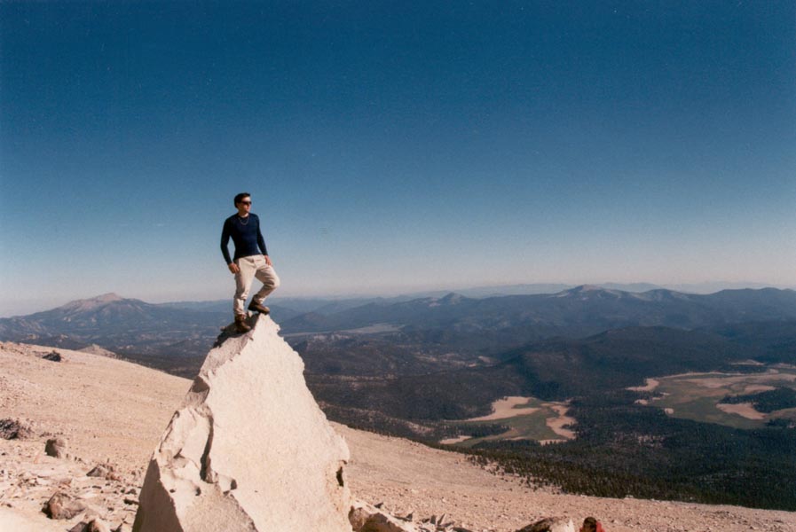
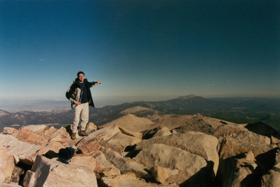
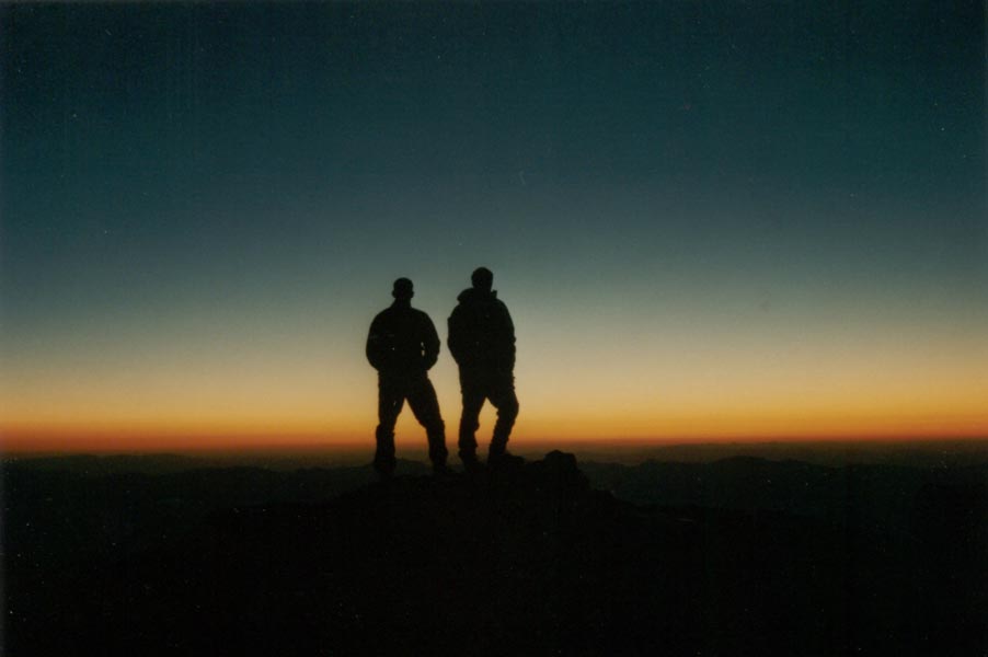
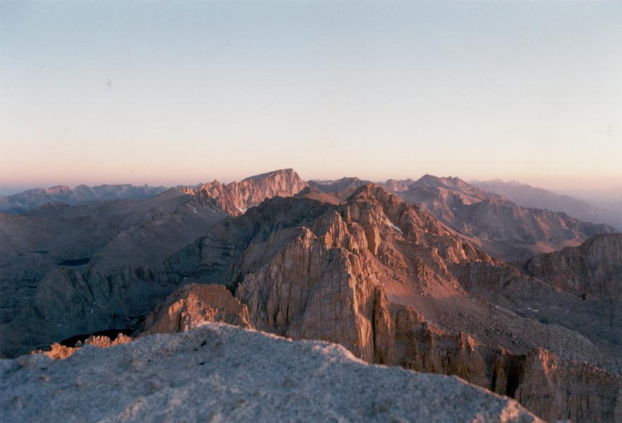
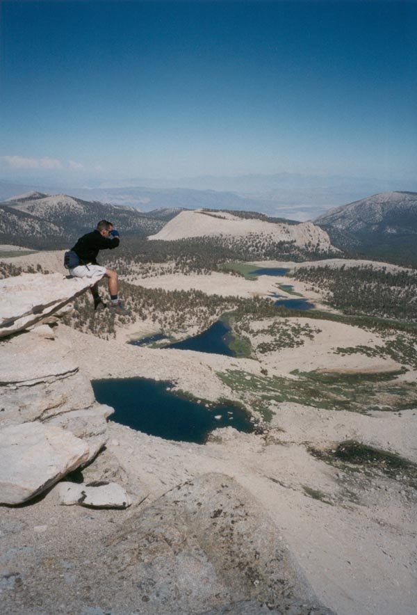
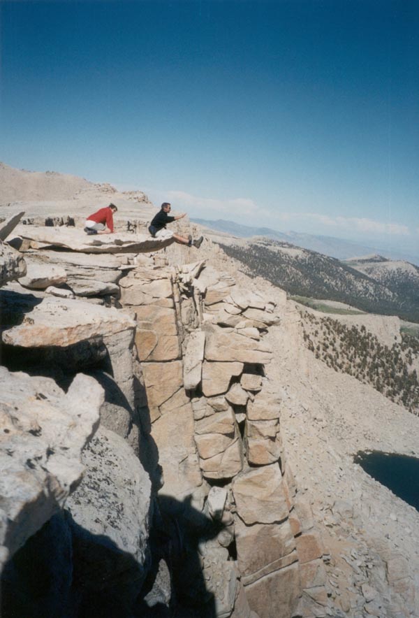
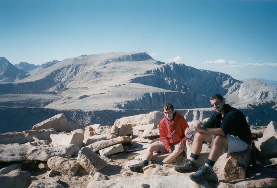
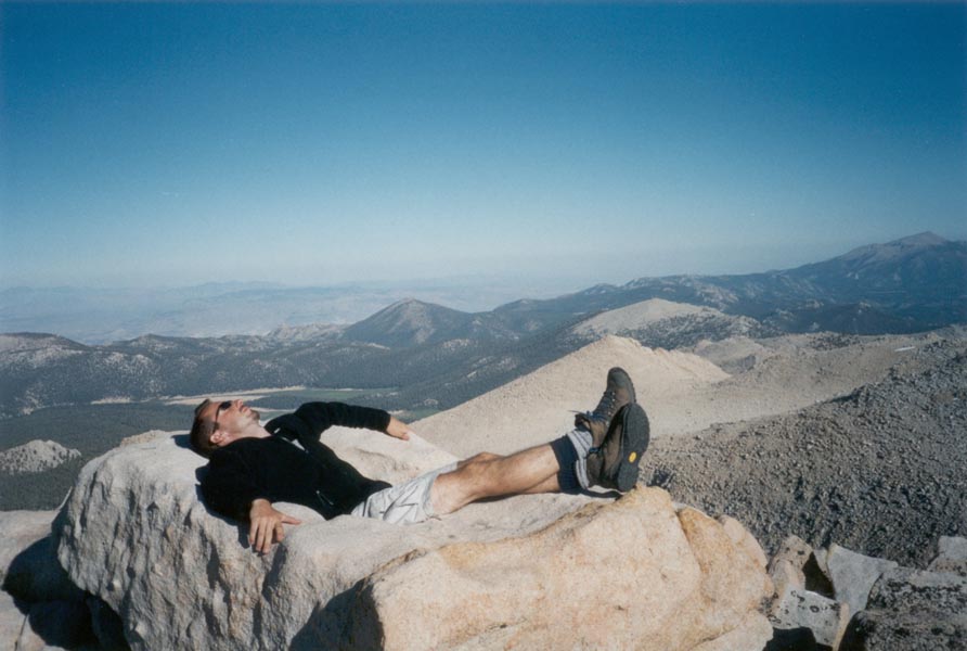
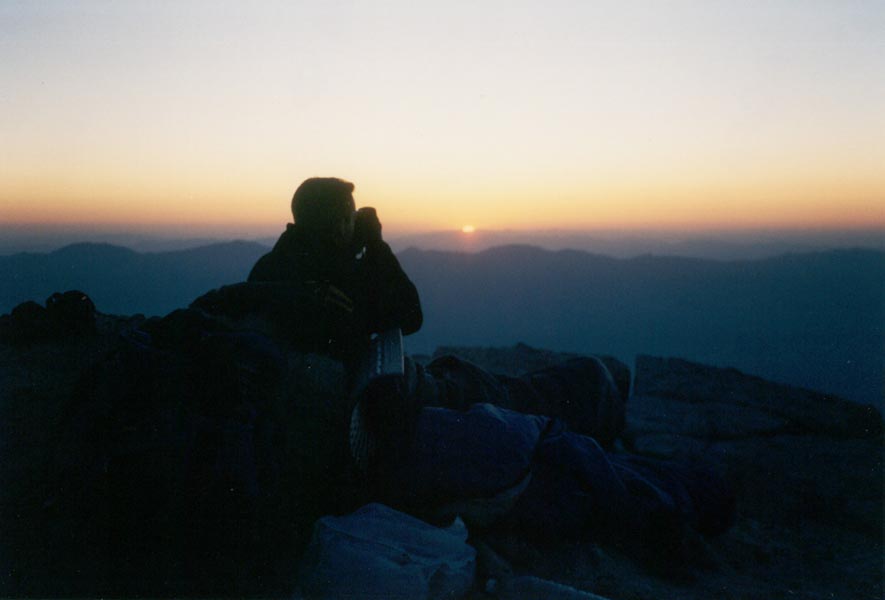
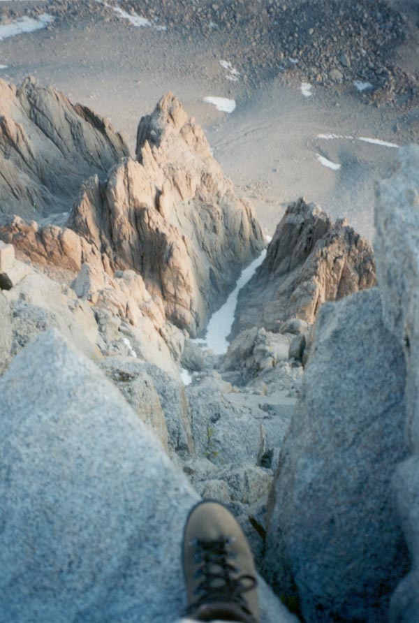
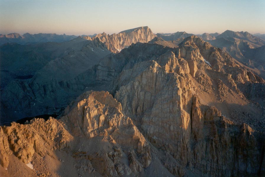
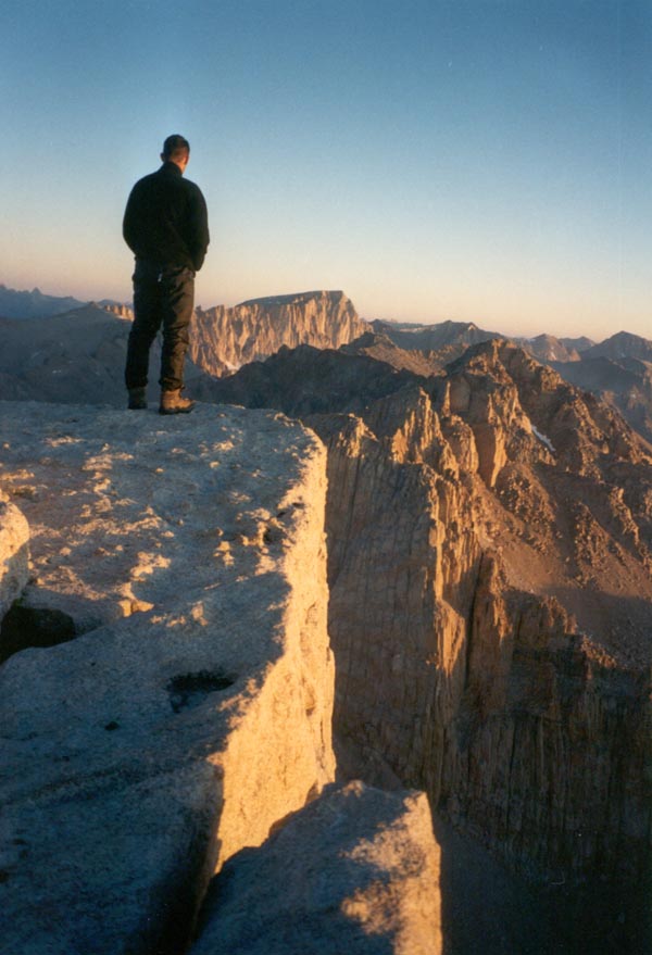
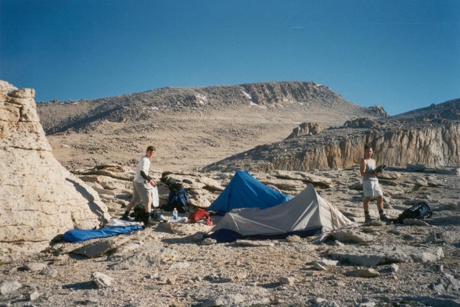
Friday night Sean and Dave and I drove to Lone Pine on the 395 and then to the Horseshoe Meadows Road to the Cottonwood Lakes trailhead at 10,000 feet. Next morning, after returning to town for our permits, we hiked in to the lakes and continued to Army Pass, where we cached our packs and climbed 12,900 foot Cirque Peak. As the sun set we made camp at 12,700 feet on the shoulder of Langley Peak. At 3am the next morning Sean and I scrambled out of our warm sleeping bags into feeezing temperatures and a star-filled sky. By moonlight we made our way to the 14,042-foot summit of Langley, climbing a boulder-strewn slope past scattered snow patches. We made the summit with time to spare before sunrise and laid out our sleeping bags at the edge of a precipitous drop into the Owens Valley thousands of feet below. The sun rose from somewhere out near Death Valley and illuminated the craggy face of Mount Whitney and the surrounding peaks with hues of pink and orange. It made for a long day hiking out, but it's not every day that one gets to watch a sunrise from 14,000 feet.
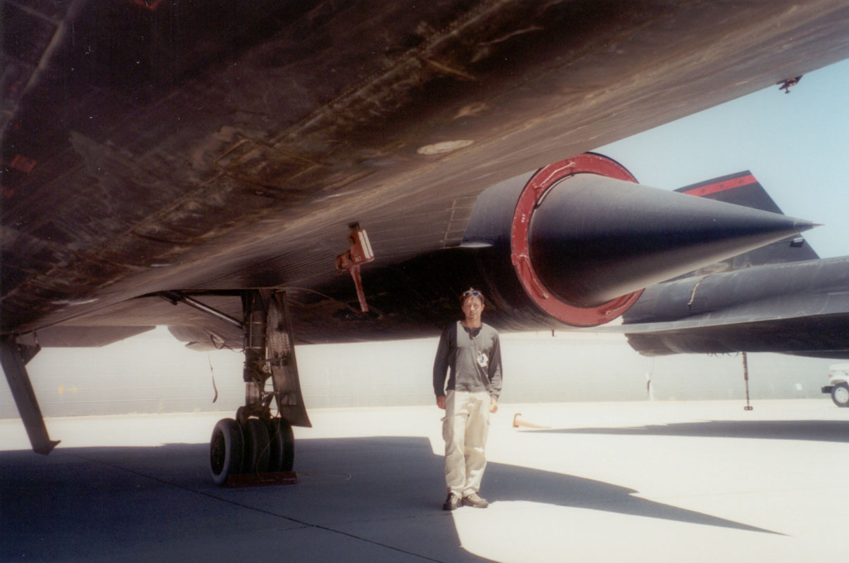
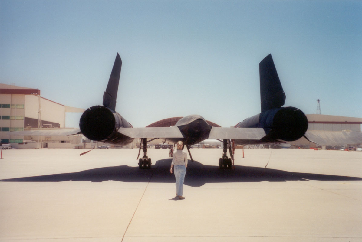
While the Lockheed aircraft technicians puttered away with their ER-2 to prepare it for my wing pod pressure enclosure, Dana and I occupied ourselves in and about the main hangar at the Dryden Flight Research Center. First we went out to see the Blackbirds, two SR-71 aircraft sitting on the flight line beside the B-52 still flown by NASA. One Blackbird set the most recent official speed record for air breathing aircraft on its last flight but now both sit grounded and dusty from blowing sand. Who knows how fast they really can go. It was fascinating to touch the titanium skin, see the expansion joints, walk below the giant engines, and feel the needle-sharp points on the nose and the engine intake cones. Next we explored a DC-8 configured for hurricane research. Instruments protruded through windows, looked out holes in the floor and ceiling, and filled the cabin between rows of first-class size seats with heavy duty restraint belts. The plane flies next in the CAMEX 4 mission later this summer. The ER-2 also will fly in CAMEX, with my pressure enclosure housing the MMIC Sounding Radiometer that I drove to Dryden on Monday.
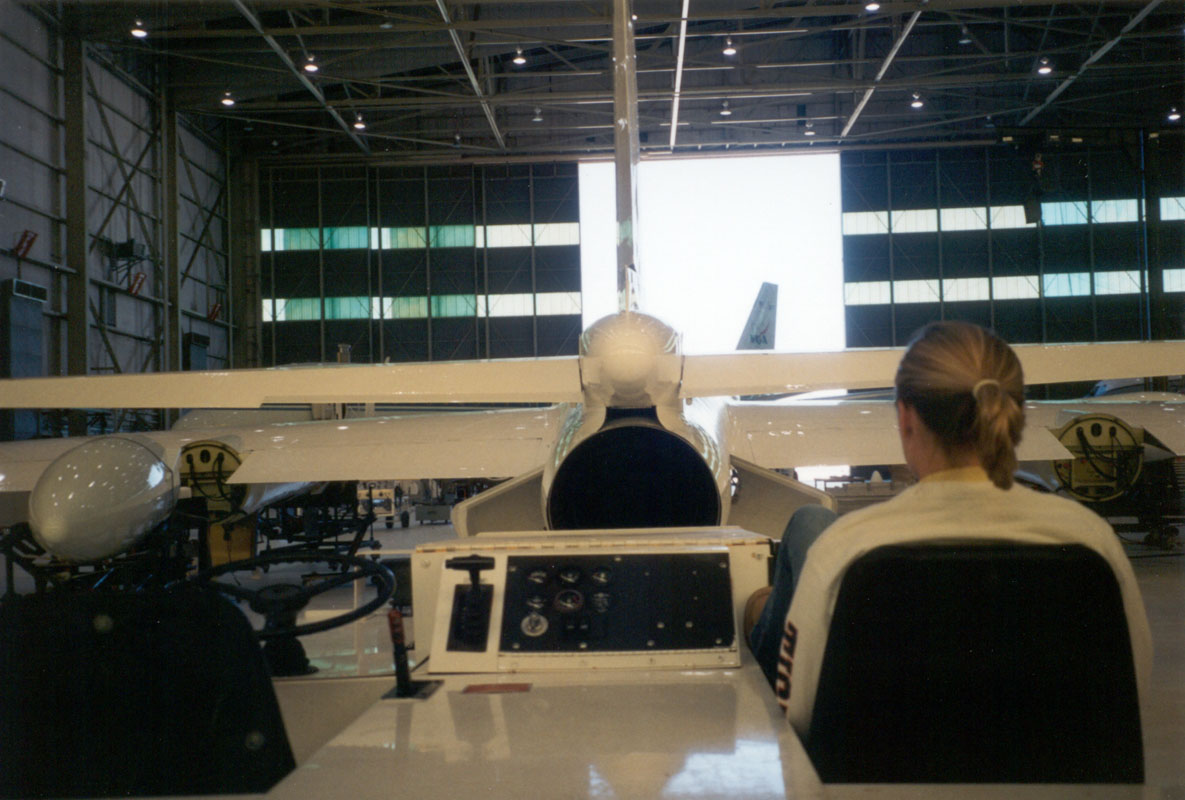
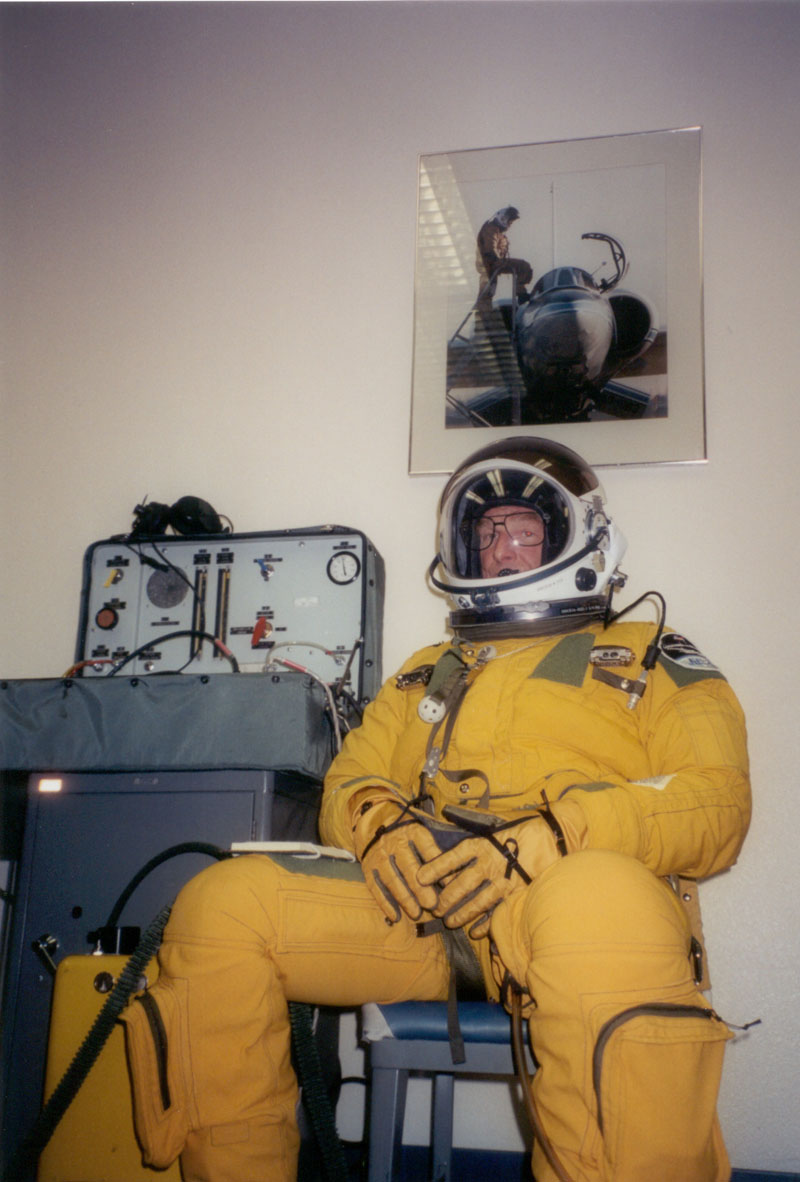
While the technicians worked on our wing pod we peeked into the ER2 cockpit, spotting the ejection controls and the food ready indicator. We met our pilot, an experienced Air Force U2 pilot, and looked at his pressure suit - complete with a feeder tube through which water and tubes of food could be squeezed. The food was quite good - we tried the apple pie. We learned that there were some quality control issues with the size of chunks in the beef stew - it must be frustrating to have one's food tube blocked by a piece of potato.
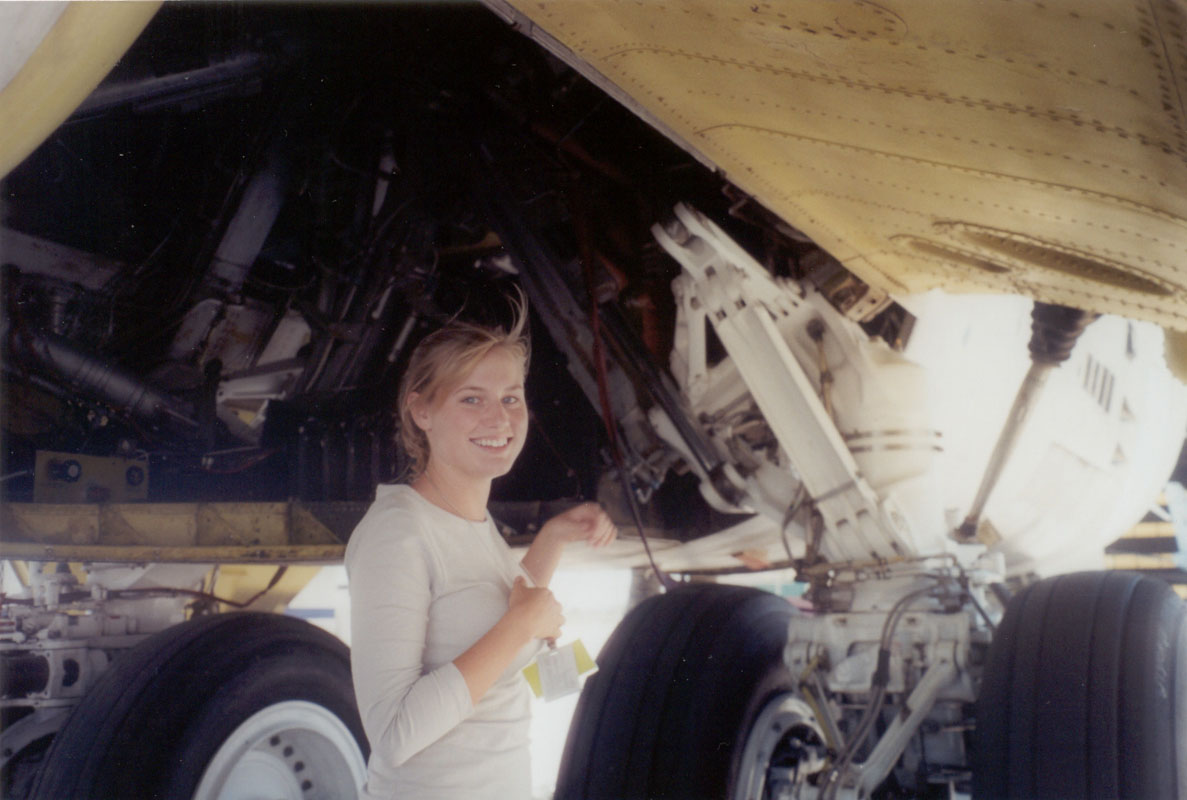
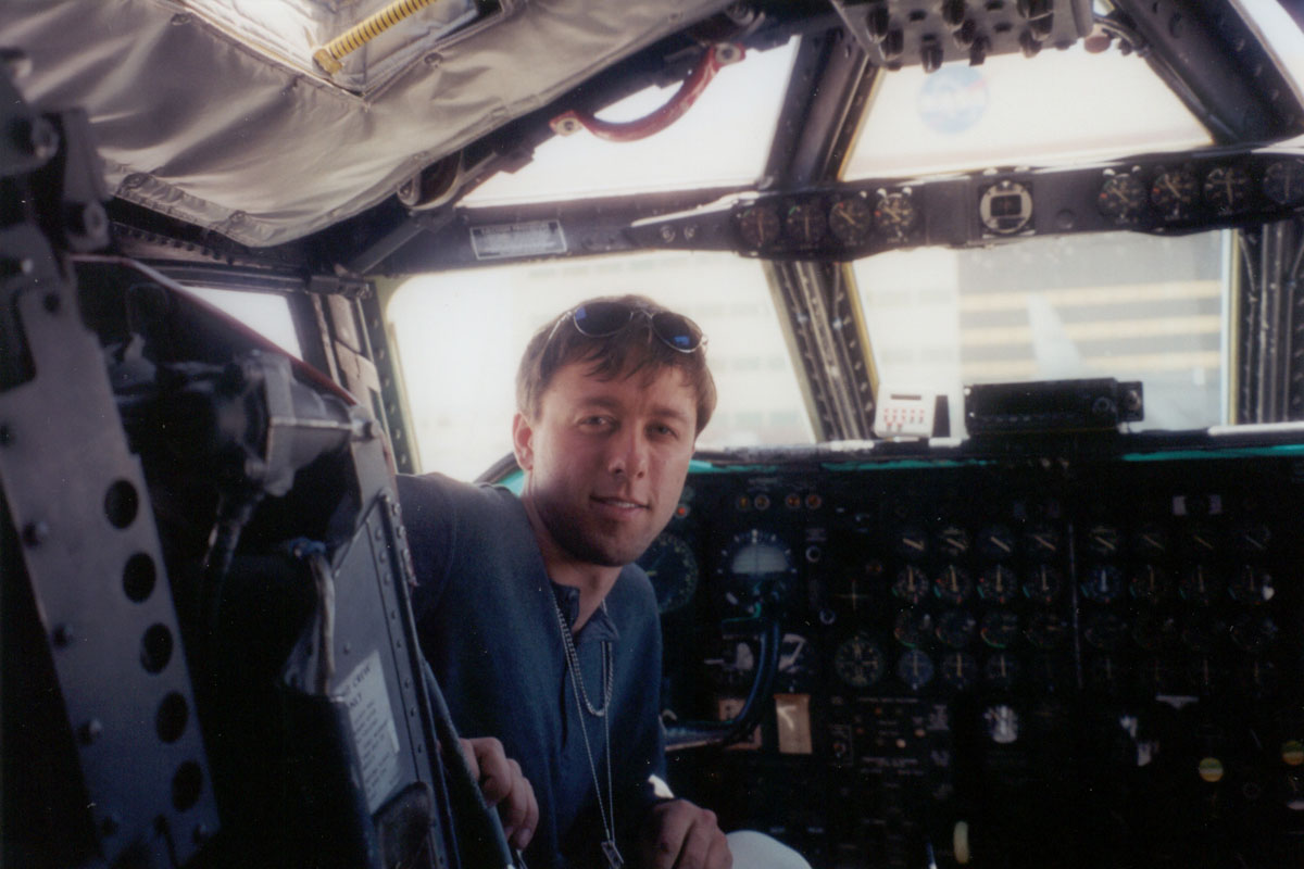
We wandered outside again and went to see the B-52. Eighth off the assembly line, it is the oldest B-52 still in use. Stenciled on the side are silhouettes of every mission flown, some comical because the picture dtest vehicle was shown embedded in the ground beside a cactus. Technicians working in the midsection invited us up inside for a quick tour. We sat in the cockpit and stared at the hundreds of gauges and latches and toggles and levers that controlled the entirely mechanical airplane. The technician said it still flew fine but that he was amazed every time it did. Eventually we made it back to the hangar to do some work - and we'll be back Friday to watch the ER-2 take off on its first test flight with our instrument.
July 21, 2001
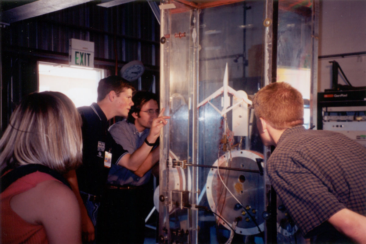
Friday at work, if it could be described as work, we watched the radiometer instrument take off in the wing pod of the ER-2 and fy off to Mono Lake and Big Sur at 65,000 feet. Dana and I got ourselves into the pilot support van that followed the plane to the end of the runway. From there we had an excellent view of the ER-2 as it floated up into the sky after just a few seconds on the runway. The pilot reported no problems whatsoever durng the two-hour flight. While he cruised about the skies for two hours, we occupied ourselves seeing the other two SR-71 Blackbirds owned by NASA, poking around a couple of F-18s and peering into the cockpit of one, strolling through the space shuttle storage hangar that also houses the X38 space station escape vehicle prototype and some other X-planes, and finally watching an experiment in the water tunnel. Used to study the fluid dynamics of scaled aircraft models, the ten foot high water column enclosed by thick polycarbonate walls was running at three inches per second. Dye trails from the leading edges of the model swirled and curved with the eddies.
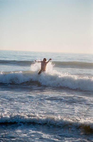
Saturday we decided to learn to surf. After breakfast in Malibu, out on the deck beside the crashing waves, Dana and I squirmed into wetsuits and attempted to balance on the tippy long boards while riding waves. Paddling back out after each run tired us quickly but our day was soon cut short by a huge wave that crashed on me, thoroughly pummeling me and leaving a gash on my face from the collision with my surfboard. Now I'm intent on returning some day to use the day's surfboard rental credit I took away when we left early. Sunday I packed and shipped boxes. Monday I hit the road.
July 30, 2001
The trip home was a classic adventure, though it was a bit lacking in the classic mishaps and side trips that usually accompany me. JC was in a hurry to get to South Carolina so after we left Colorado we drove straight through and only stopped once. I'd go back to Utah in a heartbeat, just to wander around the high country and fish for trout and bike and climb and sleep. There's not much else to do there but it is so beautiful, with meadows of wildflowers, aspen groves, and red rocky mesas overlooking vast expanses of canyon country and rangeland. We drove two-lane roads through most of Utah, taking the scenic route past Bryce Canyon and making a side trip to Moab and Arches National Park. The Rocky Mountains weren't all that I expected, especially since the weather had become gray and wet, but our raft trip down the Arkansas River there was spectacular. We were guided by JC's friend Joy, who lives in a trailer park with the other river guides from her company. Some of them live in trailers, two in a tool shed out back, one in a Uhaul trailer. Guides from other companies live a nomadic life, camping on public lands and moving every three weeks or so. The job seems fun but working six days a week and coming home to a trailer every night would get to me after a while.
From Colorado we drove to Kentucky, chasing thunderstorms all the way across Kansas. In Missouri we left the interstate to find a shorter way on two-lane roads, making our way through river bottoms and the Ozark foothills. We emerged late at night at the confluence of the Ohio and Mississippi Rivers, having lost our way only once but become stuck in a ditch for several minutes. That was after we passed the signs, "impassable in high water," and after the divided road gave way to an unpainted single lane track with signs warning of horse-drawn vehicles. It was still cloudy the next morning and remained so all the way across Tennessee and South Carolina. We spent the night at JC's parents' place in Columbia and then continued to their house on Hilton Head Island. It's quite a nice place to live, being a resort island of beautiful homes, classy restaurants, and picturesque harbors. JC took her boat out and we spent a day on the water, catching blue crabs, watching the porpoises, swimming, and enjoying the sunshine, which had just broken through the clouds that we chased in from Colorado. And finally, I had to catch a flight home and return to the real world.
here's my plane! The ER-2, in the news:
NASA STUDY TO BRAVE STORMS IN QUEST FOR
BETTER PREDICTION, UNDERSTANDING OF HURRICANES
As this year's hurricane season rolls in, a team of
researchers participating in a NASA study is waiting. Armed
with airplanes, robotic aerial vehicles and a fleet of
sophisticated instruments, they're ready to meet these
potentially deadly and destructive storms head-on, gathering
data vital to improve hurricane modeling and prediction.
They're part of the Convection And Moisture EXperiment
(CAMEX) -- the fourth in a series of field research
investigations sponsored by the Earth Science Enterprise at
NASA Headquarters, Washington, DC. The mission unites
researchers from 10 universities, five NASA centers and the
National Oceanic and Atmospheric Administration (NOAA).
Based out of the Naval Air Station at Jacksonville, FL., this
year's mission will run from Aug. 16 through Sept. 24, traditionally the most active part of the hurricane season.
During CAMEX, researchers will gather storm data from
multiple sources, including aircraft, unpiloted aerial
vehicles, satellite observations, ground-based radar, and
other ground-based sensing instruments. Unique in this
mission is the fact each storm will be monitored
simultaneously from near sea level to 65,000 feet.
Temperature, pressure, humidity, precipitation, wind speed,
lightning and ice crystal sizes are examples of the kinds of
information that will be collected. These data are expected
to provide additional insight to hurricane researchers and
forecasters who continually strive to improve our
understanding of these storms.
"One reason NASA studies hurricanes is to understand the best
way to use information from NASA resources, such as its
satellites, to provide better warnings to the American public
and people around the world affected by hurricanes," said
Robbie Hood, CAMEX mission scientist from NASA's Marshall
Space Flight Center, Huntsville, AL.
"During the last CAMEX mission in 1998, we flew over
hurricanes and collected a vast amount of data, sampling the
hurricanes' upper regions at altitudes of 35,000 feet (10,600
meters) or higher," said Hood. "This year, we're asking
ourselves additional questions, such as, 'How does a
hurricane intensify?' and 'What is its rainfall potential
after it comes to shore?' The highest number of hurricane-
related deaths are due to inland flooding, so inland rainfall
is something we will be monitoring very closely."
The CAMEX team plans to fly into the season's hurricanes
aboard two NASA planes, the ER-2 and DC-8, both from NASA's
Dryden Flight Research Center, Edwards, CA. Carrying a series
of instruments, these aircraft will fly over, through, and
around selected hurricanes as they approach landfall in the
Caribbean, Gulf of Mexico, and along the East Coast of the
United States.
The DC-8, equipped with instruments that will measure the
storms' structure, environment and changes in intensity and
tracking, will fly into storms at 35,000 to 40,000 feet
(12,200 meters). At the same time, the specially equipped
ER-2, a high-altitude research plane, will soar above storms
at 65,000 feet (19,800 meters).
NASA also is funding the flight of several unpiloted aerial
vehicles called the Aerosonde Robotic Aircraft, managed in
conjunction with the University of Colorado at Boulder.
Small, robotic aircraft designed for collection of
meteorological data over oceans and remote areas, the
Aerosondes will operate over the North Atlantic Ocean taking
observations in the lower atmosphere. In the first use of
unpiloted aircraft in an operation of this type, the
Aerosondes will skim the ocean surface collecting data on
atmospheric temperature, pressure, relative humidity, and
winds, data that cannot be obtained by any other method.
Although investigating hurricanes is the primary objective of
CAMEX-4, separate flights will study thunderstorm structure,
precipitation systems, and atmospheric water vapor profiles.
This portion of CAMEX-4 is known as Keys Area Microphysics
Project (KAMP). The project seeks improved precipitation
estimates from passive and active microwave instruments, equipment that detects precipitation and surface water by
measuring natural microwave emissions from cloud water, cloud
ice, rainfall and surface water. Flights for the microphysics
project will be approximately 300 nautical miles (560 km)
from the Key West, FL area.
The hurricane study is part of NASA's Earth Science
Enterprise, a long-term research program dedicated to better
understanding the total Earth system and the effects of
natural and human-induced changes on our global environment.
to the index page